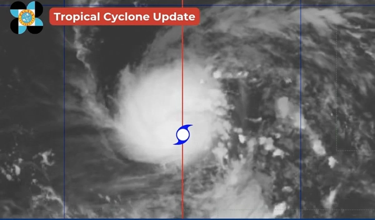
Severe Tropical Storm Francisco entered the Philippine Area of Responsibility (PAR) on Saturday night, June 20, and is expected to continue intensifying over the Philippine Sea, potentially reaching typhoon category by Sunday, June 21, the Philippine Atmospheric, Geophysical and Astronomical...
The Philippine Atmospheric, Geophysical and Astronomical Services Administration (PAGASA) on Sunday, March 22, said the easterlies will continue to affect the entire country, bringing generally warm and humid conditions along with isolated rain showers and thunderstorms. Based on its latest weather...
The easterlies continue to affect the country on Sunday, March 1, bringing partly cloudy to cloudy skies with isolated rain showers or thunderstorms over Metro Manila and the rest of the Philippines. In its latest weather forecast, the Philippine Atmospheric, Geophysical and Astronomical Services...
Several weather systems are affecting different parts of the Philippines on Wednesday, January 7, bringing scattered rains to portions of Luzon and the Visayas. In an advisory issued at 10 a.m., the Philippine Atmospheric, Geophysical and Astronomical Services Administration (PAGASA) said that no...
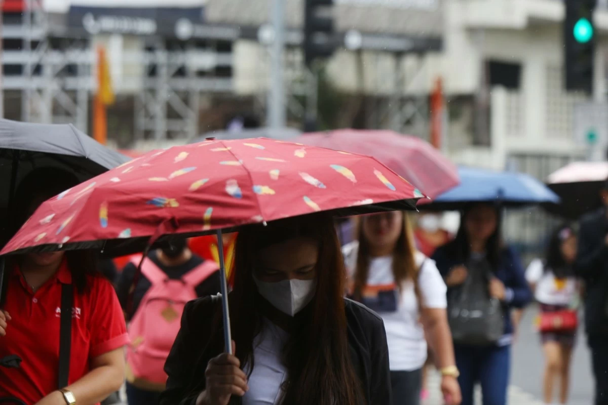
The Philippine Atmospheric, Geophysical and Astronomical Services Administration (PAGASA) said on Tuesday, December 16, that at least three weather systems will continue to affect large parts of the country this week, bringing cloudy skies, scattered rains, and possible flooding or landslides in...
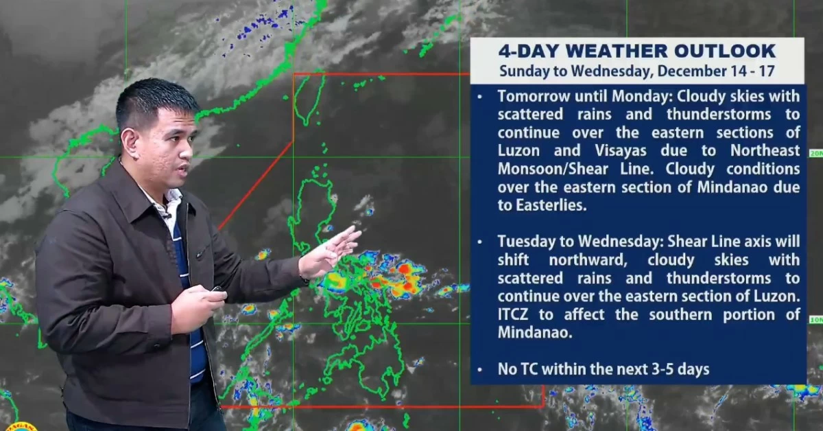
A stronger surge of the northeast monsoon, or “amihan,” is expected to affect parts of the country in the coming days, the Philippine Atmospheric, Geophysical and Astronomical Services Administration (PAGASA) said on Saturday, December 12, while ruling out the presence of any tropical cyclone...
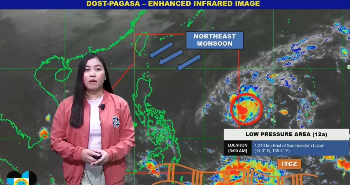
The Philippine Atmospheric, Geophysical and Astronomical Services Administration (PAGASA) on Friday, December 12, said that although no low-pressure area (LPA) is being monitored within the Philippine Area of Responsibility (PAR), several weather systems continue to affect the country, bringing...
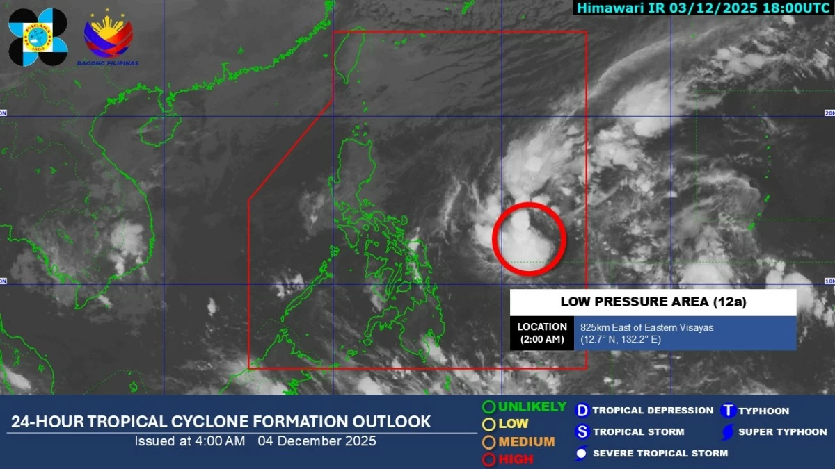
A low-pressure area (LPA) inside the Philippine Area of Responsibility (PAR) now has a high chance of developing into a tropical depression within the next 24 hours, according to the Philippine Atmospheric, Geophysical and Astronomical Services Administration (PAGASA) on Thursday, December 4. In...
A low-pressure area (LPA), which will be locally named “Wilma” once it develops into a tropical cyclone, is expected to enter the Philippine Area of Responsibility (PAR) on Wednesday, December 3, according to the Philippine Atmospheric, Geophysical and Astronomical Services Administration...
A shear line and the northeast monsoon (amihan) will continue to bring rains over parts of Northern Luzon on Saturday, November 29, according to the Philippine Atmospheric, Geophysical and Astronomical Services Administration (PAGASA). PAGASA also noted that Severe Tropical Storm Koto (formerly...
Large portions of the country are expected to experience rainy weather on Saturday, November 22, as multiple weather systems continue to affect the archipelago, according to the Philippine Atmospheric, Geophysical and Astronomical Services Administration (PAGASA). In its latest weather forecast,...
The Intertropical Convergence Zone (ITCZ) is expected to continue affecting large parts of the country, bringing rains and thunderstorms to Palawan, the Visayas, and Mindanao, the Philippine Atmospheric, Geophysical and Astronomical Services Administration (PAGASA) said on Saturday, November 15. In...