


Manila Bulletin
 Philippines
National
PAGASA: Tropical depression outside PAR maintains strength, moves west-northwest
Philippines
National
PAGASA: Tropical depression outside PAR maintains strength, moves west-northwest
Philippines
National
PAGASA: Tropical depression outside PAR maintains strength, moves west-northwest
PAGASA: Tropical depression outside PAR maintains strength, moves west-northwest
To be named 'Tino' once it enters PAR on November 2; landfall likely in Visayas or Caraga early next week
Published Nov 1, 2025 03:21 pm


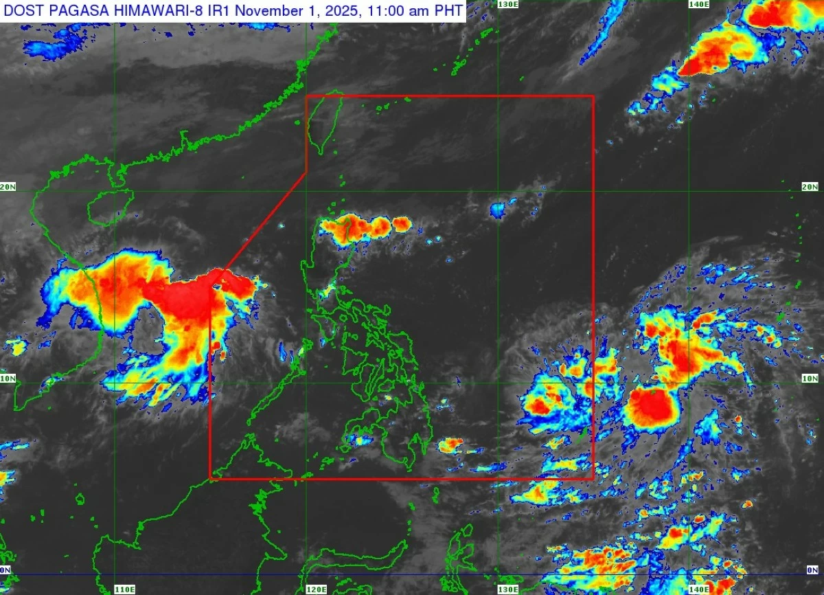
PAGASA said the tropical depression outside the Philippine Area of Responsibility (PAR) is expected to enter on November 2, 2025 as “Tino,” with a possible landfall in the Visayas or Caraga early next week as it intensifies into a typhoon. (PAGASA)
A tropical depression outside the Philippine Area of Responsibility (PAR) has maintained its strength while moving west-northwestward, the Philippine Atmospheric, Geophysical and Astronomical Services Administration (PAGASA) said on Saturday, November 1.
In its latest tropical cyclone advisory, PAGASA said the weather system — expected to enter PAR on November 2 — will be named “Tino” and could make landfall in the Visayas or Caraga region early next week.
The weather disturbance was last spotted 1,375 kilometers east of northeastern Mindanao, with maximum sustained winds of 45 km/h, gusts of up to 55 km/h, and a central pressure of 1008 hPa.
It is currently moving west-northwestward at 15 km/h, with strong winds extending up to 280 kilometers from its center.
Forecast track and possible landfall
The tropical depression is expected to enter PAR on Sunday morning or afternoon and move generally westward over the Philippine Sea.
PAGASA forecasts the system to make initial landfall over the Caraga Region or Eastern Visayas between Monday evening, November 3, and Tuesday morning, November 4.
After crossing parts of Visayas, the cyclone may traverse the northern portion of the Sulu Sea and Palawan before emerging over the West Philippine Sea by Wednesday, November 5. A close approach to the Kalayaan Islands is also possible.
Intensification and weather outlook
PAGASA said “Tino” may intensify into a tropical storm within 24 hours and could reach typhoon category by Monday afternoon or evening. The agency noted that rapid intensification is not ruled out, and the system may make landfall at or near peak intensity, possibly reaching 130 km/h.
The tropical depression is not expected to directly affect local weather conditions in the next 24 hours, but Wind Signal No. 1 may be raised over parts of Eastern Visayas and Caraga by Sunday. Based on current forecasts, the highest possible alert level could reach Signal No. 4.
Heavy rain, strong winds, and coastal threats
By Monday morning, heavy rainfall is expected to begin affecting Eastern Visayas and Caraga, prompting PAGASA to issue a Weather Advisory later today or tomorrow.
In addition, rough to very rough sea conditions are likely over the northern, western, and eastern seaboards of Luzon, and the eastern seaboards of Visayas and Mindanao within the next three days due to the combined effects of “Tino” and the Northeast Monsoon.
Gale warnings may be issued as early as Monday morning, while storm surge warnings — including possible red-level alerts — could follow soon after, PAGASA said.
PAGASA urged the public, especially those in areas likely to be affected, as well as local disaster risk reduction and management offices, to closely monitor official updates and take precautionary measures ahead of “Tino’s” entry and potential landfall.
RELATED STORY: