


Manila Bulletin
 Philippines
National
LPA east of Visayas now has 'high' chance of becoming a tropical depression within 24 hours — PAGASA
Philippines
National
LPA east of Visayas now has 'high' chance of becoming a tropical depression within 24 hours — PAGASA
Philippines
National
LPA east of Visayas now has 'high' chance of becoming a tropical depression within 24 hours — PAGASA
LPA east of Visayas now has 'high' chance of becoming a tropical depression within 24 hours — PAGASA
Published Dec 4, 2025 05:33 am


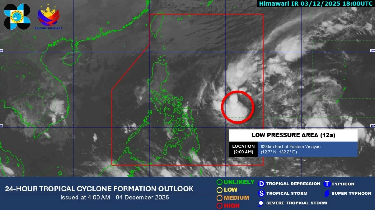
PAGASA satellite image shows the low-pressure area (LPA) inside Philippine Area of Responsibility (PAR), which now has a high chance of developing into a tropical depression within 24 hours. (PAGASA)
A low-pressure area (LPA) inside the Philippine Area of Responsibility (PAR) now has a high chance of developing into a tropical depression within the next 24 hours, according to the Philippine Atmospheric, Geophysical and Astronomical Services Administration (PAGASA) on Thursday, December 4.
In its latest forecast, PAGASA said that as of 3 a.m., the LPA was estimated at 705 kilometers east of Eastern Visayas. The weather system, identified as LPA 12a, continues to intensify over the Philippine Sea while the northeast monsoon (amihan) affects Northern and Central Luzon.
PAGASA said several areas may experience rain throughout the day.
Catanduanes, Albay, Sorsogon, Northern Samar, Eastern Samar, and Samar will have cloudy skies with scattered rains and isolated thunderstorms due to the shear line, with possible flash floods or landslides triggered by moderate to heavy rainfall.
Cagayan Valley, the Cordillera Administrative Region, Aurora, and Quezon will experience cloudy skies with rains brought by the northeast monsoon, which may also cause flash floods or landslides due to moderate to occasionally heavy rainfall.
Metro Manila and the rest of Luzon will have partly cloudy to cloudy skies with isolated light rains, with no significant impact expected.
The rest of the country will experience partly cloudy to cloudy skies with isolated rain showers or thunderstorms caused by localized thunderstorms, which may lead to flash floods or landslides during severe thunderstorms.
PAGASA advised communities in low-lying and mountainous areas to remain alert for possible flooding and landslides as the LPA continues to develop.