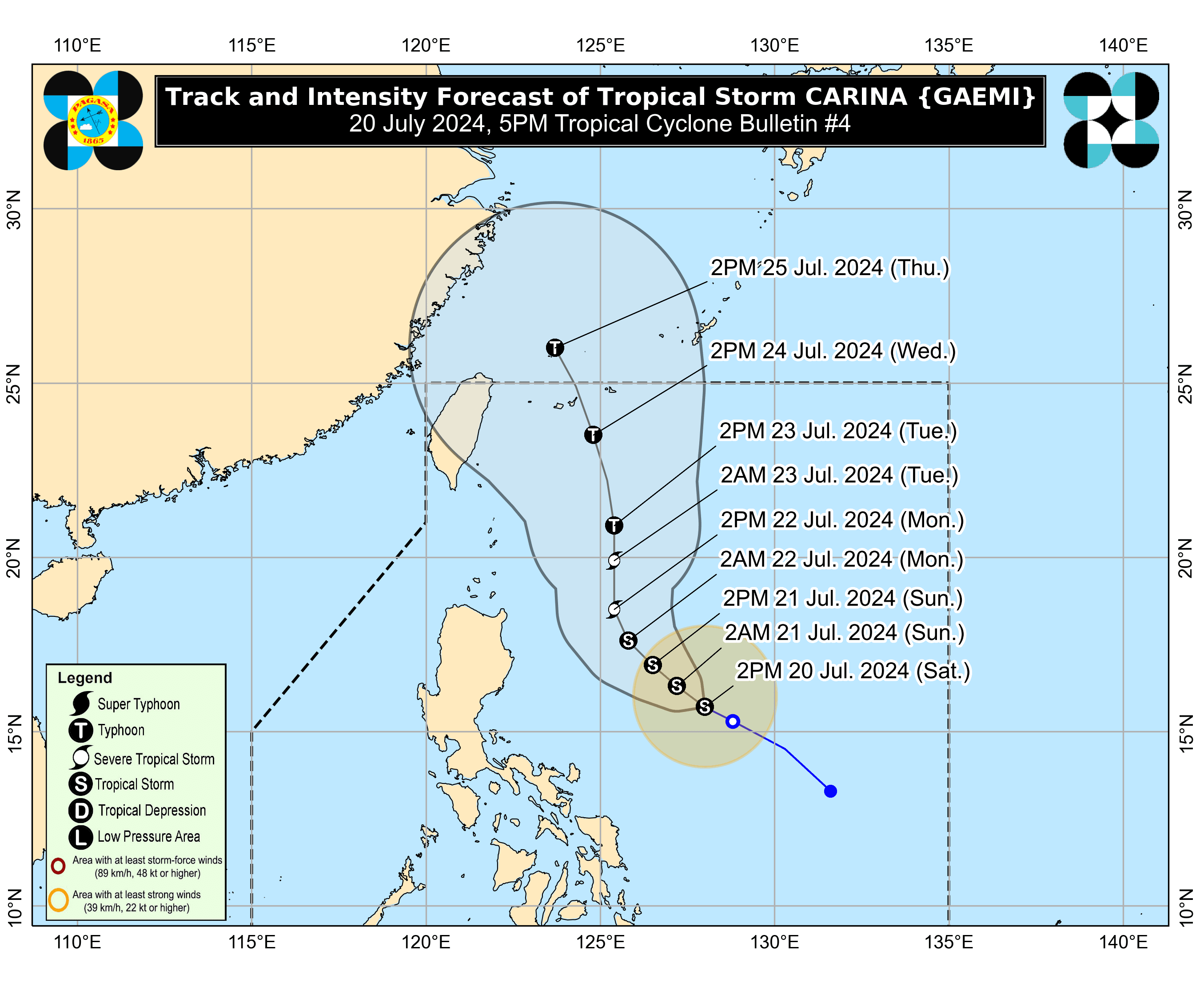
The Philippine Atmospheric, Geophysical and Astronomical Services Administration (PAGASA) on Saturday, July 20 said “Carina” intensified into a Tropical Storm (TS).

In its latest bulletin, the state weather bureau reported that as of 4 p.m., TS Carina was 630 kilometers (km) east of Casiguran, Aurora, moving west northwestward at 15 kilometers per hour (kph).
It had maximum sustained winds of 65 kph near the center and gusts of up to 80 kph.
In an 11 p.m. weather update on July 19, PAGASA noted that “Carina” intensified along with “Butchoy” (currently located outside the Philippine Area of Responsibility [PAR]) to Tropical Depression (TD).
READ:
https://mb.com.ph/2024/7/20/two-lp-as-develop-into-tropical-depressions-named-butchoy-carina
Despite the intensification, no tropical cyclone wind signals have been hoisted anywhere in the country.
Coastal waters
Meanwhile, the tropical storm, along with the southwest monsoon or “habagat,” will bring moderate seas ranging from one to two meters over the coastal waters along the eastern seaboard of the country.
“Mariners of motor bancas and similarly-sized vessels are advised to take precautionary measures while venturing out to sea,” PAGASA said.