


 Philippines
National
Two LPAs develop into tropical depressions; named 'Butchoy', 'Carina'
Philippines
National
Two LPAs develop into tropical depressions; named 'Butchoy', 'Carina'
Two LPAs develop into tropical depressions; named 'Butchoy', 'Carina'


At A Glance
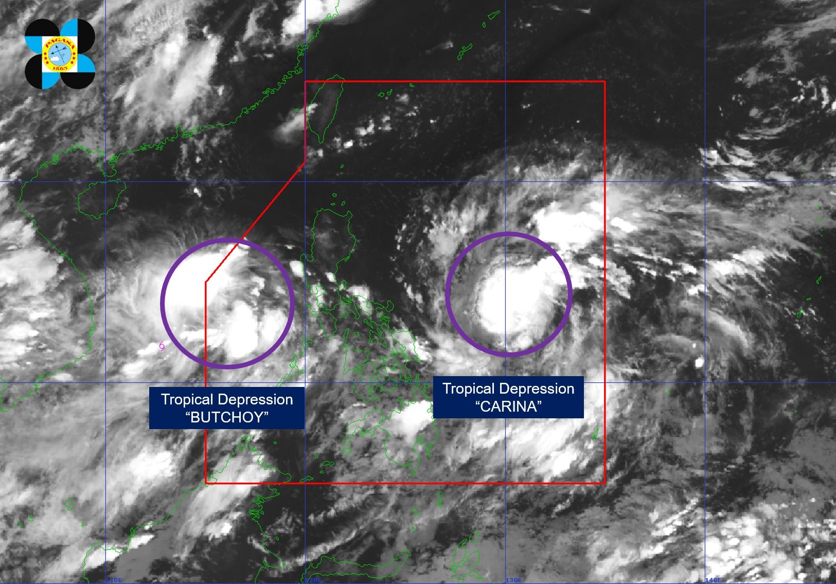
- PAGASA said the tropical depressions west of Batangas and east of Bicol region have been given the local names "Butchoy" and "Carina," respectively.
- Both cyclones are expected to enhance the southwest monsoon or "habagat" in the next few days.
The Philippine Atmospheric, Geophysical and Astronomical Services Administration (PAGASA) on Friday, July 19, said the two low pressure areas (LPA) within the country’s area of responsibility have developed into tropical depressions at 8 p.m.
PAGASA said the tropical depressions west of Batangas and east of Bicol region have been given the local names “Butchoy” and “Carina,” respectively.
In its 11 p.m. tropical cyclone bulletin, PAGASA said Butchoy is unlikely to directly affect the country within the next three days.
However, it will enhance the southwest monsoon or “habagat” and bring moderate to heavy rains over the western portions of Luzon in the next three days.
The tropical depression was located 535 kilometers west of Tanauan City, Batangas, moving westward at 25 kilometers per hour (kph) with maximum sustained winds of 55 kph and gusts of up to 70 kph.
Based on the track forecast, Butchoy may exit the Philippine area of responsibility (PAR) within the next 12 hours.
Meanwhile, tropical depression Carina was located 780 kilometers east of Virac, Catanduanes.
It has maximum sustained winds of 45 kph and gusts of up to 55 kph while moving west-northwestward at 20 kph.
PAGASA said that Carina is expected to generally follow an offshore path over the next five days and will remain far from the Philippine landmass.
However, it may also enhance the habagat beginning Sunday, July 21, and bring moderate to heavy rains over the western portions of Luzon.