







Satellite data show flood extents in Mindanao due to Typhoon Inday
Published Jul 13, 2026 08:13 am


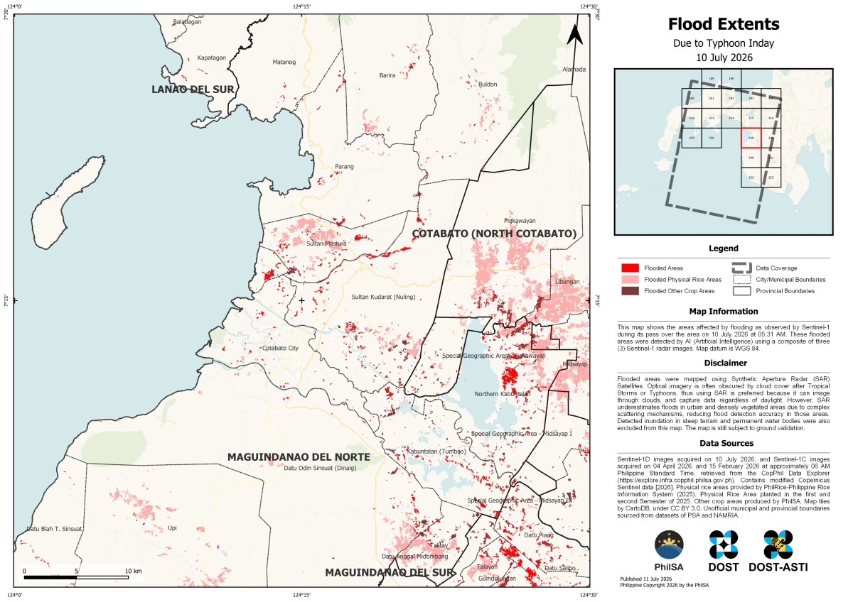
The Philippine Space Agency (PhilSA) produced flood extent maps showing flooded areas (red) and flood-affected Physical Rice Areas (pink) and Other Crop Areas (brown) in Regions 9, 10, 11, 12, 13, Bangsamoro Autonomous Region in Muslim Mindanao (BARMM), and parts of Eastern Samar and Southern Leyte following the enhanced monsoon due to Typhoon Inday. The analysis used Sentinel-1 Synthetic Aperture Radar (SAR) satellite imagery captured on 10 July 2026 at 05:31 AM PhST and 11 July 2026 at 05:22 AM PhST. The flooded areas were detected with the aid of Artificial Intelligence (AI) using a composite of three Sentinel-1 SAR images.
SAR satellite imagery is useful in flood mapping because SAR signals can penetrate through clouds that often cover large areas during storms, and regardless of daylight conditions, unlike optical imagery. However, SAR may underestimate flooding in urban and densely vegetated areas because complex surfaces may affect the backscatter data being measured and reduce flood detection accuracy. Please note that these maps remain subject to ground validation.
PhilSA supports the National Disaster Risk Reduction and Management Council (NDRRMC) in monitoring the situation and prioritizing areas for response through the analysis of wide-area coverage satellite data. By making space data accessible to stakeholders, PhilSA enables informed decision-making and strengthens disaster response.
PhilSA will continue monitoring satellite data as the situation requires. Please follow local and national agencies for the latest advisories.
Access the maps and shapefiles of flood extents here.