







New tropical depression outside PAR may spare the Philippines
Published Jul 13, 2026 11:51 am


At A Glance
- PAGASA said Tropical Depression Haishen may enter the Philippine Area of Responsibility (PAR) either Monday evening, July 13, or Tuesday morning, July 14, and will be assigned the local name "Josie."
- Despite its expected entry into the PAR, PAGASA said the tropical cyclone is less likely to directly affect the country's weather and sea conditions over the next several days.
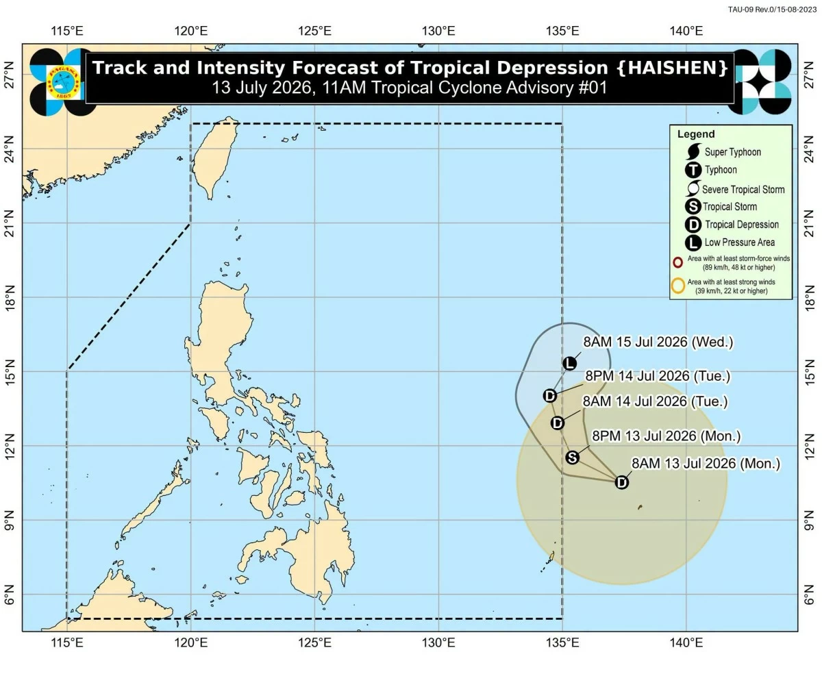
Track and intensity forecast for Tropical Depression Haishen (PAGASA)
The Philippine Atmospheric Geophysical and Astronomical Services Administration (PAGASA) on Monday, July 13, said the low-pressure area outside the country’s area of responsibility has developed into a tropical depression but is unlikely to directly affect the country's weather in the coming days.
As of 10 a.m., the center of the tropical depression with the international name “Haishen” was estimated at 1,265 kilometers east of Eastern Visayas.
The tropical depression was packing maximum sustained winds of 55 kilometers per hour (kph) near the center and gustiness of up to 70 kph. It was moving west northwestward at 30 kph.
PAGASA said Haishen may enter the Philippine Area of Responsibility (PAR) either Monday evening or Tuesday morning, July 14, and will be assigned the local name “Josie.”
The weather bureau added that the tropical cyclone is forecast to move generally northward while inside the PAR before turning north-northeastward.
It may exit the PAR by Wednesday, July 15.
PAGASA said Haishen may intensify into a tropical storm within the next 12 hours before gradually weakening due to unfavorable environmental conditions.
Despite its expected entry into the PAR, PAGASA said the tropical cyclone is less likely to directly affect the country's weather and sea conditions over the next several days.
However, the weather bureau advised the public and local disaster risk reduction and management offices to continue monitoring its updates as the forecast may still change.
READ MORE: