ADVERTISEMENT

Approaching typhoon may bring rains, enhance 'habagat'

It may enter PAR as 'Inday' by midweek

Published Jul 3, 2026 02:41 pm

At A Glance

  • In its weekly weather outlook for July 3 to 10, PAGASA said the tropical cyclone, internationally named "Bavi," may enter the Philippine Area of Responsibility (PAR) by Tuesday evening, July 7, or Wednesday morning, July 8, when it will be assigned the local name "Inday."
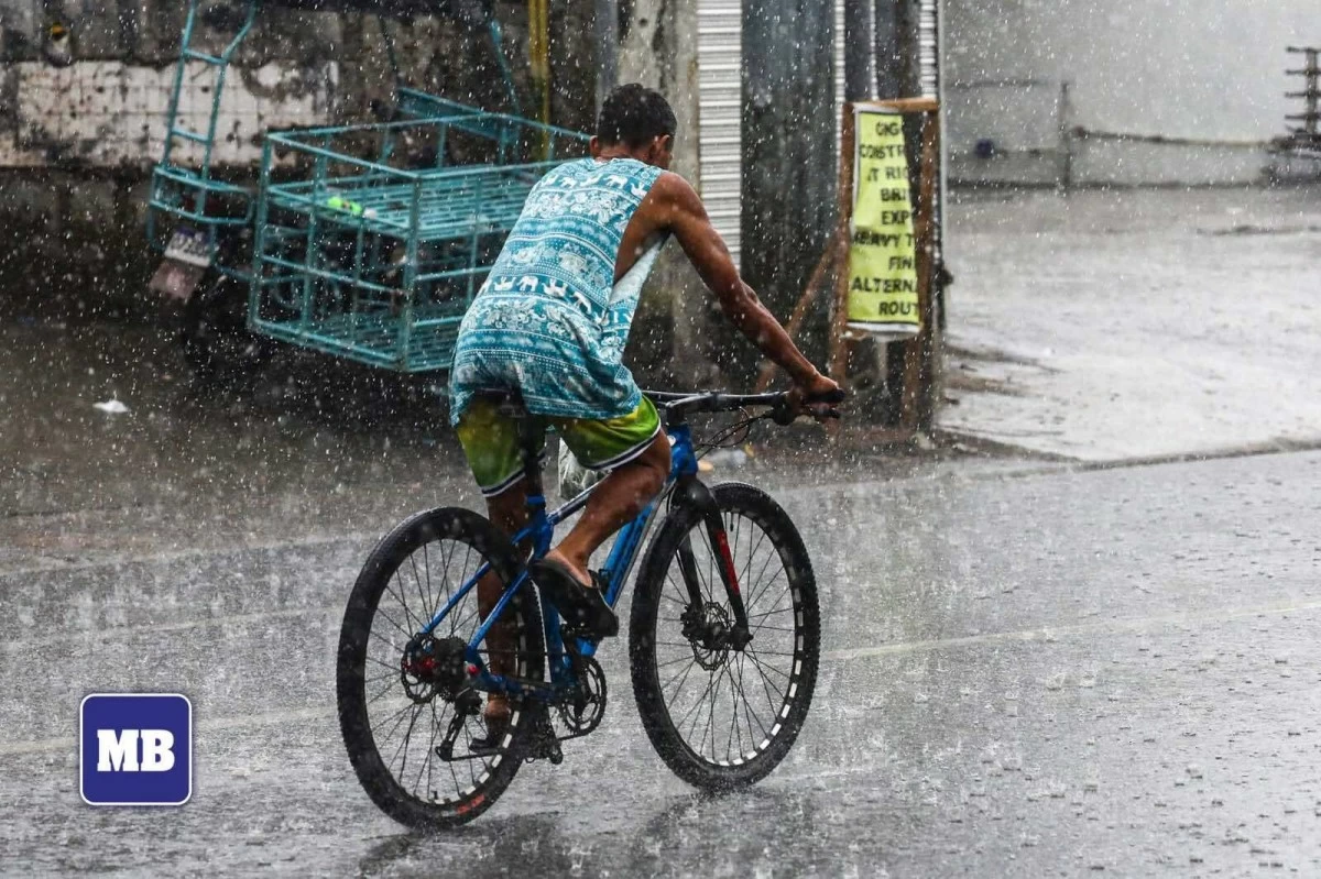
(John Louie Abrina/Manila Bulletin file)
A potential super typhoon may enhance the southwest monsoon, or “habagat,” and bring rains over parts of the country next week, the Philippine Atmospheric, Geophysical and Astronomical Services Administration (PAGASA) said on Friday, July 3.
In its weekly weather outlook for July 3 to 10, PAGASA said the tropical cyclone, internationally named “Bavi,” may enter the Philippine Area of Responsibility (PAR) by Tuesday evening, July 7, or Wednesday morning, July 8, when it will be assigned the local name “Inday.”
As of Friday, Bavi is classified as a typhoon and remains outside the PAR.
PAGASA said the easterlies will continue to prevail over most parts of the country from Friday until Tuesday, and bring partly cloudy to cloudy skies with isolated rain showers or thunderstorms, particularly in the afternoon or evening.
Beginning Wednesday, the typhoon may bring rains and gusty winds over Cagayan Valley, Ilocos Norte, and Apayao.
Meanwhile, the enhanced habagat is expected to bring light to moderate, and at times heavy, rains over Palawan, Occidental Mindoro, Western Visayas, Negros Island Region, Zamboanga Peninsula, Bangsamoro Autonomous Region in Muslim Mindanao (BARMM), and Soccsksargen.
The rest of the country will continue to experience partly cloudy to cloudy skies with isolated rain showers or thunderstorms.
By Friday, July 10, PAGASA said the typhoon may bring rains and gusty winds over Ilocos Region, Cordillera Administrative Region, and Cagayan Valley.
At the same time, monsoon rains may prevail over the western sections of Central Luzon and Southern Luzon, Western Visayas, Negros Island Region, Zamboanga Peninsula, BARMM, and Soccsksargen due to the enhanced habagat.
PAGASA advised the public to continue monitoring its official weather bulletins, as the track, intensity, and effects of the tropical cyclone may still change.
READ:
mb.com.ph/2026/07/03/potential-super-typhoon-may-enter-par-next-week-pagasa

Related Tags

PAGASA BAVI TYPHOON INDAY HABAGAT SOUTHWEST MONSOON SUPER TYPHOON
ADVERTISEMENT
.most-popular .layout-ratio{ padding-bottom: 79.13%; } @media (min-width: 768px) and (max-width: 1024px) { .widget-title { font-size: 15px !important; } }

{{ articles_filter_1561_widget.title }}

.most-popular .layout-ratio{ padding-bottom: 79.13%; } @media (min-width: 768px) and (max-width: 1024px) { .widget-title { font-size: 15px !important; } }

{{ static_articles_1562_widget.title }}

.most-popular .layout-ratio{ padding-bottom: 79.13%; } @media (min-width: 768px) and (max-width: 1024px) { .widget-title { font-size: 15px !important; } }

{{ articles_filter_1563_widget.title }}

{{ articles_filter_1564_widget.title }}

.mb-article-details { position: relative; } .mb-article-details .article-body-preview, .mb-article-details .article-body-summary{ font-size: 17px; line-height: 30px; font-family: "Libre Caslon Text", serif; color: #000; } .mb-article-details .article-body-preview iframe , .mb-article-details .article-body-summary iframe{ width: 100%; margin: auto; } .read-more-background { background: linear-gradient(180deg, color(display-p3 1.000 1.000 1.000 / 0) 13.75%, color(display-p3 1.000 1.000 1.000 / 0.8) 30.79%, color(display-p3 1.000 1.000 1.000) 72.5%); position: absolute; height: 200px; width: 100%; bottom: 0; display: flex; justify-content: center; align-items: center; padding: 0; } .read-more-background a{ color: #000; } .read-more-btn { padding: 17px 45px; font-family: Inter; font-weight: 700; font-size: 18px; line-height: 16px; text-align: center; vertical-align: middle; border: 1px solid black; background-color: white; } .hidden { display: none; }
function initializeAllSwipers() { // Get all hidden inputs with cms_article_id document.querySelectorAll('[id^="cms_article_id_"]').forEach(function (input) { const cmsArticleId = input.value; const articleSelector = '#article-' + cmsArticleId + ' .body_images'; const swiperElement = document.querySelector(articleSelector); if (swiperElement && !swiperElement.classList.contains('swiper-initialized')) { new Swiper(articleSelector, { loop: true, pagination: false, navigation: { nextEl: '#article-' + cmsArticleId + ' .swiper-button-next', prevEl: '#article-' + cmsArticleId + ' .swiper-button-prev', }, }); } }); } setTimeout(initializeAllSwipers, 3000); const intersectionObserver = new IntersectionObserver( (entries) => { entries.forEach((entry) => { if (entry.isIntersecting) { const newUrl = entry.target.getAttribute("data-url"); if (newUrl) { history.pushState(null, null, newUrl); let article = entry.target; // Extract metadata const author = article.querySelector('.author-section').textContent.replace('By', '').trim(); const section = article.querySelector('.section-info ').textContent.replace(' ', ' '); const title = article.querySelector('.article-title h1').textContent; // Parse URL for Chartbeat path format const parsedUrl = new URL(newUrl, window.location.origin); const cleanUrl = parsedUrl.host + parsedUrl.pathname; // Update Chartbeat configuration if (typeof window._sf_async_config !== 'undefined') { window._sf_async_config.path = cleanUrl; window._sf_async_config.sections = section; window._sf_async_config.authors = author; } // Track virtual page view with Chartbeat if (typeof pSUPERFLY !== 'undefined' && typeof pSUPERFLY.virtualPage === 'function') { try { pSUPERFLY.virtualPage({ path: cleanUrl, title: title, sections: section, authors: author }); } catch (error) { console.error('ping error', error); } } // Optional: Update document title if (title && title !== document.title) { document.title = title; } } } }); }, { threshold: 0.1 } ); function showArticleBody(button) { const article = button.closest("article"); const summary = article.querySelector(".article-body-summary"); const body = article.querySelector(".article-body-preview"); const readMoreSection = article.querySelector(".read-more-background"); // Hide summary and read-more section summary.style.display = "none"; readMoreSection.style.display = "none"; // Show the full article body body.classList.remove("hidden"); } document.addEventListener("DOMContentLoaded", () => { let loadCount = 0; // Track how many times articles are loaded const offset = [1, 2, 3, 4, 5, 6, 7, 8, 9, 10]; // Offset values const currentUrl = window.location.pathname.substring(1); let isLoading = false; // Prevent multiple calls if (!currentUrl) { console.log("Current URL is invalid."); return; } const sentinel = document.getElementById("load-more-sentinel"); if (!sentinel) { console.log("Sentinel element not found."); return; } function isSentinelVisible() { const rect = sentinel.getBoundingClientRect(); return ( rect.top < window.innerHeight && rect.bottom >= 0 ); } function onScroll() { if (isLoading) return; if (isSentinelVisible()) { if (loadCount >= offset.length) { console.log("Maximum load attempts reached."); window.removeEventListener("scroll", onScroll); return; } isLoading = true; const currentOffset = offset[loadCount]; window.loadMoreItems().then(() => { let article = document.querySelector('#widget_1690 > div:nth-last-of-type(2) article'); intersectionObserver.observe(article) loadCount++; }).catch(error => { console.error("Error loading more items:", error); }).finally(() => { isLoading = false; }); } } window.addEventListener("scroll", onScroll); });

Sign up by email to receive news.