


Manila Bulletin
 Philippines
National
PhilSA: Mayon ashfall potentially affected crops covering area as large as Mandaluyong
Philippines
National
PhilSA: Mayon ashfall potentially affected crops covering area as large as Mandaluyong
Philippines
National
PhilSA: Mayon ashfall potentially affected crops covering area as large as Mandaluyong
PhilSA: Mayon ashfall potentially affected crops covering area as large as Mandaluyong
By Jel Santos
Published May 9, 2026 03:34 pm


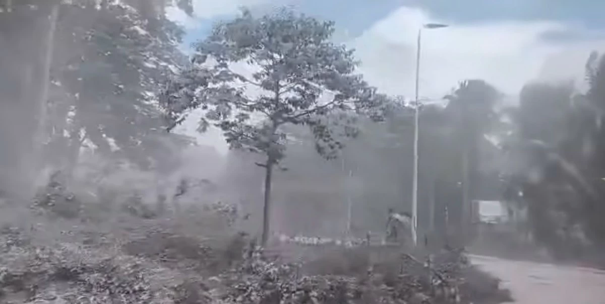
(Courtesy: PRC)
The combined area of crops potentially affected by ashfall from Mayon Volcano is now estimated to be roughly equivalent to the size of Mandaluyong City, the Philippine Space Agency (PhilSA) said.
In a statement released on Saturday, May 9, PhilSA said its satellite-based crop exposure map showed that at least 1,039 hectares of rice areas and 191 hectares of other crop areas were potentially affected following the reported pyroclastic density current along the Mi-isi gully of Mayon Volcano on May 2.
“The combined area of potentially affected crops is around the size of Mandaluyong City,” the agency stated.
PhilSA said the affected areas were identified within the “Estimated Ash Deposit Extent,” which was based on a previous satellite analysis released on May 5.
“At least 1,039 hectares (10.39 sqkm) of rice and 191 hectares (1.91 sqkm) of other crops were potentially affected because they are found within the Estimated Ash Deposit Extent,” it added.
According to PhilSA, the identified “Physical Rice Areas” were sourced from data provided by the Philippine Rice Research Institute (PhilRice), while other crop areas were classified through vegetation pattern analysis using Sentinel-2 satellite imagery collected from January to December 2024.
The agency likewise noted that at least 158 kilometers of roads are located within the estimated ash deposit extent.
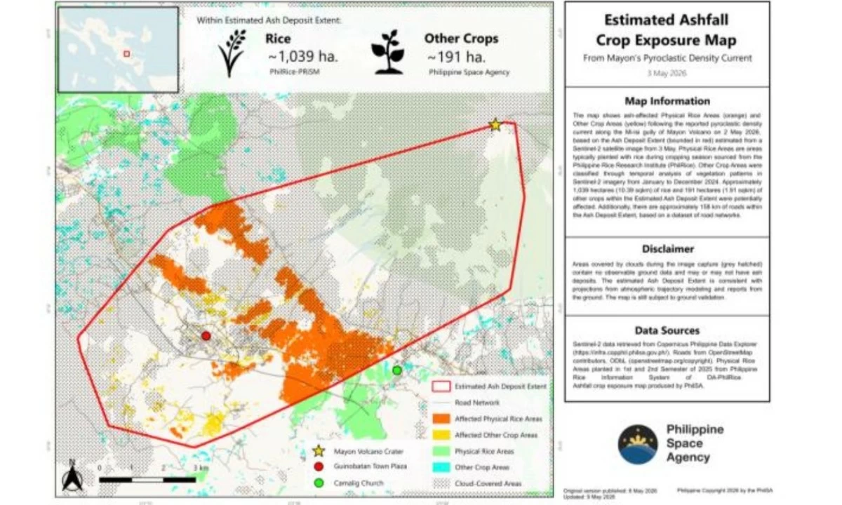
(Courtesy: PhilSA)
“The amount of information derived from satellite data is oftentimes constrained by cloud cover,” PhilSA said.
“Areas covered by clouds during the image capture (grey hatched) contain no observable ground data and may or may not have ash deposits,” it added.
PhilSA said the estimated ash deposit extent remains “subject to ground validation,” but noted that the findings are consistent with atmospheric trajectory modeling and reports from the ground.
The agency added that its satellite monitoring provides wide-area coverage that assists the National Disaster Risk Reduction and Management Council (NDRRMC) in monitoring the situation and prioritizing areas for response.
Meanwhile, the Philippine Institute of Volcanology and Seismology (Phivolcs) said Mayon Volcano remained under Alert Level 3 on Saturday, May 9, as it continued to exhibit lava effusion, volcanic earthquakes, rockfall events, and pyroclastic density current signals.
In its 24-hour observation bulletin, Phivolcs reported lava flows extending up to 3.8 kilometers along the Basud gully, 3.2 kilometers along the Bonga gully, and 1.3 kilometers along the Mi-isi gully, accompanied by “episodic minor strombolian activity and short-lived lava fountaining.”
The agency also recorded 27 volcanic earthquakes, including three volcanic tremors lasting two to four minutes, along with 318 rockfall events and two pyroclastic density current signals.