


'Tino' moves away from Philippine landmass
Published Nov 5, 2025 06:13 pm


PAGASA
After pummeling Northern Mindanao, the Visayas, and Palawan, Typhoon Tino (international name: Kalmaegi) has moved over the West Philippine Sea as of Wednesday afternoon, Nov. 5, the Philippine Atmospheric, Geophysical and Astronomical Services Administration (PAGASA) said.
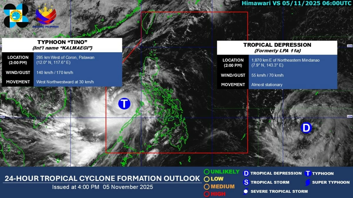
At 4 p.m., the eye of the typhoon was located 330 kilometers east-northeast of Pag-asa Island, Kalayaan, Palawan, moving west-northwest at 30 kilometers per hour (kph).
PAGASA said Tino is expected to continue moving west-northwest over the West Philippine Sea and may exit the Philippine Area of Responsibility (PAR) by Wednesday evening or Thursday morning, Nov. 6.
Gradual improvement in weather conditions is expected over the next 24 hours, particularly in areas previously affected by the typhoon.
Tropical cyclone wind signals No. 3 and 4 have been lifted but Signal No. 2 remains over Kalayaan Islands, while Signal No. 1 continues over Occidental Mindoro, Lubang Islands, the rest of Palawan, and the Calamian and Cuyo Islands.
The typhoon may re-intensify within 12 hours and reach its peak intensity while over the West Philippine Sea.
Tino remains a strong tropical cyclone with maximum sustained winds of 140 kph near the center and gustiness of up to 170 kph.
Meanwhile, PAGASA is continuously monitoring the tropical depression outside the PAR, which may intensify into a super typhoon and make landfall over Northern or Central Luzon next week.
READ MORE: