


Manila Bulletin
 Philippines
National
Signal No. 2 likely in N. Luzon once 'Mirasol' strengthens into a tropical storm — PAGASA
Philippines
National
Signal No. 2 likely in N. Luzon once 'Mirasol' strengthens into a tropical storm — PAGASA
Philippines
National
Signal No. 2 likely in N. Luzon once 'Mirasol' strengthens into a tropical storm — PAGASA
Signal No. 2 likely in N. Luzon once 'Mirasol' strengthens into a tropical storm — PAGASA
The tropical depression maintains its strength as it traverses Apayao
Published Sep 17, 2025 09:44 pm


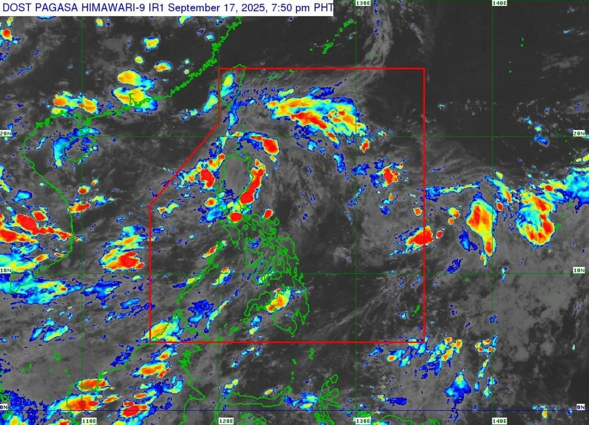
Tropical Depression Mirasol continues to bring rains and winds over Northern Luzon. PAGASA said Signal No. 2 may be raised in several provinces once it becomes a tropical storm. (PAGASA)
The Philippine Atmospheric, Geophysical and Astronomical Services Administration (PAGASA) said Wednesday night, September 17, that Tropical Depression Mirasol may intensify into a tropical storm as it moves across Northern Luzon, with the possible hoisting of Wind Signal No. 2 over some areas while maintaining its current strength over Apayao.
In its 8 p.m. bulletin, PAGASA said the center of Mirasol was located in the vicinity of Calanasan, Apayao, with maximum sustained winds of 55 km/h, gusts of up to 90 km/h, and a central pressure of 1002 hPa as of 7 p.m.
The system is moving north-northwestward at 15 km/h, PAGASA added.
PAGASA said “Mirasol” will continue moving northwestward and is expected to exit the Philippine Area of Responsibility (PAR) by Thursday morning, September 18.
“Based on the intensity forecast, MIRASOL will likely intensify into a tropical storm when it re-emerges over the Luzon Strait,” PAGASA said. “With this intensification, the hoisting of Wind Signal No. 2 is possible over some portions of Northern Luzon,” it added.
While crossing Northern Luzon, Mirasol is expected to maintain its current strength but may intensify into a tropical storm once it re-emerges over the Luzon Strait early Thursday.
Forecasters also did not rule out further strengthening into a severe tropical storm.
Several areas under Signal No. 1
PAGASA has already placed several provinces under Tropical Cyclone Wind Signal (TCWS) No. 1, warning residents of strong winds with minimal to minor threats to life and property.
1. Batanes
2. Cagayan including Babuyan Islands
3. Northern portion of Isabela (Santo Tomas, Santa Maria, Quezon, Roxas, Delfin Albano, San Pablo, Tumauini, Cabagan, Quirino, Mallig, Maconacon, San Mateo, Aurora, Cabatuan, San Manuel, Burgos, Gamu, Reina Mercedes, Luna, Ilagan City, Divilacan)
4. Apayao
5. Abra
6. Kalinga
7. Mountain Province
8. Eastern and northern portions of Ifugao (Mayoyao, Hungduan, Aguinaldo, Banaue, Alfonso Lista, Hingyon)
9. Ilocos Norte
10. Northern portion of Ilocos Sur (Sinait, Cabugao, San Juan, Magsingal, Santo Domingo, Bantay, San Vicente, San Ildefonso, Santa Catalina, City of Vigan, Caoayan, Santa, Cervantes, Quirino, San Emilio, Gregorio del Pilar, San Esteban, Banayoyo, Burgos, City of Candon, Santa Lucia, Santiago, Lidlidda, Nagbukel, Suyo, Sigay, Galimuyod, Santa Cruz, Santa Maria, Narvacan, Salcedo)
PAGASA noted that minimal to minor wind impacts are expected in these areas, especially in coastal and upland communities.
Rain, monsoon winds expected to affect other areas
PAGASA said the southwest monsoon (habagat), enhanced by TD Mirasol, will also bring strong to gale-force gusts in Southern Quezon, Camarines Norte, Camarines Sur, and Mimaropa (Sept. 17); Metro Manila, Isabela, Cagayan, Babuyan Islands, Batanes, Ilocos Region, Zambales, Bataan, Cavite, Quezon, Bicol Region, Mimaropa, and Western Visayas (Sept. 18); and Ilocos Region, Zambales, and Bataan (Sept. 19).
Meanwhile, PAGASA said moderate to rough seas are expected along the eastern seaboard of mainland Cagayan and Isabela (up to 3.0 meters), as well as in the surrounding waters of Batanes, Babuyan Islands, Aurora, and Ilocos provinces (up to 2.5 meters).
RELATED STORY: