


 Philippines
National
More areas in Cagayan Valley under Signal No. 1 as 'Carina' intensifies into a typhoon
Philippines
National
More areas in Cagayan Valley under Signal No. 1 as 'Carina' intensifies into a typhoon
More areas in Cagayan Valley under Signal No. 1 as 'Carina' intensifies into a typhoon


At A Glance
- Signal No. 1 was hoisted over Batanes, the eastern portion of mainland Cagayan (Santa Ana, Gattaran, Baggao, Peñablanca, Lal-Lo, Gonzaga), including the eastern portion of Babuyan Islands (Camiguin Island and Babuyan Island), and the northeastern portion of Isabela (Divilacan, Palanan, Maconacon).
- Typhoon Carina is not expected to make landfall, however, it may bring moderate to intense rains over parts of Cagayan Valley until Thursday, July 25.
- Rains from the enhanced southwest monsoon or "habagat" may persist until Wednesday, July 24.
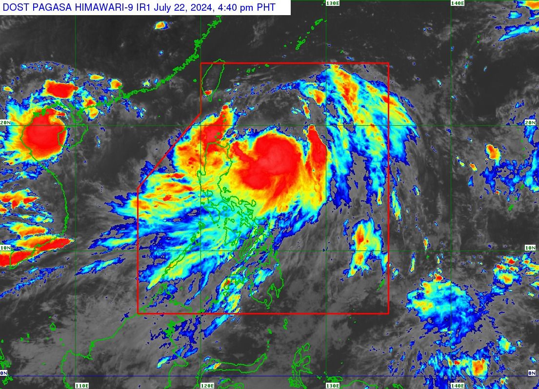
Tropical cyclone “Carina” (international name “Gaemi”) has intensified into a typhoon, prompting the Philippine Atmospheric, Geophysical and Astronomical Services Administration (PAGASA) to raise Wind Signal No. 1 over more areas in Cagayan Valley on Monday afternoon, July 22.
In its 5 p.m. bulletin, PAGASA said Carina is currently packing maximum sustained winds of 120 kilometers per hour (kph) near the center, with gusts of up to 150 kph, up from 110 kph maximum sustained winds and 135 kph gusts six hours ago.
The typhoon was located 420 kilometers east of Tuguegarao City and is not expected to make landfall.
However, due to Carina’s strong winds, Signal No. 1 was hoisted over Batanes, the eastern portion of mainland Cagayan (Santa Ana, Gattaran, Baggao, Peñablanca, Lal-Lo, Gonzaga), including the eastern portion of Babuyan Islands (Camiguin Island and Babuyan Island), and the northeastern portion of Isabela (Divilacan, Palanan, Maconacon).
Until Tuesday afternoon, July 23, heavy to intense rains (100 to 200 millimeters) may continue to affect the extreme northeastern portion of mainland Cagayan, while moderate to heavy rains (50 to 100 millimeters) may persist in Babuyan Islands and the eastern parts of mainland Cagayan and Isabela.
From Tuesday afternoon to Wednesday afternoon, July 24, Batanes may continue to experience heavy to intense rains, while Babuyan Islands and the northeastern portion of mainland Cagayan may have moderate to heavy rains.
From Wednesday afternoon to Thursday afternoon, July 25, moderate to heavy rains may persist in Batanes.
As typhoon Carina moves north-northeastward slowly, it is pulling the southwest monsoon inland towards Luzon, affecting various parts of the island.
PAGASA said rains from the enhanced southwest monsoon or “habagat” may persist until Wednesday.
READ: https://mb.com.ph/2024/7/22/carina-may-become-a-typhoon-habagat-rains-to-persist-in-next-2-days
Based on its track forecast, it is expected to exit the country’s area of responsibility on Wednesday evening or Thursday morning.