


 Philippines
National
TD Aghon slightly intensifies, makes another landfall in Marinduque
Philippines
National
TD Aghon slightly intensifies, makes another landfall in Marinduque
TD Aghon slightly intensifies, makes another landfall in Marinduque
By Sonny Daanoy


Tropical Depression Aghon slightly intensified as it made its seventh landfall over Torrijos, Marinduque, the Philippine Atmospheric, Geophysical, and Astronomical Services Administration (PAGASA) said on Saturday, May 25.
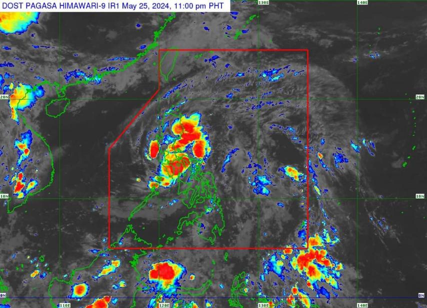
In the 11 p.m. bulletin, PAGASA said TD Aghon's maximum sustained winds had slightly increased to 55 kilometers per hour (kph) near the center, up from 45 kph in the 7 p.m. monitoring.
READ:
At 10 p.m., PAGASA sighted the location of "Aghon" over the vicinity of Torrijos, Marinduque, moving northwestward at 15 kph with gusts of up to 75 kph.
This landfall marks the seventh for "Aghon."
The previous landfalls occurred in Guiuan, Eastern Samar at 11:20 p.m. on May 24, followed by Giporlos, Eastern Samar at 12:40 a.m. on May 25.
The third landfall was in Basiao, Catbalogan, Samar at 4 a.m. on May 25, and the fourth in Cagduyong, Catbalogan, Samar at 5 a.m. on the same day.
Aghon then made its fifth landfall on Ticao Island at 10:20 a.m. and its sixth landfall in Masbate City at 10:40 a.m. on May 25.
Wind signals
Tropical Cyclone Wind Signal (TCWS) No. 1 was still hoisted over the southeastern portion of Isabela, the southern portion of Quirino, the southern portion of Nueva Vizcaya, the eastern and southern portions of Nueva Ecija, Aurora, the eastern portion of Pampanga, Bulacan, Metro Manila, Quezon, Rizal, Laguna, and the eastern portion of Cavite.
A similar wind signal was up for areas such as the eastern portion of Batangas, the northern portion of Oriental Mindoro, portions of Occidental Mindoro, Marinduque, Romblon, Camarines Norte, Camarines Sur, Catanduanes, Albay, and Burias Island.