PAGASA: 'Pepito' exits Philippine area of responsibility

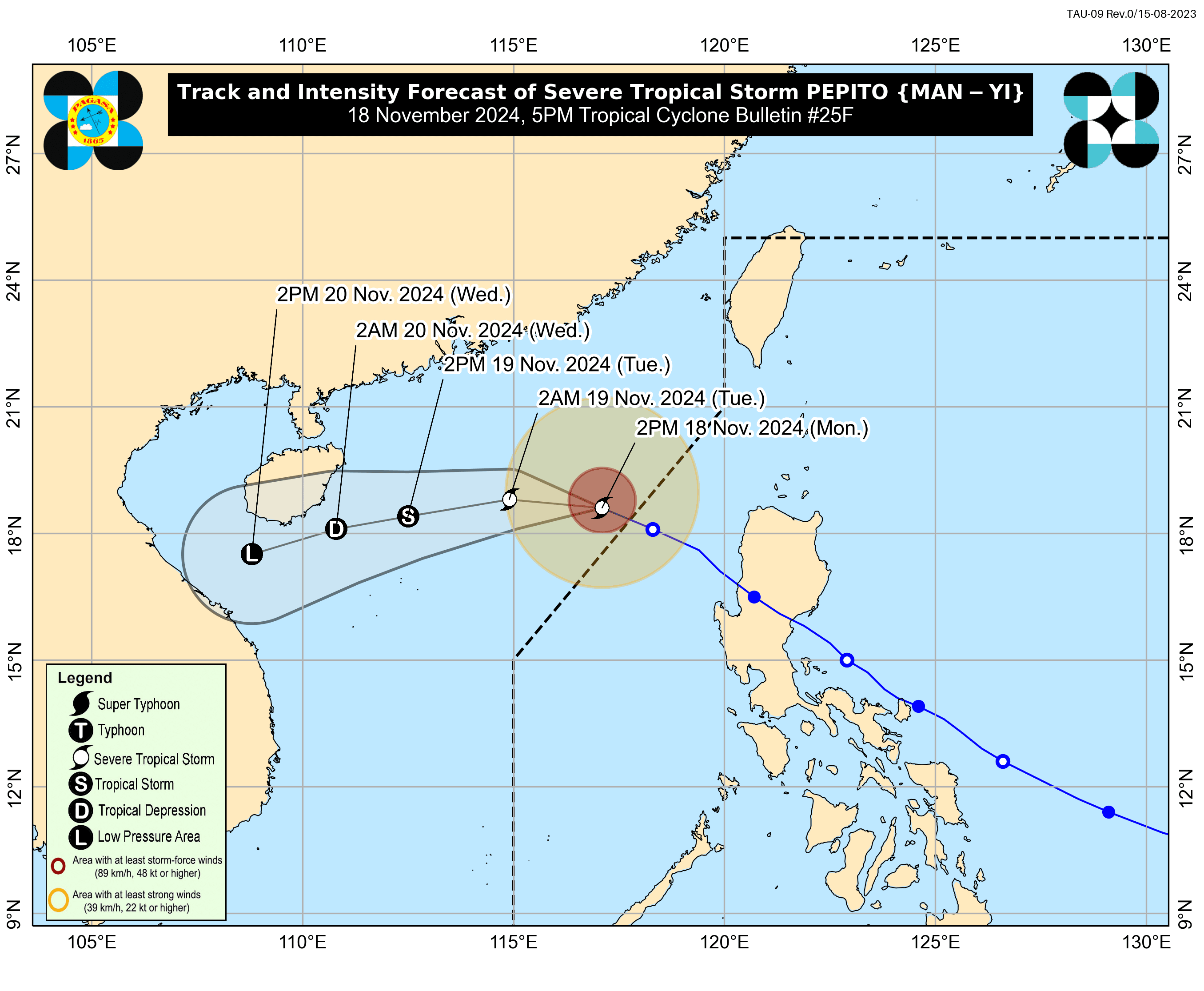
Severe Tropical Storm “Pepito” (international name: Man-yi) exited the Philippine area of responsibility (PAR) at 12 p.m. on Monday, Nov. 18, said the Philippine Atmospheric, Geophysical and Astronomical Services Administration (PAGASA).
In its final tropical cyclone bulletin issued at 5 p.m., PAGASA reported that Pepito was spotted 405 kilometers west-northwest of Sinait, Ilocos Sur. The severe tropical storm had maximum sustained winds of 110 kilometers per hour (kph) near its center and gusts reaching 135 kph.
As Pepito no longer directly affects any part of the country, PAGASA has lifted all wind signals associated with the storm.
READ MORE: https://mb.com.ph/2024/11/18/philippines-gets-much-needed-break
Over the next 24 hours, the shear line, northeasterly surface wind flow, and easterlies will be the dominant weather systems in the country.
The shear line, which forms when cold air from the northeasterly winds meets warm air from the easterlies, may bring cloudy skies with scattered rains and isolated thunderstorms over Babuyan Islands.
Meanwhile, the northeasterly surface wind flow, the initial blast of cold air associated with the northeast monsoon or “amihan,” may bring cloudy skies and rains over Batanes.
Eastern Visayas, Caraga, and Davao Region are likely to experience partly cloudy to cloudy skies with isolated rain showers or thunderstorms due to the easterlies, or warm winds from the Pacific Ocean.
The rest of the country will experience partly cloudy to cloudy skies with isolated rain showers due to localized thunderstorms.
Moreover, due to the strong to gale-force winds associated with the northeasterly surface wind flow, PAGASA has issued a gale warning for the northern seaboard of Northern Luzon, including Batanes, northern Ilocos Norte (Burgos, Bangui, Pagudpud), and Babuyan Islands (Babuyan Island, Calayan Island, and Dalupiri Island). Rough to very rough seas are expected in these areas.