


 Philippines
National
'Goring' may re-intensify into super typhoon as it makes landfall or passes close to Batanes — PAGASA
Philippines
National
'Goring' may re-intensify into super typhoon as it makes landfall or passes close to Batanes — PAGASA
'Goring' may re-intensify into super typhoon as it makes landfall or passes close to Batanes — PAGASA


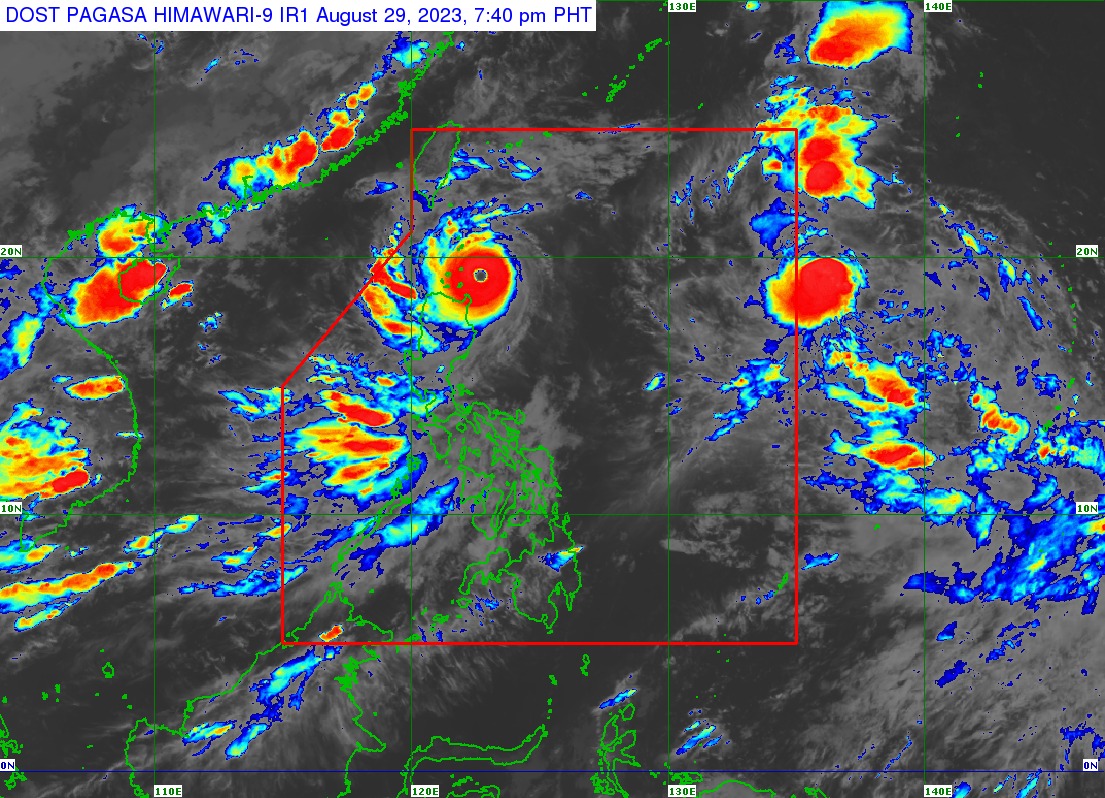
The Philippine Atmospheric, Geophysical and Astronomical Services Administration (PAGASA) said typhoon Goring (international name: Saola) further intensified as it approaches the Balintang Channel on Tuesday evening, Aug. 29.
In its 8 p.m. bulletin, PAGASA said Goring was last located 140 kilometers east of Calayan, Cagayan, moving northwestward at 10 kilometers per hour (kph).
“The latest track forecast indicates that the typhoon may pass very close or make landfall in the vicinity of Babuyan Island tonight (Aug. 29) or tomorrow early morning (Aug. 30),” PAGASA said.
However, it noted that a slight northward shift in the track forecast may bring the eye and eyewall region of Goring to the southern portion of Batanes.
Super typhoon
As of 8 p.m., Goring has maximum sustained winds of 175 kph near the center and gusts of up to 215 kph.
PAGASA said it may continue to re-intensify and reach super typhoon status by the time it passes very close to or over Batanes.
A super typhoon has maximum sustained winds of at least 185 kph.
Wind signals
Tropical Cyclone Wind Signal No. 4 remains hoisted over the northeastern portion of the Babuyan Islands.
Signal No. 3 is still in effect over the southern portion of Batanes and the rest of Babuyan Islands.
Meanwhile, the northeastern portion of mainland Cagayan, the rest of Batanes, and the northern portions of Ilocos Norte and Apayao are under Signal No. 2
Signal No. 1 is still up over the northern and eastern portion of Isabela, the rest of Ilocos Norte, the rest of Cagayan, the rest of Apayao, and the northern portions of Abra and Kalinga.
PAGASA said heavy rains due to Goring and the southwest monsoon, or “habagat” may continue to affect parts of the country in the next few days.
READ MORE: https://mb.com.ph/2023/8/29/typhoon-goring-slightly-intensifies-signal-no-4-up