


Typhoon Goring slightly intensifies; Signal No. 4 up


At A Glance
- The typhoon may pass very close or make landfall in the vicinity of Babuyan Islands between Tuesday evening and early Wednesday morning, Aug. 30.
- The highest possible warning that may be hoisted by PAGASA over extreme Northern Luzon is Signal No. 5.
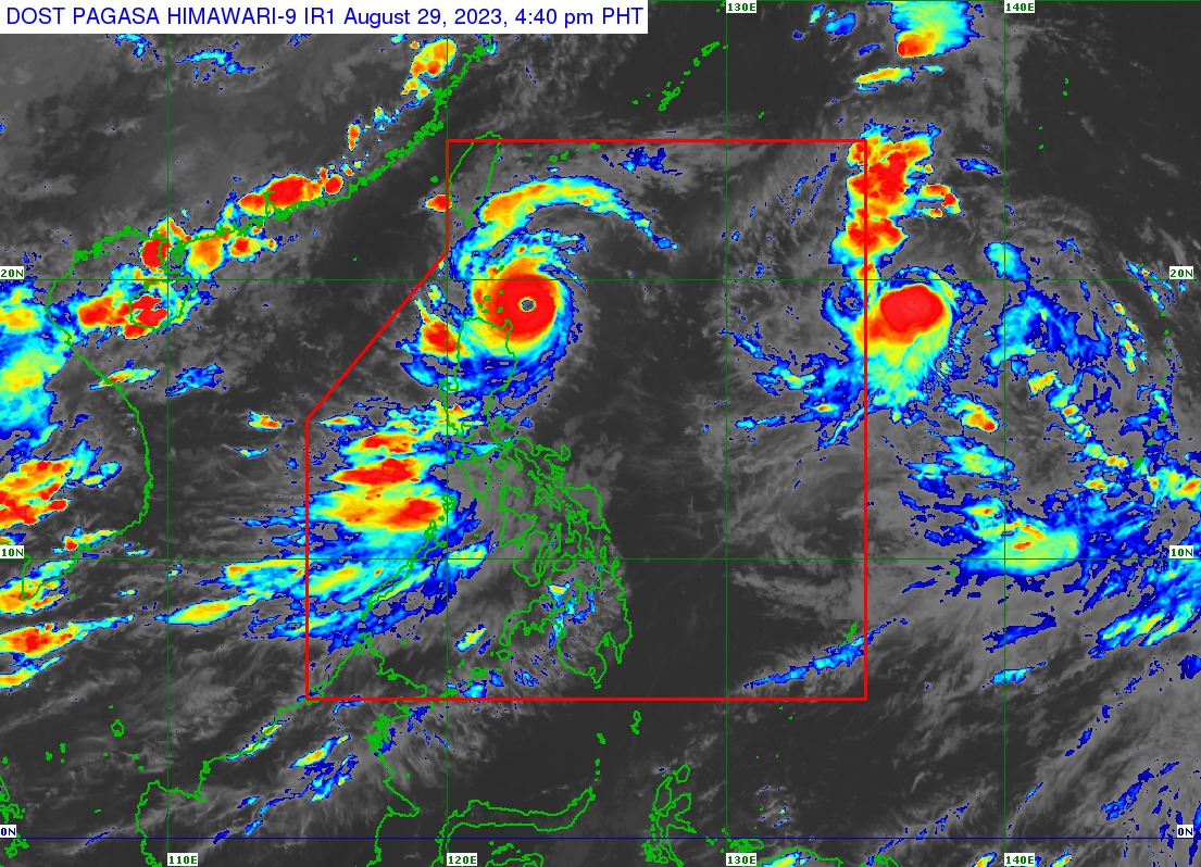
The Philippine Atmospheric, Geophysical and Astronomical Services Administration (PAGASA) issued Tropical Cyclone Wind Signal No. 4 over the northeastern portion of the Babuyan Islands, as typhoon Goring (international name: Saola) intensified slightly on Tuesday afternoon, Aug. 29.
Signal No. 3 was also hoisted over the southern portion of Batanes and the rest of Babuyan Islands.
The northeastern portion of mainland Cagayan, the rest of Batanes, and the northern portions of Ilocos Norte and Apayao were placed under Signal No. 2, while the northern and eastern portion of Isabela, the rest of Ilocos Norte, the rest of Cagayan, the rest of Apayao, and the northern portions of Abra and Kalinga were under Signal No. 1.
In its 5 p.m. bulletin, PAGASA said Goring has maximum sustained winds of 165 kilometers per hour (kph) near the center and gusts of up to 205 kph.
It is currently moving west-northwestward at 10 kph, and was last spotted 165 kilometers east of Calayan, Cagayan.
Landfall, Signal No. 5 possible
PAGASA said Goring will cross the Luzon Strait as it moves northwestward or west-northwestward from Tuesday until it leaves the Philippine area of responsibility (PAR) on Wednesday evening or Thursday morning, Aug. 30 or 31.
The typhoon may pass very close or make landfall in the vicinity of Babuyan Islands between Tuesday evening and early Wednesday morning, Aug. 30, it pointed out.
However, a slight northward shift in the track forecast may bring the eye and eyewall region of Goring to the southern portion of Batanes, it added.
The highest possible warning that may be hoisted by PAGASA over extreme Northern Luzon is Signal No. 5.
Heavy rains to persist
Until Wednesday afternoon, Goring may continue to bring intense rains (100-200 millimeters) to the Babuyan Islands, while heavy rains (50-100 millimeters) may prevail over Batanes, Ilocos Norte, the northern portions of Abra and Apayao, and the northern and eastern portions of mainland Cagayan.
From Wednesday afternoon to Thursday afternoon, Aug. 31, Batanes and Babuyan Islands may experience torrential rains (more than 200 millimeters), while the northern portion of Ilocos Norte and the northwestern portion of Cagayan may receive intense rains.
Heavy rains may also affect Apayao, Abra, the northern portion of Ilocos Sur, northeastern portion of mainland Cagayan, and the rest of Ilocos Norte.
The southwest monsoon, or “habagat” enhanced by Goring may also bring heavy rains to Occidental Mindoro, Zambales, Bataan, Cavite, Batangas, the northern portion of Palawan, including Calamian and Cuyo Islands, Antique, the southwestern portion of Iloilo, and the northwestern portion of Aklan on Tuesday.
By Wednesday, heavy monsoon rains may prevail over Occidental Mindoro, Zambales, Bataan, and northern portion of Palawan, including Calamian and Cuyo Islands
By Thursday, heavy rains may affect Zambales, Bataan, Occidental Mindoro, Metro Manila, Rizal, Bulacan, Cavite, Batangas, and Pangasinan.