The northeast monsoon, locally known as “amihan,” is bringing cloudy skies with rains in northern Luzon, the Philippine Atmospheric, Geophysical and Astronomical Services Administration (PAGASA) said on Saturday, Dec. 17. The weather system, according to PAGASA Weather Specialist Daniel...
Senator Francis ‘’Tol’’ Tolentino on Friday, December 16, said it is the call of President Ferdinand "Bongbong" Marcos Jr. to decide whether to relay to Chinese President Xi Jinping the "unfriendly" acts of the Chinese Coast Guard (CCG) in retrieving a debris from a Chinese rocket that fell...
(MB VISUAL CONTENT GROUP) The Philippine Atmospheric, Geophysical and Astronomical Services Administration (PAGASA) said the northeast monsoon and shear line will be the dominant weather systems that will bring cloudy skies across the entire archipelago next week. In its weekly weather outlook...
(MB VISUAL CONTENT GROUP) Several areas in Luzon may experience cloudy and rainy weather due to the shear line and northeast monsoon, the Philippine Atmospheric, Geophysical and Astronomical Services Administration (PAGASA) said on Thursday, Dec. 15. PAGASA said the shear line—a boundary line...
(MB VISUAL CONTENT GROUP) The northeast monsoon and intertropical convergence zone (ITCZ) will be the dominant weather systems in the country in the next 24 hours, the Philippine Atmospheric, Geophysical and Astronomical Services Administration (PAGASA) said on Wednesday, Dec. 14. Cloudy and rainy...
(MB VISUAL CONTENT GROUP) Tropical storm Rosal (international name: Pakhar) has weakened into a low pressure area (LPA) and is expected to dissipate within 24 hours, the Philippine Atmospheric, Geophysical and Astronomical Services Administration (PAGASA) said on Tuesday, Dec. 13. In its 5 a.m....
(MB VISUAL CONTENT GROUP) The Philippine Atmospheric, Geophysical and Astronomical Services Administration (PAGASA) said on Monday afternoon, Dec. 12, that tropical storm Rosal (international name: Pakhar) has weakened slightly as it continues to move away from the country. In its latest bulletin,...
(MB VISUAL CONTENT GROUP) Batanes and Babuyan Islands may experience cloudy weather with light rains due to the northeast monsoon or “amihan,” the Philippine Atmospheric, Geophysical and Astronomical Services Administration (PAGASA) said on Monday, Dec. 12. PAGASA said the surge of the amihan,...
Cyclone Rosal (international name: Pakhar) has intensified into a tropical storm, the Philippine Atmospheric, Geophysical and Astronomical Services Administration (PAGASA) said on Sunday evening, Dec. 11. (MB Visual Content Group) Rosal, based on PAGASA’s latest bulletin, was last seen 570...
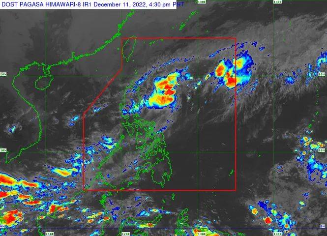
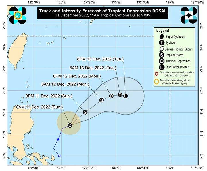
Tropical depression Rosal maintained its strength while moving northeastward over the Philippine Sea, the Philippine Atmospheric, Geophysical and Astronomical Services Administration (PAGASA) said on Sunday afternoon, Dec. 11. In its latest bulletin, the state weather bureau said Rosal was last...
Tropical depression Rosal may intensify into a “low-end” tropical storm in 24 hours, the Philippine Atmospheric, Geophysical and Astronomical Services Administration (PAGASA) said on Sunday, Dec. 11. The said weather disturbance continues to move away from the Philippine landmass. PAGASA’s...
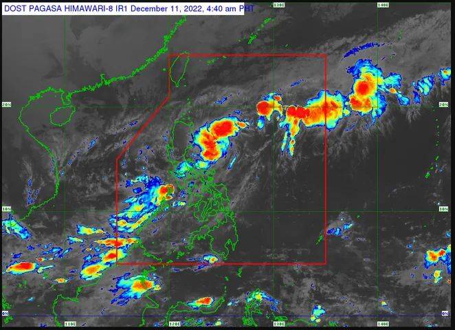
Tropical depression Rosal, the country’s 18th cyclone in 2022, is now moving away from the Philippine landmass, but the state weather bureau said it is still expected to bring moderate to at times heavy rain showers in the provinces of Mindoro, Marinduque, Romblon, and Palawan (MIMAROPA) on...