






Manila Bulletin
 Philippines
National
LPA unlikely to become storm, affect PH; habagat to bring rains —PAGASA
Philippines
National
LPA unlikely to become storm, affect PH; habagat to bring rains —PAGASA
Philippines
National
LPA unlikely to become storm, affect PH; habagat to bring rains —PAGASA
LPA unlikely to become storm, affect PH; habagat to bring rains —PAGASA
By Jel Santos
Published Aug 15, 2026 01:43 pm


At A Glance
- * An LPA spotted 2,270 kilometers east of extreme Northern Luzon poses little threat to the Philippines, according to PAGASA.
- * The weather disturbance is unlikely to become a tropical cyclone within the next 24 hours and is moving away from the country.
- * The 'habagat,' however, will continue to bring rains over Luzon, including Metro Manila, and the western portion of the Visayas.
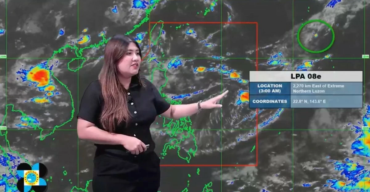
Screenshot
The low-pressure area (LPA) being monitored outside the Philippine Area of Responsibility (PAR) is unlikely to develop into a tropical cyclone or affect any part of the country, the Philippine Atmospheric, Geophysical and Astronomical Services Administration (PAGASA) said on Saturday, Aug. 15.
PAGASA weather specialist Veronica Torres said the LPA was last located 2,270 kilometers east of extreme Northern Luzon as of 3 a.m.
“Mayroon tayong mino-monitor na low-pressure area sa labas ng ating Philippine Area of Responsibility (We are monitoring a low-pressure area outside the Philippine Area of Responsibility),” she said.
“Itong LPA na ito ay napakababa ng tyansa na maging isang ganap na bagyo in the next 24 hours (This LPA has a very low chance of developing into a tropical cyclone within the next 24 hours).”
Torres added that the weather disturbance is moving farther away from the Philippine landmass.
“Itong low-pressure area na ito, mababa ‘yung tiyansang makaapekto sa kahit anong parte ng ating bansa. At ito nga ay papalayo na rin sa ating landmass (This low-pressure area has a low chance of affecting any part of the country. It is also moving farther away from our landmass),” she said.
Meanwhile, PAGASA said the southwest monsoon or “habagat,” continues to affect Luzon and the western section of the Visayas.
The weather specialist said the “habagat” will bring rains over a large portion of Luzon, including Metro Manila.