






Manila Bulletin
 Philippines
National
Potential tropical depression may trigger 'habagat' rains by weekend, says PAGASA
Philippines
National
Potential tropical depression may trigger 'habagat' rains by weekend, says PAGASA
Philippines
National
Potential tropical depression may trigger 'habagat' rains by weekend, says PAGASA
Potential tropical depression may trigger 'habagat' rains by weekend, says PAGASA
Published May 25, 2026 06:30 pm


At A Glance
- Based on PAGASA historical data, the onset of the southwest monsoon (habagat) season associated with the country's rainy season typically occurs between May 16 and June 15.
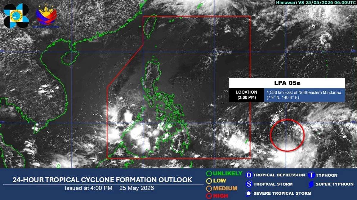
Satellite image (Courtesy of PAGASA)
Better keep your umbrellas ready as the rainy season may soon begin.
The low-pressure area (LPA) being monitored outside the Philippine Area of Responsibility (PAR) may develop into a tropical depression within 24 hours and could pull the southwest monsoon or “habagat” into the country by the weekend, the Philippine Atmospheric, Geophysical and Astronomical Services Administration (PAGASA) said on Monday, May 25.
PAGASA weather specialist Grace Castañeda said the LPA was last spotted 1,530 kilometers east of northeastern Mindanao on Monday afternoon.
“Tumataas na po ‘yung possibility nito na maging isang ganap na tropical depression within the next 24 hours and posible po itong pumasok sa loob ng ating Area of Responsibility this coming weekend, either by Friday po ‘yan or Saturday (The possibility of this system developing into a tropical depression within the next 24 hours is increasing, and it may enter the PAR this coming weekend, either Friday or Saturday, May 29 or 30),” she said.
Castañeda said the weather disturbance remains erratic in movement but is expected to move west-northwestward before turning northward over the waters east of the country in the coming days.
However, she noted that the LPA is still far from the country and may still change course or intensity.
“Nakikita po natin na sa pagpasok po nitong LPA na ito is posible din po nitong ma-trigger ‘yung southwesterly o ‘yung habagat po natin. So possible po sa mga susunod na linggo is itong southwesterly component or wind flow po natin ‘yung posibleng magdulot ng mga pag-ulan dito sa malaking bahagi ng Southern Luzon, Visayas at Mindanao lalong-lalo na po dito sa may western section (We are seeing that once this LPA enters PAR, it may also trigger the southwesterly winds or the southwest monsoon. In the coming days, the southwesterly wind flow may bring rains over large parts of Southern Luzon, the Visayas, and Mindanao, especially in western sections),” she said.
“Sa ngayon po nasa labas pa itong low-pressure area na mino-monitor natin but ‘yung trough or extension nito ay nagdudulot pa rin ng mga pag-ulan (At present, this low-pressure area we are monitoring is still outside the PAR, but its trough or extension continues to bring rains,” she added.
Castañeda said cloud clusters associated with the southwesterly wind flow are also expected to bring scattered rains over Palawan, the Zamboanga Peninsula, the Bangsamoro Autonomous Region in Muslim Mindanao, Soccsksargen, Lanao del Norte, and Misamis Occidental.
She warned that occasional moderate to heavy rains may trigger floods and landslides in areas affected by the LPA’s trough and southwesterly wind flow.
Meanwhile, Metro Manila and the rest of the country may continue to experience partly cloudy to cloudy skies with isolated rain showers and thunderstorms due to easterlies and localized thunderstorms.
Based on PAGASA historical data, the onset of the southwest monsoon (habagat) season associated with the country's rainy season typically occurs between May 16 and June 15.