


PAGASA: 'Crising' nears landfall; Signal No. 2 up in 11 areas
By Jel Santos
Published Jul 18, 2025 05:46 pm


(PHOTO: DOST-PAGASA FACEBOOK PAGE)
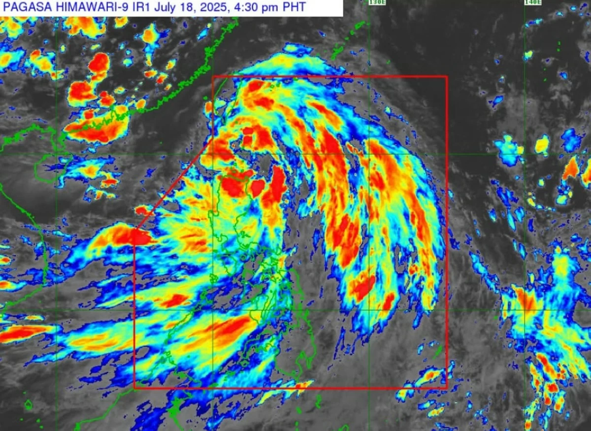
Tropical Storm Crising is expected to make landfall Friday night, July 18, over the northeastern portion of mainland Cagayan or the Babuyan Islands, state weather bureau Philippine Atmospheric, Geophysical and Astronomical Services Administration (PAGASA) said.
“Crising will move west northwestward within the next 12 hours. On the forecast track, it may make landfall over northeastern portion of mainland Cagayan or Babuyan Islands this evening,” PAGASA said in its 5 p.m. bulletin.
As of 4 p.m., the agency said Crising was 135 kilometers east of Aparri, Cagayan, with winds of 75 kph and gusts of up to 105 kph, moving west northwest at 20 kph.
The state weather bureau said the tropical storm’s strong to gale-force winds extend outward up to 550 kilometers from the center.
The storm, according to PAGASA, is expected to exit the Philippine Area of Responsibility (PAR) by Saturday afternoon, July 19, and continue intensifying.
“Crising will continue to intensify until it reaches Severe Tropical Storm category by tomorrow evening or Sunday (20 July) early morning,” PAGASA added.
Wind signals raised across North Luzon
The agency said Tropical Cyclone Wind Signal No. 2 was raised over Batanes, Cagayan including Babuyan Islands, Isabela, Apayao, Kalinga, Ilocos Norte, and parts of Abra, Ilocos Sur, Mountain Province, and Ifugao.
“Minor to moderate impacts from gale-force winds are possible within any of the localities where Wind Signal No. 2 is hoisted,” PAGASA warned.
It added that Signal No. 1 was raised in more than 30 other areas in Luzon, including Quirino, Nueva Vizcaya, Benguet, La Union, the northern portion of Pangasinan, and northern Aurora.
“Minimal to minor impacts from strong winds are possible within any of the areas under Wind Signal No. 1,” the agency said.
Up to 2-meter storm surges expected
The state weather bureau warned that Crising may trigger storm surges up to 2.0 meters high within the next 24 hours along coastal areas of Batanes, Cagayan including Babuyan Islands, Ilocos Norte, and Ilocos Sur.
“There is a minimal to moderate risk of life-threatening storm surge with peak heights reaching 1.0 to 2.0 m within 24 hours over the low-lying or exposed coastal localities,” the PAGASA said.
Sea travel suspended, gale warning in effect
A gale warning is hoisted over the northern seaboard of Northern Luzon, where waves may reach 6.0 meters. Conditions are dangerous for all types of vessels, PAGASA said.
“Sea travel is risky for all types or tonnage of vessels. All mariners must remain in port or, if underway, seek shelter or safe harbor as soon as possible until winds and waves subside,” it added
Also, the agency said Crising is enhancing the Southwest Monsoon, which is expected to bring strong to gale-force gusts and heavy rains to parts of Luzon, Visayas, and Mindanao.
PAGASA said affected areas include Metro Manila, Pangasinan, Zambales, Bataan, CALABARZON, Bicol Region, MIMAROPA, Western Visayas, and parts of Mindanao, through the weekend.
“Persons living in areas identified to be highly or very highly susceptible to these hazards are advised to follow evacuation and other instructions from local officials,” it said.