






Manila Bulletin
 Philippines
National
PAGASA: 'Moderate-to-strong' El Niño already present in tropical Pacific
Philippines
National
PAGASA: 'Moderate-to-strong' El Niño already present in tropical Pacific
Philippines
National
PAGASA: 'Moderate-to-strong' El Niño already present in tropical Pacific
PAGASA: 'Moderate-to-strong' El Niño already present in tropical Pacific
Published Aug 26, 2026 01:41 pm


At A Glance
- PAGASA Weather Specialist Joey Figuracion said both oceanic and atmospheric indicators continue to show that El Niño is strengthening, prompting the agency to raise its assessment from moderate to moderate-to-strong.
- Despite the prevailing El Niño, PAGASA expects tropical cyclone activity to continue through the remainder of 2026.
- PAGASA expects two or three cyclones in September and one or two each in October, November, and December.
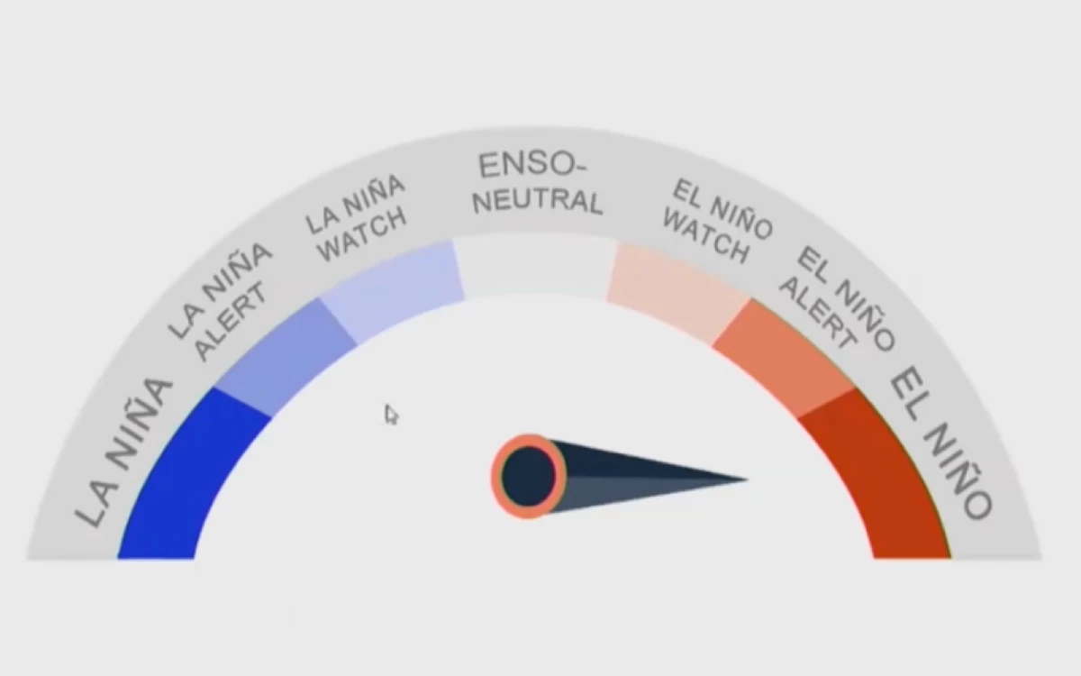
PAGASA ENSO Alert System Status
El Niño conditions over the tropical Pacific have strengthened to “moderate-to-strong” and are more likely to become “very strong” before the end of the year, the Philippine Atmospheric, Geophysical and Astronomical Services Administration (PAGASA) said.
PAGASA Weather Specialist Joey Figuracion said both oceanic and atmospheric indicators continue to show that El Niño is strengthening, prompting the agency to raise its assessment from moderate to moderate-to-strong.
“Our updated ENSO (El Niño-Southern Oscillation) Alert and Warning System statement is that moderate-to-strong conditions are ongoing. The El Niño has strengthened from moderate to moderate-to-strong, which is what we are now experiencing in the tropical Pacific,” Figuracion said during PAGASA’s Climate Outlook Forum on Wednesday, Aug. 26.
He also noted that the latest weekly reading in the Niño 3.4 region was 1.8 degrees Celsius above average, already beyond PAGASA’s threshold for a strong El Niño.
Climate models also indicate that El Niño could reach the very strong category before the end of 2026 and continue into the first half of 2027.
Rainfall outlook
PAGASA’s climate outlook forecasts below-normal rainfall over several parts of the country in the next six months.
Most of Northern Luzon is expected to have below-normal rainfall in September, while below-normal conditions are forecast over Luzon, Visayas, and Caraga in October.
In November, way-below-normal to below-normal rainfall is expected across most of the country, although some areas in Mindanao may receive near-normal rainfall.
The rainfall pattern is expected to change in December, when above-normal rainfall is forecast over most of Luzon and Western Visayas, while much of the Visayas and Mindanao may experience below-normal rainfall.
Way-below-normal to below-normal rainfall is again expected across the country in January and February 2027, except for some areas in Mindanao that may have near-normal rainfall in January.
PAGASA also expects surface air temperatures to be slightly warmer to warmer-than-usual in most parts of the country during the outlook period.
5 to 7 cyclones until yearend
Despite the prevailing El Niño, PAGASA expects tropical cyclone activity to continue through the remainder of the year and into early 2027.
Five to eight tropical cyclones may develop or enter the Philippine Area of Responsibility (PAR) from September 2026 to February 2027.
PAGASA expects two or three in September, one or two each in October, November, and December, zero or one in January, and a slim chance of a tropical cyclone in February.
Figuracion said the chances of landfall also tend to increase during the “ber” months before easing in January and February as tropical cyclone activity generally declines.