






Manila Bulletin
 Philippines
National
PAGASA sees brief break from 'habagat' rains; another monsoon surge possible next week
Philippines
National
PAGASA sees brief break from 'habagat' rains; another monsoon surge possible next week
Philippines
National
PAGASA sees brief break from 'habagat' rains; another monsoon surge possible next week
PAGASA sees brief break from 'habagat' rains; another monsoon surge possible next week
Published Aug 20, 2026 08:24 am


At A Glance
- PAGASA expects Tropical Depression Neneng to weaken into a low-pressure area and exit the PAR within the next 12 hours.
- Meanwhile, a tropical storm with the international name "Saudel" may enter the PAR between Sunday, Aug. 23, and Monday, Aug. 24.
PAGASA
A respite from rains brought by the southwest monsoon or “habagat” is expected as Tropical Depression Neneng weakens, but the break may be short-lived as another surge of the monsoon is possible next week.
Philippine Atmospheric, Geophysical and Astronomical Services Administration (PAGASA) weather specialist Leanne Loreto said the weakening of Neneng would ease the enhancement of the habagat and allow weather conditions to generally improve on Thursday, Aug. 20.
Loreto said some areas of Luzon could still experience rain, but breaks in the cloudy weather are expected, particularly over eastern Luzon.
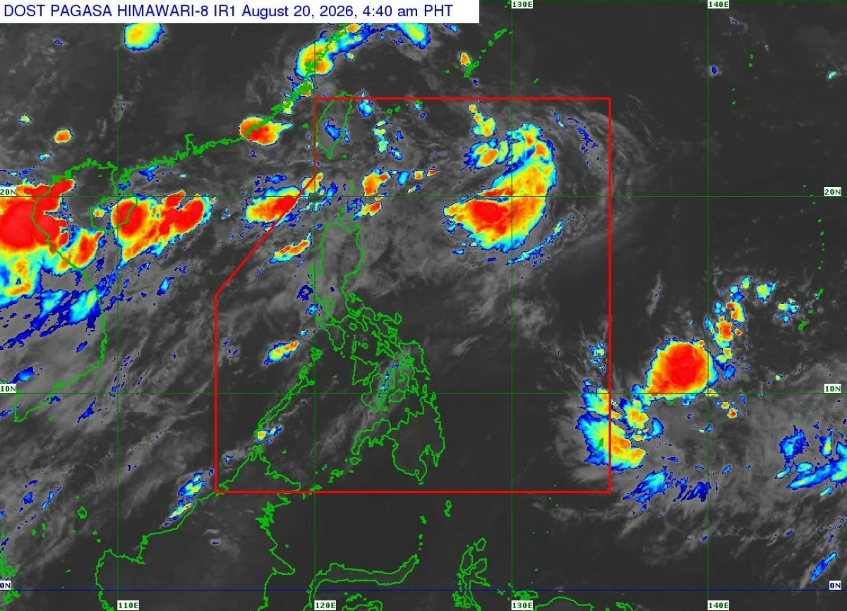
As of 4 a.m., Neneng was located 390 kilometers north of Itbayat, Batanes, with maximum sustained winds of 45 kilometers per hour (kph) and gustiness of up to 55 kph.
Neneng is expected to slow down as it moves northward over the waters off eastern Taiwan or makes landfall over northern Taiwan before weakening into a low-pressure area.
PAGASA expects the weather disturbance to exit the Philippine Area of Responsibility (PAR) within the next 12 hours.
Occasional rains may still affect the Ilocos Region, Batanes, Zambales, and Bataan on Thursday.
Scattered rains may also occur over Metro Manila, the Cordillera Administrative Region, the rest of Cagayan Valley and Central Luzon, Cavite, Batangas, Laguna, Rizal, Occidental Mindoro, Oriental Mindoro, and Palawan.
The rest of the country is expected to have generally fair weather, except for isolated rain showers or thunderstorms in the afternoon or evening.
Potential typhoon
While Neneng weakens, PAGASA is monitoring a tropical storm with the international name “Saudel,” which could trigger another surge of the habagat next week.
As of 3 a.m. Thursday, Saudel was located 2,960 kilometers east of northeastern Mindanao, with maximum sustained winds of 75 kph and gustiness of up to 90 kph.
Loreto said Saudel remains far from the Philippine landmass and has no effect on the country at present.
However, Saudel could strengthen further over the Pacific and may become a typhoon over the weekend.
Loreto said the storm may move west-northwestward and could enter the PAR through its northeastern boundary.
If it enters between Sunday and Monday, Aug. 23 and 24, PAGASA will give it the local name “Obet.”
Loreto said Saudel could once again enhance the habagat.
“Pagsapit ng Sunday at Monday, maaaring nasa northern part ito ng Philippine Sea at ito yung hihila sa habagat. Nakikita natin between Sunday and Monday, magsisimula muling magkaroon tayo ng enhancement o palalakasin muli nito yung habagat (By Sunday and Monday, it may be over the northern part of the Philippine Sea, where it could pull the habagat and we could see the southwest monsoon strengthen again),” Loreto said.
“Magkakaroon ng panibagong surge by Sunday, start po yan at mag-i-increase ang intensity ng habagat Monday onwards (There will be another surge starting Sunday, and the intensity of the habagat will increase from Monday onward),” she added.
Luzon and the western section of Visayas could consequently experience more rain next week, she said.
PAGASA warned that the scenario for Saudel could still change since the tropical cyclone remains far from the country.
Meanwhile, another tropical depression was located 1,100 kilometers west of extreme Northern Luzon, also outside the PAR.
The weather disturbance was moving southwestward at 10 kph and could make landfall over Vietnam or mainland southern China.
It was moving away from the Philippines and was not expected to affect the country.