






Manila Bulletin
 Philippines
National
'Habagat' rains to gradually ease in next few days, says PAGASA
Philippines
National
'Habagat' rains to gradually ease in next few days, says PAGASA
Philippines
National
'Habagat' rains to gradually ease in next few days, says PAGASA
'Habagat' rains to gradually ease in next few days, says PAGASA
Published Aug 10, 2026 10:01 am


At A Glance
- PAGASA weather specialist Chenel Dominguez said significant rainfall would still affect a large part of Luzon on Monday due to the typhoon-enhanced southwest monsoon or "habagat."
- It is expected to gradually weaken over the next few days after the typhoon with the international name "Dolphin" made landfall in mainland China.
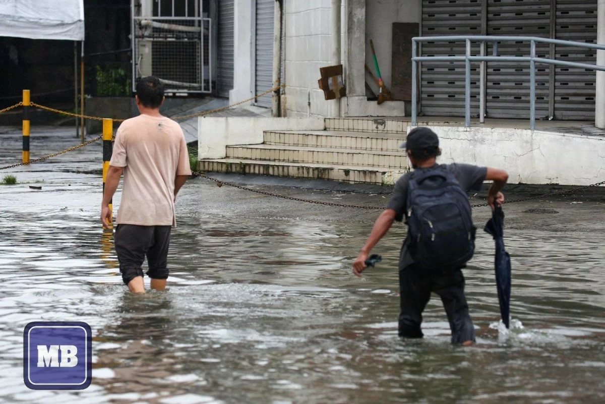
(John Louie Abrina/Manila Bulletin)
The southwest monsoon or “habagat” is expected to gradually weaken over the next few days after the typhoon with the international name “Dolphin” made landfall in mainland China, the Philippine Atmospheric, Geophysical and Astronomical Services Administration (PAGASA) said Monday, Aug. 10.
PAGASA weather specialist Chenel Dominguez said the typhoon was expected to weaken due to its interaction with land, which could also weaken the habagat it has been strengthening over the past week.
“Dahil na rin sa interaction nito sa kalupaan, ay hihina na rin ito at posible na rin humina itong southwest monsoon natin na pinalalakas nito sa mga susunod na araw (Due to its interaction with land, it is also expected to weaken, which could cause the southwest monsoon that it has been strengthening to weaken in the coming days),” Dominguez said.
However, she said significant rainfall would still affect a large part of Luzon on Monday.
PAGASA forecast more than 200 millimeters of rainfall (intense to torrential) in Benguet, 100 to 200 millimeters of rain (heavy to intense) in Zambales, Bataan, and Occidental Mindoro, and 50 to 100 millimeters of rain (moderate to heavy) in Metro Manila, Ilocos Norte, Ilocos Sur, La Union, Abra, Pangasinan, Kalinga, Mountain Province, Ifugao, Nueva Vizcaya, Tarlac, Nueva Ecija, Pampanga, Bulacan, Rizal, Cavite, Batangas, Laguna, and Oriental Mindoro and several provinces across Luzon and Mindoro.
“Ilang araw na po tayo nakakaranas ng mga pag-ulan dito kaya saturated na ang ating mga kalupaan, kaya mataas na ang tsansa ng mga pagbaha at mga pagguho ng lupa (We have been experiencing rains for several days, so the ground is already saturated, increasing the risk of flooding and landslides),”Dominguez said.
She urged residents to coordinate with their respective local government units on possible evacuations.
A gale warning also remained in effect due to strong winds associated with the southwest monsoon.
Rough seas and strong winds were expected over Batanes, the Babuyan Islands, the western coast of Ilocos Norte, the western coast of Pangasinan, Zambales, and Bataan.
Dominguez advised fishermen and operators of small sea vessels in these areas to postpone sailing due to the hazardous sea conditions.
By Tuesday, Aug. 11, rainfall from the habagat is expected to decrease but could still be significant enough to trigger flooding and landslides.
Rainfall of 100 to 200 millimeters is expected over Benguet, Zambales, Bataan, and Occidental Mindoro, while 50 to 100 mm of rain is forecast over Ilocos Sur, La Union, Pangasinan, Batangas, and Oriental Mindoro.
By Wednesday, Aug. 12, rainfall of 50 to 100 millimeters is expected over Zambales, Bataan, and Occidental Mindoro as the habagat further weakens.
PAGASA is also monitoring a storm outside the PAR with the international name “Peilou.”
Dominguez said it was moving away from the Philippines and was not expected to directly affect any part of the country.
While Luzon and the western section of the Visayas remained affected by the habagat, she said that generally fair weather was expected over Visayas and Mindanao, although localized thunderstorms could still develop in the afternoon and evening.