






Manila Bulletin
 Philippines
National
Signal No. 3 raised as 'Kiyapo' intensifies into severe tropical storm
Philippines
National
Signal No. 3 raised as 'Kiyapo' intensifies into severe tropical storm
Philippines
National
Signal No. 3 raised as 'Kiyapo' intensifies into severe tropical storm
Signal No. 3 raised as 'Kiyapo' intensifies into severe tropical storm
Published Jul 24, 2026 08:33 pm


At A Glance
- Signal No. 3 was hoisted over the western portion of Babuyan Islands (Calayan Island, Dalupiri Island, Fuga Island).
- As of the 8 p.m. tropical cyclone bulletin, Kiyapo, internationally known as "Noul," had maximum sustained winds of 95 kph near the center and gustiness of up to 130 kph.
- Kiyapo is expected to exit the Philippine Area of Responsibility late Friday evening or early Saturday morning.
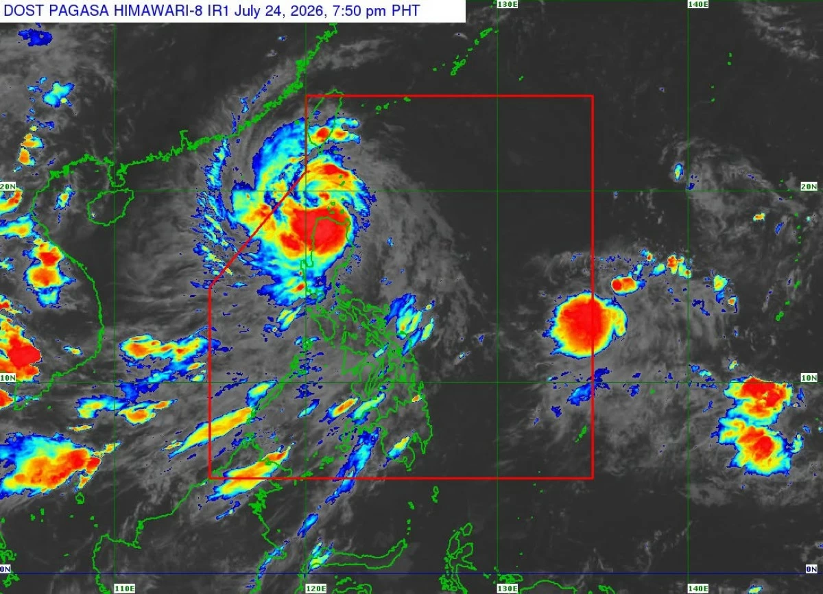
Satellite image showing Severe Tropical Storm Kiyapo, internationally called “Noul” (PAGASA)
Severe Tropical Storm Kiyapo intensified further on Friday evening, July 24, prompting the Philippine Atmospheric, Geophysical and Astronomical Services Administration (PAGASA) to raise Tropical Cyclone Wind Signal No. 3 over parts of Babuyan Islands.
As of the 8 p.m. tropical cyclone bulletin, Kiyapo, internationally known as “Noul,” had maximum sustained winds of 95 kilometers per hour (kph) near the center and gustiness of up to 130 kph.
The center of Kiyapo was estimated based on all available data over the coastal waters of Calayan Island, Calayan, Cagayan.
It was moving west-northwestward at 25 kph.
Signal No. 3 was hoisted over the western portion of Babuyan Islands (Calayan Island, Dalupiri Island, Fuga Island).
Signal No. 2 was raised over Batanes, the rest of the Babuyan Islands, the northern portion of mainland Cagayan (Santa Ana, Gonzaga, Santa Teresita, Camalaniugan, Aparri, Ballesteros, Abulug, Pamplona, Sanchez-Mira, Claveria, Santa Praxedes, Buguey, Allacapan, Lal-Lo, Gattaran, Baggao, Lasam), the northern portion of Apayao (Luna, Santa Marcela, Calanasan, Pudtol, Flora), and the northern portion of Ilocos Norte (Pagudpud, Dumalneg, Adams, Bangui, Burgos, Vintar).
Signal No. 1 was hoisted over the rest of mainland Cagayan, Isabela, Quirino, Nueva Vizcaya, the rest of Apayao, Abra, Kalinga, Mountain Province, Ifugao, Benguet, the rest of Ilocos Norte, Ilocos Sur, La Union, and the northern and central portions of Aurora (Dilasag, Casiguran, Dinalungan, Dipaculao).
PAGASA said moderate to significant impacts from storm-force winds are possible in areas under Signal No. 3.
Minor to moderate impacts from gale-force winds are possible in areas under Signal No. 2, while minimal to minor impacts from strong winds are possible in areas under Signal No. 1.
Kiyapo made landfall over Camiguin Island in Calayan, Cagayan at 2:10 p.m. on Friday.
‘Kiyapo’ to leave PAR
PAGASA said Severe Tropical Storm Kiyapo will continue moving west-northwestward over the West Philippine Sea until Saturday, July 25, before turning northwestward to northward toward southern mainland China.
The weather bureau said Kiyapo is expected to exit the Philippine Area of Responsibility (PAR) late Friday evening or early Saturday morning.
Meanwhile, the tropical cyclone is expected to continue intensifying as it moves over the West Philippine Sea.
Due to favorable environmental conditions, Kiyapo may undergo rapid intensification and could reach typhoon category before making landfall over southern mainland China, PAGASA said.
It is expected to weaken as it moves further inland, it added.