







New LPA forms east of Luzon. Could this be 'Kiyapo'?
Published Jul 21, 2026 09:59 am


At A Glance
- PAGASA weather specialist Veronica Torres said the LPA, designated as LPA 07d, has a medium chance of developing into a tropical cyclone, and its chances of development are expected to increase beyond the next 24 hours.
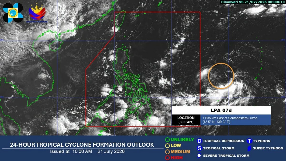
Satellite image showing the low-pressure area outside the Philippine Area of Responsibility (PAGASA)
A low-pressure area (LPA) has formed from the cloud clusters being monitored outside the Philippine Area of Responsibility (PAR) and has the potential to become a tropical depression in the coming days, the Philippine Atmospheric, Geophysical and Astronomical Services Administration (PAGASA) said on Tuesday, July 21.
PAGASA weather specialist Veronica Torres said the LPA, designated as LPA 07d, has a medium chance of developing into a tropical cyclone, and its chances of development are expected to increase beyond the next 24 hours.
If the LPA develops into a tropical cyclone after entering PAR, it will be named “Kiyapo,” the next name on PAGASA's list.
As of 8 a.m. Tuesday, the LPA was estimated at 1,635 kilometers east of southeastern Luzon.
It may enter PAR Tuesday afternoon or Wednesday morning, July 22.
Once it enters PAR and gradually moves closer to the country, the LPA may bring rains to a large part of the country, Torres said.
As of Tuesday, however, it was not yet affecting any part of the country.
Meanwhile, the southwest monsoon or “habagat” remained the dominant weather system and was affecting more areas.
Within the next 24 hours, cloudy skies, scattered rains, and thunderstorms may prevail over Western Visayas, Negros Island Region, Zamboanga Peninsula, and Bangsamoro Autonomous Region in Muslim Mindanao.
The rest of the country may experience partly cloudy to cloudy skies with isolated rain showers or thunderstorms.