






Manila Bulletin
 Philippines
National
Tropical Storm Josie may only briefly stay inside PAR, says PAGASA
Philippines
National
Tropical Storm Josie may only briefly stay inside PAR, says PAGASA
Philippines
National
Tropical Storm Josie may only briefly stay inside PAR, says PAGASA
Tropical Storm Josie may only briefly stay inside PAR, says PAGASA
Published Jul 14, 2026 08:34 am


At A Glance
- Tropical Storm Josie is expected to exit the Philippine Area of Responsibility by Tuesday evening, July 14, or early Wednesday, July 15.
- PAGASA said Josie is less likely to directly affect the country's weather throughout the forecast period.
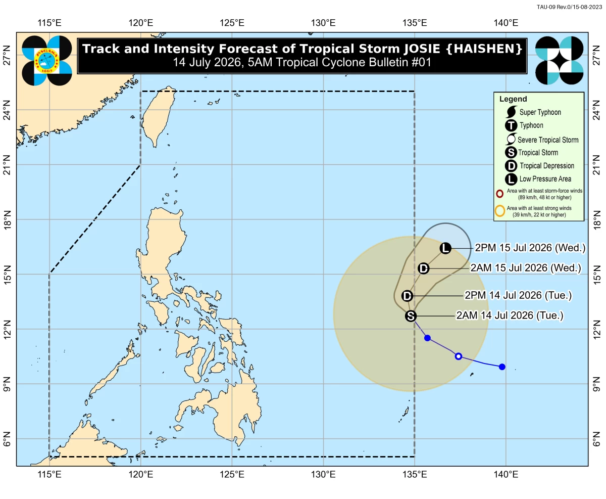
Track and intensity forecast for Tropical Storm Josie (PAGASA)
Tropical Storm Josie entered the Philippine Area of Responsibility (PAR) on Tuesday, July 14, but is expected to exit by Tuesday evening or early Wednesday, July 15, according to the Philippine Atmospheric, Geophysical and Astronomical Services Administration (PAGASA).
Josie, internationally named Haishen, was estimated at 1,085 kilometers east of Eastern Visayas as of 4 a.m. Tuesday.
It was moving northwestward at 25 kilometers per hour (kph) with maximum sustained winds of 65 kph near the center and gusts of up to 80 kph.
PAGASA said Josie is less likely to directly affect the country's weather throughout the forecast period.
However, the southwest monsoon or “habagat,” which is being enhanced by the tropical storm, may continue to bring strong to gale force wind gusts, particularly in coastal and upland areas.
On Tuesday, these gusts may affect the Ilocos Region, Cordillera Administrative Region, Cagayan Valley, Central Luzon, Cavite, Batangas, and Occidental Mindoro.
By Wednesday, they may be experienced in the Ilocos Region, Abra, Apayao, Zambales, Bataan, Batanes, and the Babuyan Islands.
Meanwhile, on Thursday, July 15, they may persist over the Ilocos Region, Abra, Apayao, Batanes, and the Babuyan Islands.
PAGASA also warned of rough seas of up to three meters along the western seaboards of the Babuyan Islands and Pangasinan, as well as the seaboards of Ilocos Norte, Ilocos Sur, and La Union.
Small fishing boats and other similarly sized vessels, especially motor bancas, were advised not to venture out to sea under these conditions.
According to PAGASA, Josie is expected to move generally northward until Wednesday before turning northeastward and exiting PAR by Tuesday night or early Wednesday morning.
The weather bureau also expects the storm to weaken into a tropical depression within the next 12 hours and possibly deteriorate into a low-pressure area by Wednesday due to unfavorable environmental conditions.