






Manila Bulletin
 Philippines
National
PAGASA: Signal No. 2 up in Batanes as Typhoon Inday weakens into typhoon
Philippines
National
PAGASA: Signal No. 2 up in Batanes as Typhoon Inday weakens into typhoon
Philippines
National
PAGASA: Signal No. 2 up in Batanes as Typhoon Inday weakens into typhoon
PAGASA: Signal No. 2 up in Batanes as Typhoon Inday weakens into typhoon
By Jel Santos
Published Jul 9, 2026 12:05 pm
|
Updated Jul 9, 2026 02:18 pm


At A Glance
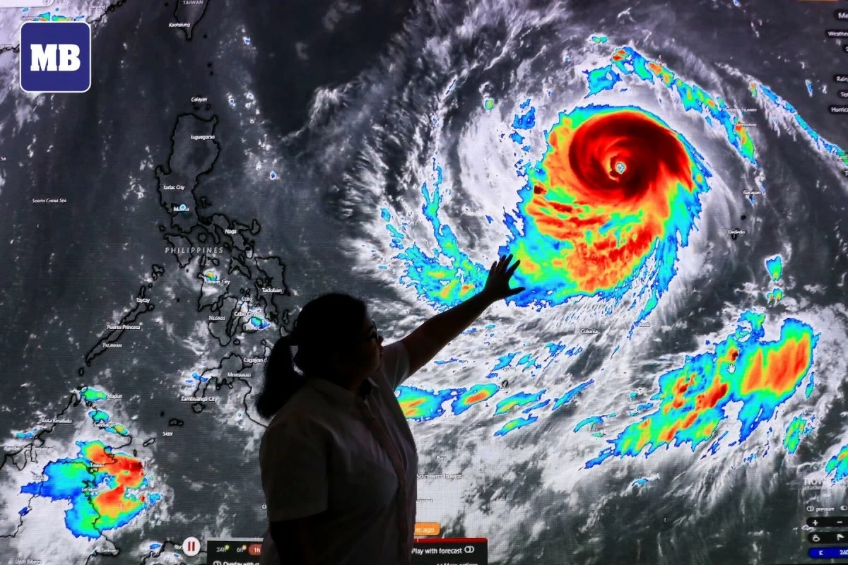
- Despite weakening into the typhoon category, PAGASA said Inday has maintained its broad circulation, with strong to typhoon-force winds extending up to 870 kilometers from its center.
(MB FILE PHOTO)
Tropical Cyclone Wind Signal (TCWS) No. 2 was raised over Batanes on Thursday, July 9, as Super Typhoon Inday weakened into a typhoon while continuing its northwestward movement over the Philippine Sea, the Philippine Atmospheric, Geophysical and Astronomical Services Administration (PAGASA) said.
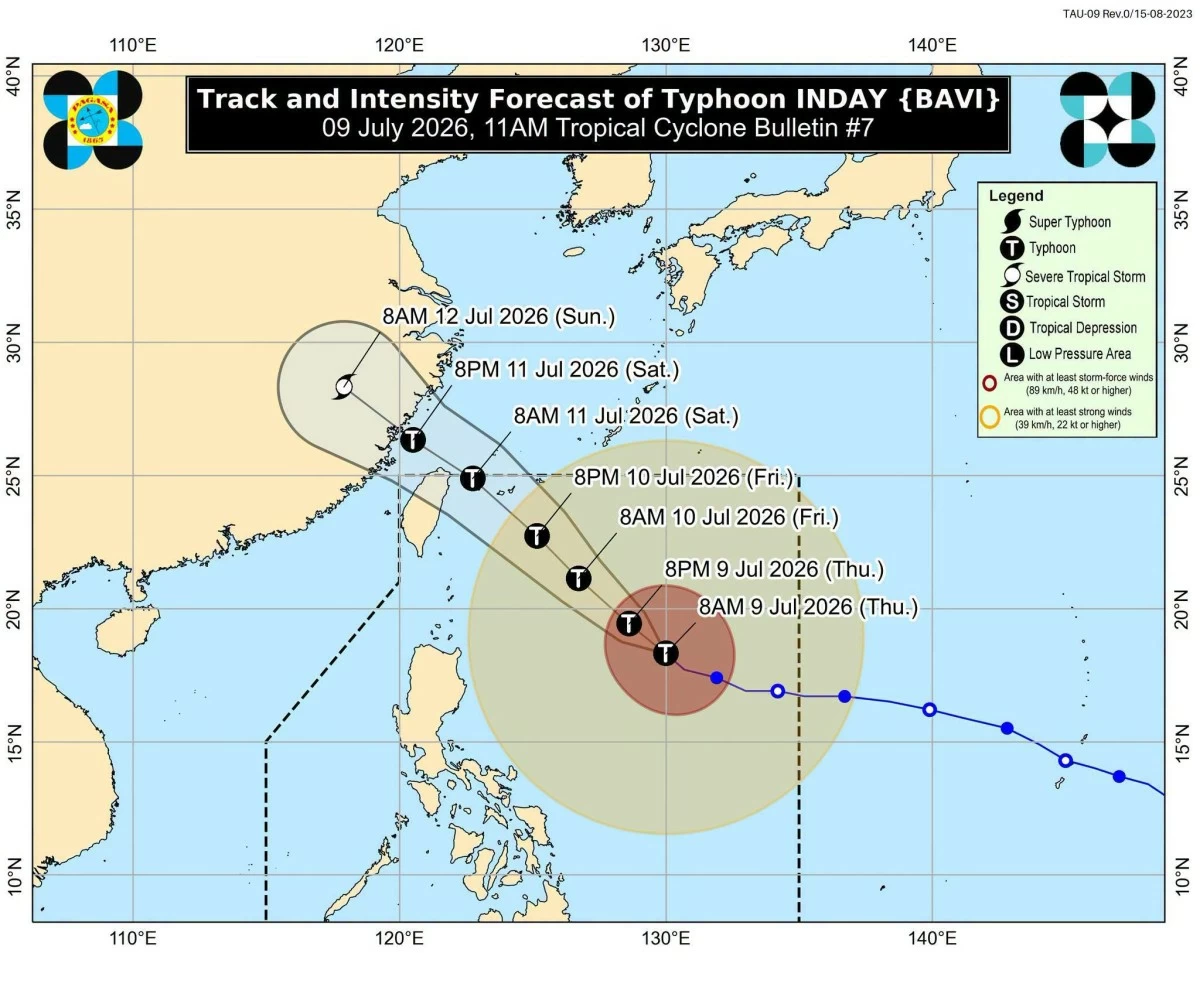
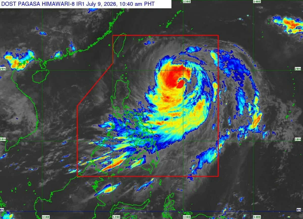
In its 11 a.m. tropical cyclone bulletin, the agency said the center of Inday’s eye was estimated at 865 kilometers east of Northern Luzon as of 10 a.m., with maximum sustained winds of 165 kilometers per hour (kph) near the center, gustiness of up to 205 kph, and movement northwestward at 15 kph.
Despite weakening into the typhoon category, PAGASA said Inday has maintained its broad circulation, with strong to typhoon-force winds extending up to 870 kilometers from its center.
Under TCWS No. 2, the agency said Batanes may experience gale-force winds of 62 to 88 kph within 24 hours, posing a minor to moderate threat to life and property.
(DOST-PAGASA)
Meanwhile, the following areas in Luzon remain under TCWS No. 1: Cagayan, including the Babuyan Islands, Isabela, the northeastern portion of Quirino (Maddela), Apayao, the northern portion of Abra (Tineg, Lagayan, Danglas, San Juan, Lagangilang, Licuan-Baay, Malibcong, Lacub, Daguioman, Dolores, and La Paz), Kalinga, the eastern portion of Mountain Province (Natonin and Paracelis), the eastern portion of Ifugao (Aguinaldo and Alfonso Lista), Ilocos Norte, the northern portion of Aurora (Dilasag and Casiguran), and the northern and central portions of Catanduanes (Pandan, Caramoran, Bagamanoc, Panganiban, Viga, Gigmoto, Baras, and San Miguel).
Likewise, the state weather bureau warned that the enhanced southwest monsoon and Inday’s outer circulation may bring strong to gale-force wind gusts over most parts of the country through Saturday, July 11, especially in coastal and upland areas.
A gale warning remains in effect over the northern and eastern seaboards of Luzon and the eastern seaboard of the Visayas, it added.
(DOST-PAGASA)
Per PAGASA, sea travel remains risky over affected waters and advised all mariners to remain in port or, if already at sea, seek shelter or safe harbor until winds and waves subside.
PAGASA said Inday is forecast to continue moving northwestward over the Philippine Sea and may pass closest to Extreme Northern Luzon between Friday evening, July 10, and Saturday morning, July 11.
The agency said the typhoon is expected to remain within the typhoon category while inside the Philippine Area of Responsibility before exiting the country by Saturday morning or afternoon.