







Super typhoon 'Bavi' slightly weakens, Pagasa says
Areas with gale-force gusts, heavy rains named
Published Jul 7, 2026 02:31 pm


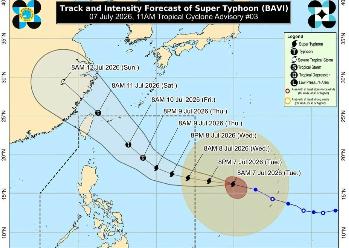
Super typhoon “Bavi” is inching closer to the country and will be named ‘Inday” once it enters the Philippine area of responsibility (PAR) either by Tuesday night or Wednesday morning, weather experts said.
The good news is that “Bavi” has slightly weakened while moving towards the country, according to the Philippine Atmospheric Geophysical and Astronomical Services Administration (Pagasa).
“This tropical cyclone is forecast to maintain its strength as a super typhoon as it enters PAR. Gradual weakening is expected as it moves near Extreme Northern Luzon while approaching the east of Taiwan,” the Pagasa advisory read.
In its latest advisory, Pagasa said the center of “Bavi” was estimated at 1,845 kilometers east of Central Luzon and moving at 20 kilometer per hour. It packs 185 kilometer per hour strong winds of gustiness of up to 230 kph.
Pagasa earlier said that the weather disturbance is unlikely to make a landfall but it said wind signals may be raised over the northern and eastern portions of Northern Luzon as early as Tuesday night—likely signal number 2 or 3.
“Bavi”, or ‘Inday”, is expected to bring strong to gale-force gusts in the following areas:
1. Over most part of Mindanao on Tuesday;
2. Pangasinan, Zambales, Bataan, Cavite, Batangas, most of MIMAROPA, most of Bicol Region, most of Visayas, and most of Mindanao on Wednesday;
3. Most of the country by Thursday.
Pagasa also warned of heavy rains in the following areas:
From Wednesday noon to Thursday noon with 50m to 100mm rainfall:
1. Antique
2. Negros Occidental
3. Sultan Kudarat
4. Sarangani
Thursday noon to Friday noon with 50-100 mm rain fall:
1. Occidental Mindoro
2. Palawan
3. Antique
4. Guimaras
5. Iloilo
6. Negros Occidental
7. Lanao del Norte
8. Lanao del Sur
“Forecast rainfall may be higher in mountainous and elevated areas. Moreover, impacts in some areas may be worsened by significant antecedent rainfall,” the P{agasa advisory read.