


Manila Bulletin
 Philippines
National
No tropical cyclone expected inside PAR over the next 3 days, says PAGASA
Philippines
National
No tropical cyclone expected inside PAR over the next 3 days, says PAGASA
Philippines
National
No tropical cyclone expected inside PAR over the next 3 days, says PAGASA
No tropical cyclone expected inside PAR over the next 3 days, says PAGASA
Published Jul 2, 2026 10:01 am


At A Glance
- Hot and humid conditions will prevail over most parts of the country, although isolated rain showers and thunderstorms are still expected, particularly in the afternoon or evening.
PAGASA
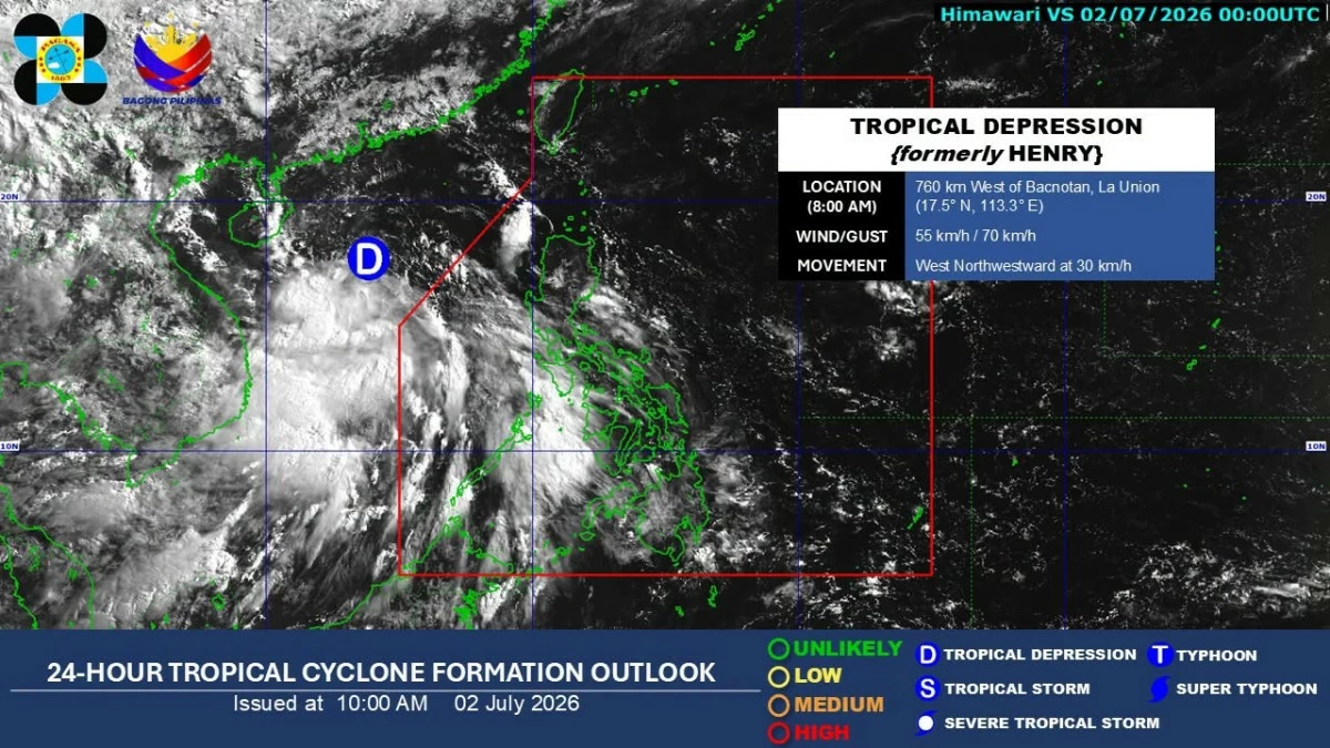
Following the departure of Tropical Depression Henry from the Philippine Area of Responsibility (PAR) on Wednesday evening, July 1, no tropical cyclone is expected to affect the country over the next three days, according to the Philippine Atmospheric, Geophysical and Astronomical Services Administration (PAGASA).
PAGASA weather specialist Leanne Loreto said on Thursday, July 2, that Henry no longer has any effect on the country's weather.
Hot and humid conditions will prevail over most parts of the country, although isolated rain showers and thunderstorms are still expected, particularly in the afternoon or evening.
Loreto said the southwest monsoon, or “habagat,” will continue to affect Palawan and Occidental Mindoro, which will bring cloudy skies with scattered rain showers and thunderstorms.
PAGASA warned that moderate to heavy rains may trigger flooding or landslides in vulnerable areas.
The habagat will also bring partly cloudy to cloudy skies with isolated rain showers or thunderstorms over Zamboanga Peninsula, Basilan, Tawi-Tawi, and Antique.
Meanwhile, Loreto said the easterlies, or warm winds from the Pacific Ocean, will bring partly cloudy to cloudy skies with isolated rain showers or thunderstorms over Bicol Region, Eastern Visayas, Caraga, Davao Region, and Quezon.
Metro Manila and the rest of the country will also experience partly cloudy to cloudy skies with isolated rain showers or thunderstorms due to localized thunderstorms.
PAGASA advised the public to stay alert for possible flash floods or landslides during severe thunderstorms, especially in low-lying and mountainous areas.