






Manila Bulletin
 Philippines
National
Potential cyclone bringing rains over Metro Manila, parts of Luzon and Visayas
Philippines
National
Potential cyclone bringing rains over Metro Manila, parts of Luzon and Visayas
Philippines
National
Potential cyclone bringing rains over Metro Manila, parts of Luzon and Visayas
Potential cyclone bringing rains over Metro Manila, parts of Luzon and Visayas
Published Jun 30, 2026 08:37 am


At A Glance
- Once it develops into a tropical depression, it will be given the local name "Henry."
- PAGASA said Tropical Cyclone Wind Signal No. 1 may immediately be raised over parts of Western Luzon and the Visayas once the weather disturbance becomes a tropical depression.
PAGASA
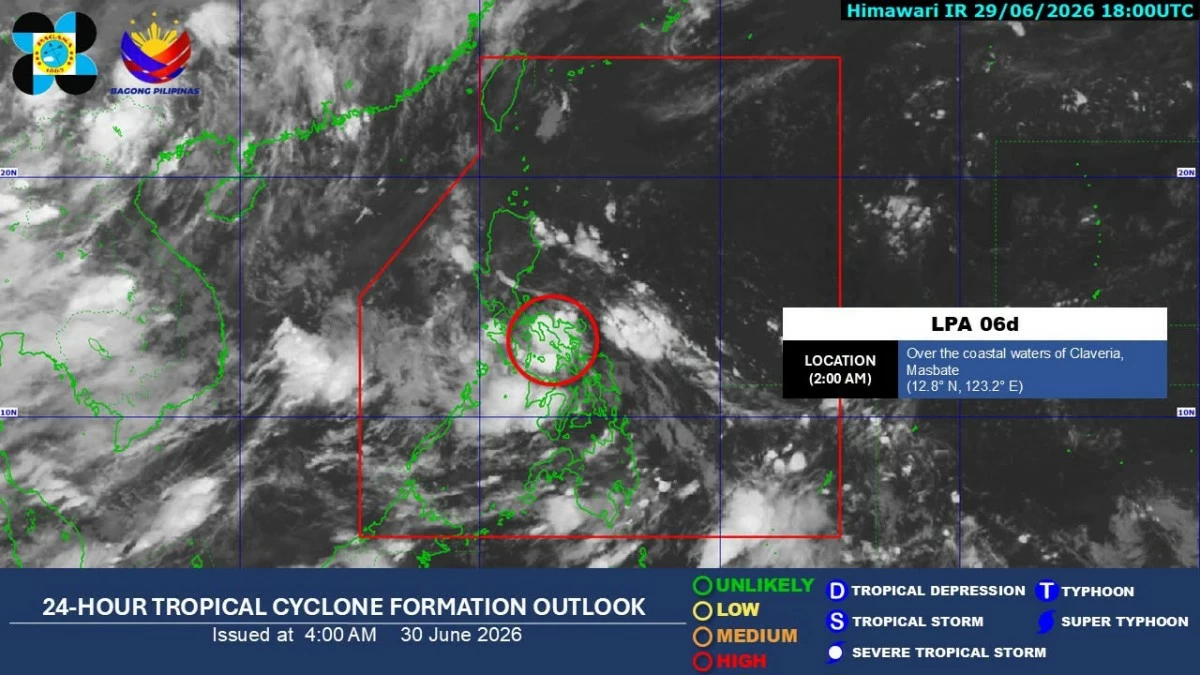
The low-pressure area (LPA) being monitored inside the Philippine Area of Responsibility (PAR) remains likely to develop into a tropical depression as it moves across the country, the Philippine Atmospheric, Geophysical and Astronomical Services Administration (PAGASA) said on Tuesday, June 30.
PAGASA weather specialist Chenel Dominguez said the weather disturbance, designated as LPA 06d, was last located over the coastal waters of San Pascual, Masbate early Tuesday morning and remains likely to intensify into a tropical depression during or after its passage over the country.
Once it develops into a tropical depression, it will be given the local name “Henry.”
Dominguez added that Tropical Cyclone Wind Signal No. 1 may immediately be raised over parts of Western Luzon and the Visayas once the weather disturbance becomes a tropical depression.
Over the next 24 hours, the LPA is expected to bring cloudy skies with scattered rains and thunderstorms over Metro Manila, the Visayas, Calabarzon, Bicol Region, Occidental Mindoro, Oriental Mindoro, Marinduque, and Romblon.
Meanwhile, the southwest monsoon, locally known as “habagat,” has weakened further and is now affecting only Palawan, where scattered rains and thunderstorms may also prevail.
The rest of the country will experience partly cloudy to cloudy skies with isolated rain showers or thunderstorms, mainly due to localized thunderstorms.
PAGASA advised the public to remain alert for possible flooding and landslides in areas affected by moderate to heavy rainfall.