


'Gardo' exits PAR; 'habagat' continues to affect Luzon
Published Jun 26, 2026 12:10 pm
|
Updated Jun 26, 2026 01:54 pm


At A Glance
- As of 10 a.m., the center of the storm was estimated at 1,310 kilometers east northeast of extreme Northern Luzon.
PAGASA
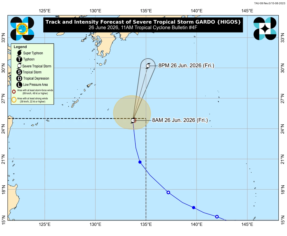
The Philippine Atmospheric, Geophysical and Astronomical Services Administration (PAGASA) said Severe Tropical Storm Gardo (international name: Higos) has exited the Philippine Area of Responsibility (PAR) at 9:30 a.m. on Friday, June 26.
As of 10 a.m., the center of the storm was estimated at 1,310 kilometers east northeast of extreme Northern Luzon.
The storm was packing maximum sustained winds of 95 kilometers per hour (kph) and gustiness of up to 115 kph. It was moving northward at 50 kph.
Although the storm has exited the PAR, PAGASA said the southwest monsoon or “habagat” will continue to affect parts of the country.
Moderate to heavy rains may persist in Zambales, Bataan, and Occidental Mindoro over the next 24 hours.
PAGASA warned that localized flooding and landslides remain possible, especially in areas highly susceptible to these hazards.
Strong to gale-force gusts are also expected over most of Luzon on Friday, while Batanes, Babuyan Islands, Ilocos Norte, and Ilocos Sur may experience similar conditions on Saturday, June 27.
PAGASA also warned of rough seas of up to 3 meters along the northern seaboard of Batanes.
Small seacraft, including motorbancas, are advised not to venture out to sea.
Moderate seas are forecast over the northern and western seaboards of the Babuyan Islands, Ilocos Norte, Ilocos Sur, La Union, Zambales, Lubang Island, the Kalayaan Islands, Pangasinan, Bataan, and Batangas.
Mariners of small vessels were advised to take precautionary measures and avoid sea travel if possible.