


PAGASA: Tropical storm likely to enter PAR this weekend
Experts said it would be named 'Francisco'
By Jel Santos
Published Jun 20, 2026 12:03 pm
|
Updated Jun 20, 2026 02:04 pm


At A Glance
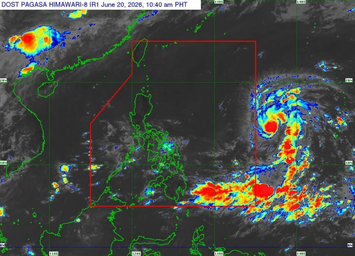
- PAGASA reported that the tropical cyclone was carrying maximum sustained winds of 85 kilometers per hour (kph) near the center, gusts of up to 105 kph, and a central pressure of 996 hectopascals (hPa). It was moving westward at 20 kph.

(MB FILE PHOTO)
The tropical storm east of Southeastern Luzon is expected to enter the Philippine Area of Responsibility (PAR) either Saturday night or Sunday morning, June 21, when it will be assigned the local name Francisco, the Philippine Atmospheric, Geophysical and Astronomical Services Administration (PAGASA) said.
In its 11 a.m. tropical cyclone advisory issued Saturday, June 20, the agency said the storm was estimated at 1,590 kilometers east of Southeastern Luzon, outside PAR.
PAGASA reported that the tropical cyclone was carrying maximum sustained winds of 85 kilometers per hour (kph) near the center, gusts of up to 105 kph, and a central pressure of 996 hectopascals (hPa). It was moving westward at 20 kph.
“The tropical storm is forecast to move generally west northwestward and is expected to enter the Philippine Area of Responsibility (PAR) tonight or tomorrow (21 June) morning. Once inside the PAR, the tropical cyclone will be given the domestic name FRANCISCO. A landfall scenario is less likely at this time,” it said.
Per the state weather bureau, the tropical storm is expected to continue intensifying and may reach typhoon strength by Sunday.
“This tropical cyclone will continue to intensify and may reach typhoon category by tomorrow,” it said.
(DOST-PAGASA)
Also, PAGASA said that while a landfall scenario remains less likely, the possibility of the storm passing close to Northern Luzon next week could still prompt the hoisting of tropical cyclone wind signals.
“Due to its possible close proximity to land on Tuesday (23 June) and Wednesday (24 June) and the possible changes in the track forecast in the succeeding bulletins, the hoisting of Wind Signal No. 1 over the northern and eastern portions of Northern Luzon is not ruled out,” the agency said.
The agency likewise warned that the tropical cyclone could begin affecting weather conditions over Extreme Northern Luzon by Tuesday.
“This tropical storm will begin affecting the weather conditions of Extreme Northern Luzon beginning on Tuesday. Furthermore, moderate to rough sea due to the tropical storm will be experienced over the northern and eastern coastal waters of Northern Luzon on Tuesday,” PAGASA stated.