


Manila Bulletin
 Philippines
National
PAGASA warns of heavy rains due to tropical cyclone-enhanced 'habagat'
Philippines
National
PAGASA warns of heavy rains due to tropical cyclone-enhanced 'habagat'
Philippines
National
PAGASA warns of heavy rains due to tropical cyclone-enhanced 'habagat'
PAGASA warns of heavy rains due to tropical cyclone-enhanced 'habagat'
Published Jun 5, 2026 01:31 pm


At A Glance
- Tropical Depression Ester is expected to move northeastward over the next few hours and may exit the Philippine area of responsibility by Saturday morning, June 6.
- Despite its expected exit, PAGASA said the enhanced habagat will continue to bring significant rainfall over parts of western Luzon.
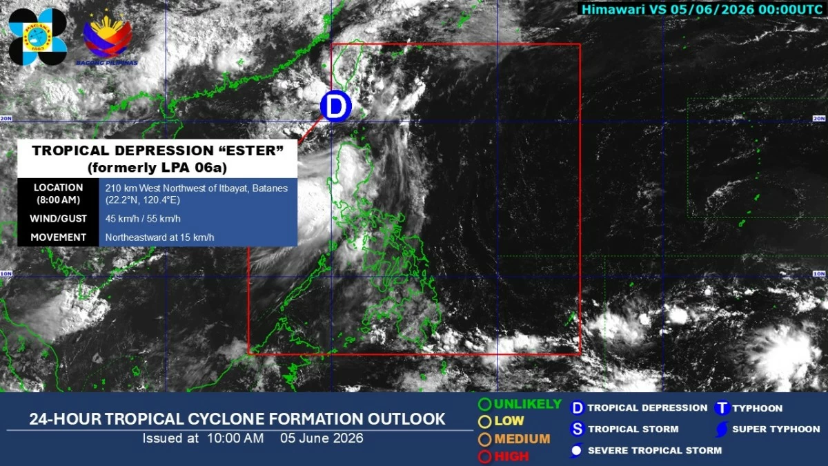
Satellite image of Tropical Depression Ester (PAGASA)
The Philippine Atmospheric, Geophysical and Astronomical Services Administration (PAGASA) on Friday, June 5, warned of heavy rainfall in parts of western Luzon as Tropical Depression Ester continued to enhance the southwest monsoon or “habagat.”
As of 11 a.m., the center of Ester was estimated at 230 kilometers north-northwest of Itbayat, Batanes, with maximum sustained winds of 45 kilometers per hour (kph) near the center and gusts of up to 55 kph.
PAGASA said Ester is expected to move northeastward over the next few hours and may exit the Philippine area of responsibility by Saturday morning, June 6.
Tropical Cyclone Wind Signal No. 1 remains in effect over Batanes and will likely be lifted once the tropical depression no longer has a direct effect on the country.
Despite Ester's expected exit, the state weather bureau said the enhanced habagat will continue to bring significant rainfall over parts of western Luzon.
From Friday noon to Saturday noon, June 6, heavy to intense rainfall, or 100 to 200 millimeters, may affect La Union, Pangasinan, and Zambales.
Meanwhile, moderate to heavy rainfall, or 50 to 100 millimeters, may occur in Batanes, Ilocos Norte, Ilocos Sur, Abra, Benguet, and Bataan.
From Saturday noon to Sunday noon, June 7, moderate to heavy rainfall may persist in Ilocos Norte, Ilocos Sur, La Union, Pangasinan, and Zambales.
PAGASA advised residents in affected areas to remain alert for possible flooding and landslides due to prolonged rainfall.