


Manila Bulletin
 Philippines
National
LPA trough, southwesterly wind flow to bring rains across parts of PH in the coming days — PAGASA
Philippines
National
LPA trough, southwesterly wind flow to bring rains across parts of PH in the coming days — PAGASA
Philippines
National
LPA trough, southwesterly wind flow to bring rains across parts of PH in the coming days — PAGASA
LPA trough, southwesterly wind flow to bring rains across parts of PH in the coming days — PAGASA
Published May 22, 2026 01:35 pm


At A Glance
- PAGASA said the southwesterly wind flow—a weather system that brings warm and moist winds from the southwest across the country and is often seen as a precursor to the southwest monsoon or "habagat"—may begin affecting the western sections next week.
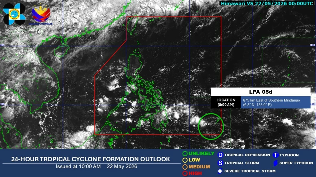
Satellite image (Courtesy of PAGASA)
The trough or extension of a low-pressure area (LPA) will continue to bring cloudy skies with scattered rains and thunderstorms over parts of the country until early next week, before a southwesterly windflow begins affecting the western sections of the country in the latter part of the week, the Philippine Atmospheric, Geophysical and Astronomical Services Administration (PAGASA) said on Friday, May 22.
As of 8 a.m. Friday, LPA 05d was located about 875 kilometers east of southern Mindanao or outside the Philippine area of responsibility.
PAGASA weather specialist Loriedin dela Cruz-Galicia said the weather disturbance remains unlikely to develop into a tropical depression within the next 24 hours.
From May 23 to 25, the trough of the LPA is expected to bring cloudy skies with scattered rains and thunderstorms over Mindanao, Eastern Visayas, and Palawan, while the rest of the country will continue to experience partly cloudy to cloudy skies with isolated rain showers or thunderstorms.
“Easterlies pa rin ang prevailing sa Luzon at Visayas at asahan pa rin natin ang mainit at maalinsang panahon sa malaking bahagi ng bansa [this weekend] (Easterlies are still prevailing over Luzon and Visayas, and we can still expect hot and humid weather over much of the country this weekend),” she said.
She added that isolated thunderstorms or rain showers may still occur in the afternoon or evening.
“Meron lamang pong tsansa ng mga thunderstorms o ‘yung mga isolated na mga pagbuhos ng ulan sa hapon at gabi (There is only a chance of thunderstorms or isolated rain showers in the afternoon and evening),” dela Cruz-Galicia said.
From May 26 to 27, PAGASA said the southwesterly wind flow—a weather system that brings warm and moist winds from the southwest across the country and is often seen as a precursor to the southwest monsoon or “habagat”—may begin affecting the western sections of the country.
The weather system may bring scattered rains and thunderstorms over Zamboanga Peninsula, Bangsamoro Autonomous Region in Muslim Mindanao, and Palawan.
PAGASA said the southwesterly wind flow is expected to continue affecting these areas from May 28 to 29.
Meanwhile, the rest of the country will continue to experience generally fair weather, with chances of isolated rain showers or thunderstorms, especially over Visayas and the rest of Mindanao.