


'Caloy' weakens into LPA; another LPA may dissipate
Published May 12, 2026 08:51 am


At A Glance
- PAGASA said hot and humid weather may persist in the next three to five days.
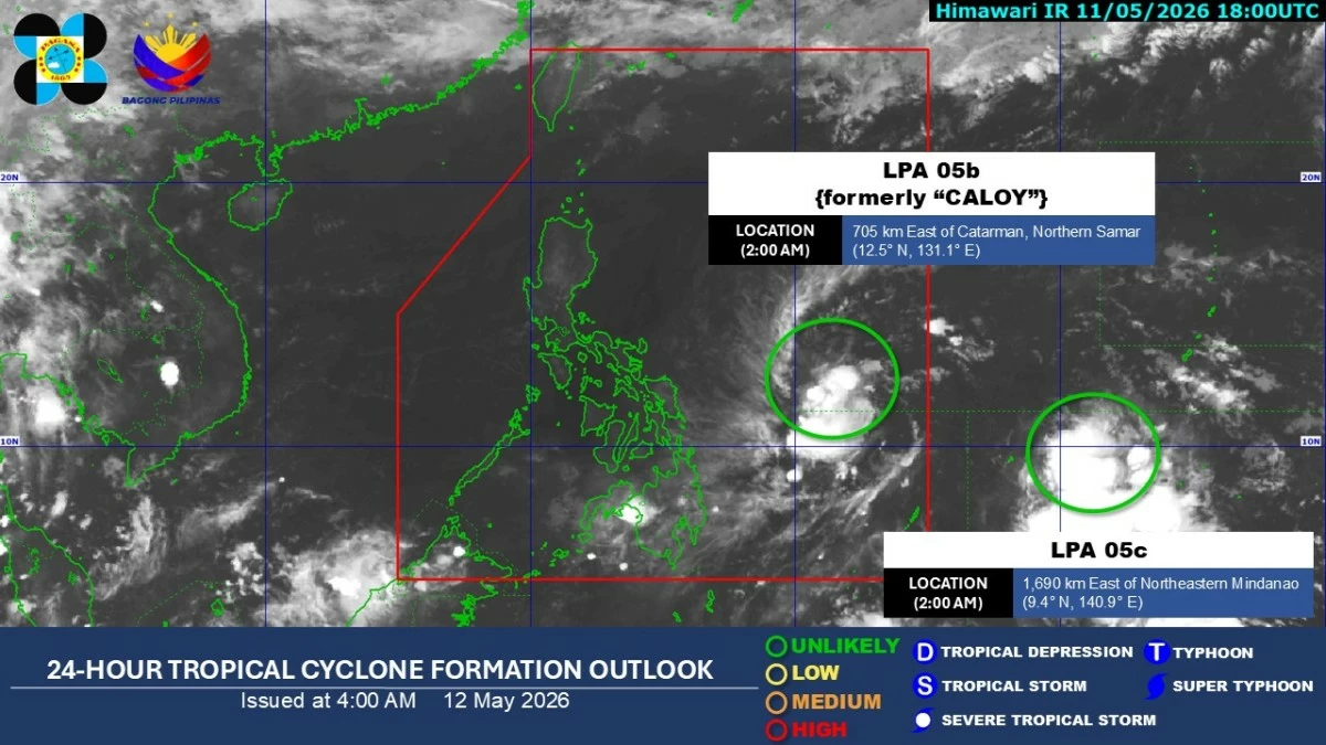
Satellite image (Courtesy of PAGASA)
Tropical Depression “Caloy” (international name: Hagupit) weakened into a low-pressure area (LPA) on Monday evening, May 11, while another weather disturbance being monitored outside the Philippine Area of Responsibility (PAR) is unlikely to develop into a cyclone, according to the State weather bureau.
The Philippine Atmospheric, Geophysical and Astronomical Services Administration (PAGASA) said the remnant of “Caloy” is expected to move generally northward or northeastward over the Philippine Sea.
“As it moves over increasingly less favorable environmental conditions, there is a likelihood that it may dissipate within the next five days,” the agency said.
PAGASA weather specialist Veronica Torres said the LPA was located 690 kilometers east of Catarman, Northern Samar as of 3 a.m. on Tuesday, May 12.
She added that the weather disturbance has no direct effect on any part of the country
Meanwhile, the second LPA (LPA 05C) was estimated at 1,680 kilometers east of northeastern Mindanao.
Torres said the weather disturbance has a “very low” chance of developing into a tropical depression and is unlikely to enter the PAR.
Filipinos may expect hot and humid weather in the next three to five days.
Torres said partly cloudy to cloudy skies with isolated rain showers or thunderstorms, especially in the afternoon or evening, will prevail across the country.
However, the public is advised to remain vigilant against possible flash floods or landslides during severe thunderstorms.