


PNP activates disaster response units as TS Hagupit nears PAR
Published May 8, 2026 05:25 pm


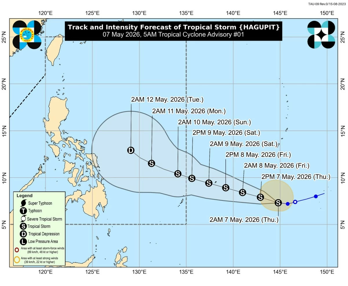
Track and intensity forecast for Tropical Storm Hagupit (PAGASA)
The Philippine National Police (PNP) said Friday, May 8, that it has activated disaster response preparations as Tropical Storm “Hagupit” moved closer to the Philippine Area of Responsibility (PAR).
PNP chief, Police General Jose Melencio C. Nartatez Jr. said police commanders in areas expected to be affected by the storm were already instructed to prepare personnel and equipment ahead of the weather disturbance’s entry into PAR over the weekend.
“Our police commanders in areas concerned were already alerted and advised to activate the necessary disaster response protocol. The goal is always to ensure public safety and maximize the assistance in all scenarios,” Nartatez said.
Nartatez said the PNP was preparing emergency equipment and logistical support units to help local governments identify communities that may need forced or preemptive evacuation if conditions worsen.
“I assure the public that the PNP will continue to monitor the track and developments of this tropical storm,” he said.
The Philippine Atmospheric, Geophysical and Astronomical Services Administration (PAGASA) warned that Hagupit could intensify within 48 hours and may reach the “high-end tropical storm” category before entering PAR.
Once inside the country’s monitoring area, the storm will be given the local name “Caloy.”
PAGASA said Hagupit was located at 1,460 km east of Northeastern Mindanao (outside PAR) as of 10 a.m. Friday, while moving westward at around 20 kilometers per hour.
It was packing maximum sustained winds of 85 km/h near the center and gustiness of up to 105 km/h.
Meanwhile, the PNP reminded residents in areas vulnerable to flooding, storm surges, and landslides to closely monitor official advisories and evacuation notices before the storm’s expected entry into PAR.