


LPA outside PAR develops into tropical depression — PAGASA
Published Mar 10, 2026 10:09 am


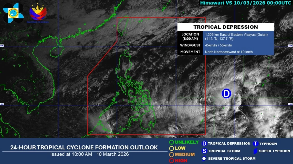
Satellite image of a tropical depression outside the Philipine Area of Responsibility (Courtesy of PAGASA)
The low-pressure area (LPA) being monitored outside the Philippine area of responsibility (PAR) has developed into a tropical depression on Tuesday morning, March 10, said the Philippine Atmospheric, Geophysical and Astronomical Services Administration (PAGASA).
As of 8 a.m., PAGASA said the tropical depression was located about 1,305 kilometers east of Eastern Visayas, packing maximum sustained winds of 45 kilometers per hour near the center and gustiness of up to 55 kph.
It was moving north-northeastward at 10 kph.
PAGASA said the trough or extension of the tropical depression may continue to affect parts of the country and bring cloudy skies with scattered moderate to heavy rains and thunderstorms over Masbate, Visayas, and Mindanao.
The weather bureau said the system remains outside the PAR and has a low chance of entering PAR.
Aside from the tropical depression, PAGASA weather specialist Veronica Torres said no other low-pressure area or tropical cyclone was being monitored inside or near the PAR as of Tuesday.
Meanwhile, the northeast monsoon, locally known as “amihan,” continues to prevail over Luzon.
Due to the weather system, cloudy skies with light rains may affect Cagayan Valley, Cordillera Administrative Region, Aurora, Quezon, and the rest of Bicol Region.
Metro Manila and the rest of Luzon may experience partly cloudy to cloudy skies with isolated light rains due to the amihan.