


Manila Bulletin
 Philippines
National
LPA has medium chance of forming into tropical depression, unlikely to enter PAR — PAGASA
Philippines
National
LPA has medium chance of forming into tropical depression, unlikely to enter PAR — PAGASA
Philippines
National
LPA has medium chance of forming into tropical depression, unlikely to enter PAR — PAGASA
LPA has medium chance of forming into tropical depression, unlikely to enter PAR — PAGASA
Published Mar 9, 2026 10:17 am


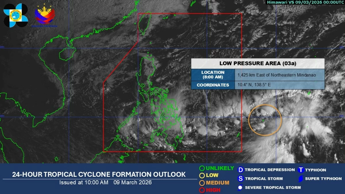
Satellite image of a low-pressure area outside the Philippine area of responsibility (Courtesy of PAGASA)
The low-pressure area (LPA) being monitored outside the Philippine area of responsibility (PAR) has a medium chance of developing into a tropical depression within 24 hours, according to the Philippine Atmospheric, Geophysical and Astronomical Services Administration (PAGASA) on Monday, March 9.
PAGASA weather specialist Aldczar Aurelio said the weather disturbance, although unlikely to enter PAR, is already affecting parts of the country through its trough or extension.
As of 8 a.m., the LPA was located about 1,425 kilometers east of northeastern Mindanao.
Aurelio said the trough of the LPA is extending into the country and bringing cloudy skies with scattered rains and thunderstorms over Visayas, Mindanao, Sorsogon, and Masbate.
Meanwhile, the northeast monsoon, locally known as “amihan,” has strengthened and is affecting a large part of Luzon.
The weather system may continue to affect the country over the next two to three days, Aurelio said.
Due to the amihan, cloudy skies with moderate to heavy rains may affect Cagayan Valley, Aurora, Quezon, and the rest of Bicol Region.
Cloudy skies with light rains may also prevail over Cordillera Administrative Region, Oriental Mindoro, Marinduque, and Romblon.
Metro Manila and the rest of Luzon may experience partly cloudy to cloudy skies with isolated light monsoon rains.