


Manila Bulletin
 Philippines
National
New LPA has slim chance of becoming tropical cyclone in next 24 hours — PAGASA
Philippines
National
New LPA has slim chance of becoming tropical cyclone in next 24 hours — PAGASA
Philippines
National
New LPA has slim chance of becoming tropical cyclone in next 24 hours — PAGASA
New LPA has slim chance of becoming tropical cyclone in next 24 hours — PAGASA
Published Mar 7, 2026 05:49 pm


PAGASA PHOTO
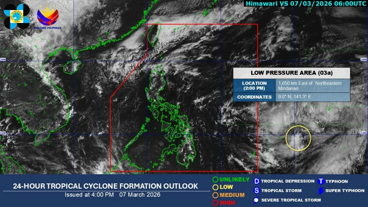
The Philippine Atmospheric, Geophysical and Astronomical Services Administration (PAGASA) on Saturday, March 7 said a low-pressure area (LPA) has formed east of northeastern Mindanao, but has a “low chance” of developing into a tropical cyclone within the next 24 hours.
The weather disturbance, located about 1,650 kilometers east of northeastern Mindanao, is still outside the Philippine area of responsibility and is not expected to directly affect the country until Sunday, March 8, PAGASA weather specialist Daniel James Villamil said.
Meanwhile, the northeast monsoon, or “amihan,” continues to bring cloudy skies with moderate to heavy rains over Cagayan Valley, Ilocos Norte, Apayao, and Kalinga, with light rains expected over the rest of Cordillera Administrative Region.
Tarlac, Nueva Ecija, and the rest of Ilocos Region may experience partly cloudy to cloudy skies with isolated light rains.
Meanwhile, Aurora and Quezon may see cloudy skies with moderate to, at times, heavy rains and thunderstorms due to warm air from the Pacific Ocean, known as the easterlies.
Metro Manila and other parts of the country will have partly cloudy to cloudy skies with isolated rain showers or thunderstorms.