


Manila Bulletin
 Philippines
National
Up to 1 tropical cyclone may form or enter PAR in March — PAGASA
Philippines
National
Up to 1 tropical cyclone may form or enter PAR in March — PAGASA
Philippines
National
Up to 1 tropical cyclone may form or enter PAR in March — PAGASA
Up to 1 tropical cyclone may form or enter PAR in March — PAGASA
Published Feb 28, 2026 10:40 am


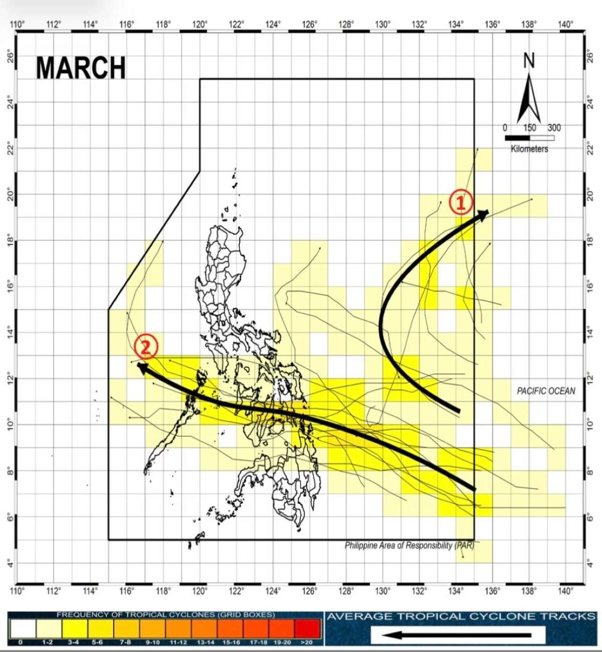
Historical tropical cyclone tracks in March within the Philippine area of responsibility (Courtesy of PAGASA)
The Philippine Atmospheric, Geophysical and Astronomical Services Administration (PAGASA) said “zero to one” tropical cyclone is expected to enter or form within the Philippine area of responsibility (PAR) in March, indicating a generally low chance of storm activity during the month.
The next tropical cyclone will be named Caloy, based on PAGASA’s list of tropical cyclone names for 2026.
PAGASA said historical or climatological cyclone tracks for March show two common scenarios.
Some tropical cyclones forming over the western Pacific may enter PAR but later recurve away from the Philippines, while others may track westward, make landfall over the central Philippines, and weaken as they move into the West Philippine Sea.
PAGASA weather specialist Loriedin de la Cruz-Galicia said PAGASA is not monitoring any tropical cyclone inside the PAR as of Saturday, Feb. 28.
She said the northeast monsoon or “amihan” has re-emerged but is currently affecting only extreme Northern Luzon.
Over the next 24 hours, the amihan will bring partly cloudy to cloudy skies with isolated light rains over Batanes and Babuyan Islands.
Meanwhile, the easterlies, or warm winds coming from the Pacific Ocean, will bring cloudy skies with scattered rains and thunderstorms over Davao Region, Surigao del Sur, Agusan del Sur, South Cotabato, and Sarangani.
Metro Manila and the rest of the country will experience generally fair weather, with partly cloudy to cloudy skies and possible isolated rain showers or thunderstorms.
No gale warning has been raised over any of the country’s seaboards, thus small boats and other sea vessels are safe to sail.