


Manila Bulletin
 Philippines
National
'Basyang' weakens into tropical depression as it heads for Central Visayas, Negros Island Region
Philippines
National
'Basyang' weakens into tropical depression as it heads for Central Visayas, Negros Island Region
Philippines
National
'Basyang' weakens into tropical depression as it heads for Central Visayas, Negros Island Region
'Basyang' weakens into tropical depression as it heads for Central Visayas, Negros Island Region
Published Feb 6, 2026 12:35 pm
|
Updated Feb 6, 2026 01:10 pm


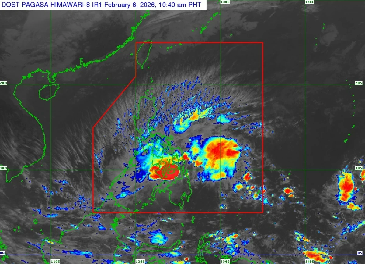
Satellite image of Tropical Depression Basyang (international name: Penha) (Courtesy of PAGASA)
Tropical Storm Basyang (international name: Penha) weakened into a tropical depression on Friday morning, Feb. 6 as it moved over the Bohol Sea and headed toward Central Visayas and Negros Island Region, said the Philippine Atmospheric, Geophysical and Astronomical Services Administration (PAGASA).
In its 11 a.m. bulletin, PAGASA said the center of Basyang was over the coastal waters of Anda, Bohol, moving west-northwestward at 10 kilometers per hour (kph).
The weather bureau said the tropical depression now has maximum sustained winds of 55 kph near the center and gustiness of up to 70 kph.
On the forecast track, the center of Basyang may pass close to or make landfall over Bohol and the southern portions of Cebu and Negros Oriental.
Afterward, it is expected to pass close to the southern portion of Panay Island by Saturday afternoon or evening, Feb. 7.
Basyang made its initial landfall over Bayabas, Surigao del Norte at 11:50 p.m. on Thursday, Feb. 5.
PAGASA said the weather disturbance will likely remain a tropical depression while traversing Central Visayas and Negros Island Region, but may weaken into a low-pressure area by Saturday afternoon or evening.
Tropical cyclone wind warnings have been lifted or downgraded, with Tropical Cyclone Wind Signal No. 1 remaining hoisted over several areas.
These include the southern portion of Occidental Mindoro, southern portion of Oriental Mindoro, Romblon, northern portion of Palawan including the Cuyo, Cagayancillo, and Calamian islands, southern portion of Masbate, southern portions of Eastern Samar and Samar, Iloilo, Capiz, Antique, Aklan, Biliran, Bohol, Cebu, Negros Occidental, Negros Oriental, Leyte, Southern Leyte, Siquijor, Dinagat Islands, Surigao del Norte including the Siargao-Bucas Grande Islands, Agusan del Norte, Misamis Oriental, Camiguin, northern portion of Surigao del Sur, northern and central portions of Agusan del Sur, northern and central portions of Bukidnon, eastern portion of Lanao del Norte, northern portion of Misamis Occidental, northernmost portion of Lanao del Sur, and eastern portion of Zamboanga del Norte.
PAGASA said minimal to minor impacts from strong winds remain possible in areas still under Signal No. 1.
It also warned of continuous heavy rainfall in several areas over the next few days due to Basyang and the shear line.
From Friday to noon Saturday noon, 100 to 200 millimeters of rainfall (heavy to intense) is expected over Palawan, Negros Occidental, Negros Oriental, Cebu, Bohol, Siquijor, Antique, Iloilo, and Guimaras, while 50 to 100 millimeters of rainfall (moderate to heavy) may affect Eastern Samar, Samar, Biliran, Southern Leyte, Leyte, Aklan, Capiz, Surigao del Norte, Dinagat Islands, Agusan del Norte, Misamis Oriental, Camiguin, Misamis Occidental, Lanao del Norte, and Zamboanga del Norte.
From Saturday noon to Sunday noon, 50 to 100 millimeters of rain is expected over Palawan, Quezon, Oriental Mindoro, Marinduque, and Camarines Norte.
From Sunday noon to Monday noon, Feb. 9, PAGASA said 50 to 100 millimeters of rainfall may affect Cagayan, Isabela, Aurora, Quezon, Oriental Mindoro, Marinduque, and Camarines Norte.