ADVERTISEMENT

'Basyang' nears eastern Mindanao, landfall expected within hours — PAGASA

Published Feb 5, 2026 03:34 pm
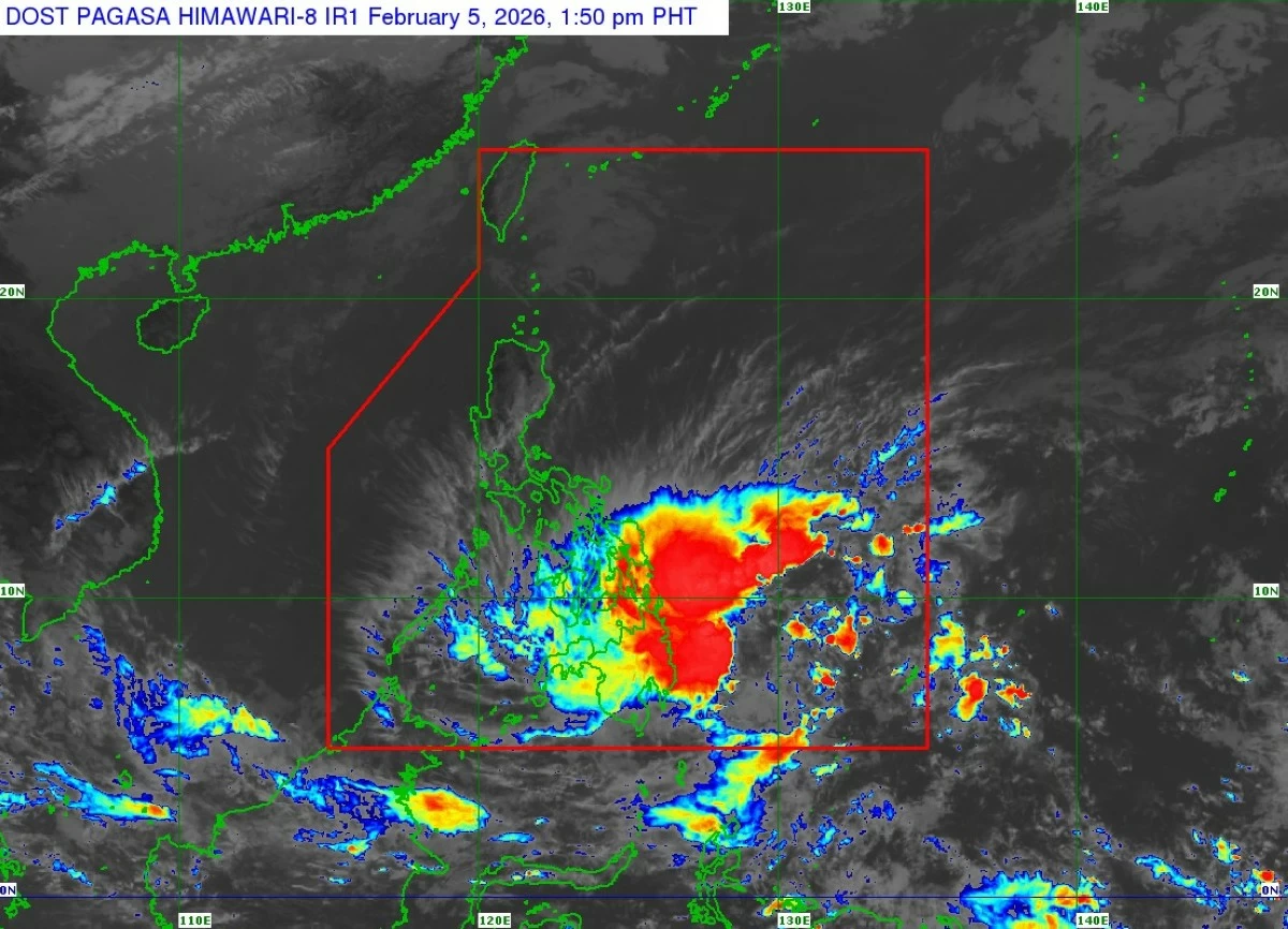
Satellite image of Tropical Storm Basyang (international name: Penha) (Courtesy of PAGASA)
The Philippine Atmospheric, Geophysical and Astronomical Services Administration (PAGASA) on Thursday afternoon, Feb. 5, said Tropical Storm Basyang (Penha) is expected to make landfall between Thursday evening and early morning on Friday, Feb. 6 as it continues moving westward toward eastern Mindanao.
As of 1 p.m., the center of Basyang was estimated at 230 kilometers east of Hinatuan, Surigao del Sur, with maximum sustained winds of 65 kilometers per hour near the center and gustiness of up to 80 kph.
The storm was moving westward at 25 kph.
“Areas directly affected include the northern and eastern portions of Mindanao—Caraga, Davao Region, and Northern Mindanao—as well as the Visayas,” PAGASA Administrator Nathaniel Servando warned in Filipino in a press conference on Thursday.
Heavy rains, strong winds
On the forecast track, PAGASA said Basyang will continue moving westward before turning west-northwestward, with its initial landfall expected over Surigao del Sur.
After crossing Mindanao, it is likely to emerge over the Bohol Sea and may pass close to or make another landfall over Siquijor and the southern portion of Negros Oriental before moving into the Sulu Sea and toward northern Palawan.
“Based on the latest data, the risk of impacts in these areas is continuing to rise in the next few hours. We expect it to hit land by Thursday evening. We anticipate heavy and continuous rains that may cause widespread flooding and landslides, especially in low-lying and mountainous areas. There is also a threat of strong winds that may damage homes and topple trees,” Servando said.
PAGASA said Tropical Cyclone Wind Signal No. 2 is in effect over Siquijor, southern portion of Negros Oriental, southern portion of Cebu, southern portion of Bohol, Surigao del Norte including the Siargao-Bucas Grande Islands, Surigao del Sur, the extreme northern portion of Davao Oriental, Agusan del Norte; Agusan del Sur, Misamis Oriental, northern portion of Bukidnon, northeastern portion of Lanao del Norte, northeastern portion of Misamis Occidental, and Camiguin.
Under Signal No. 1 are the northern portion of Palawan including the Calamian, Cuyo, and Cagayancillo Islands; southern portion of Eastern Samar; southern portion of Samar; Biliran; Leyte; Southern Leyte; the rest of Bohol; the rest of Cebu; the rest of Negros Oriental; Negros Occidental; Guimaras; Iloilo; Capiz; Aklan; Antique; Dinagat Islands; northern and central portions of Davao Oriental; Davao de Oro; Davao del Norte; northern portion of Davao del Sur; the rest of Bukidnon; northern portion of Cotabato; Lanao del Sur; northern portion of Maguindanao del Norte; the rest of Lanao del Norte; the rest of Misamis Occidental; eastern and central portions of Zamboanga del Norte; northern and central portions of Zamboanga del Sur; and northern portion of Zamboanga Sibugay.
PAGASA said minor to moderate impacts from gale-force winds are possible in areas under Signal No. 2, while minimal to minor impacts from strong winds are expected in areas under Signal No. 1.
Storm surge, gale warnings
“For our coastal communities, we also remind them of the possibility of storm surges and rough seas. We strongly advise avoiding sailing and fishing while the threat from Tropical Storm Basyang persists,” Servando said.
The weather bureau warned of heavy rains over parts of Mindanao and the Visayas, with a minimal to moderate risk of storm surge of up to 2.0 meters over low-lying or exposed coastal communities, including Surigao del Norte, Surigao del Sur, Agusan del Norte, Davao Oriental, Misamis Oriental, Camiguin, Cebu, Bohol, Negros Oriental, Negros Occidental, and Southern Leyte.
A gale warning remains in effect over the northern seaboard of Mindanao and the eastern seaboards of the Visayas and Mindanao, and PAGASA advised mariners, especially those operating small seacraft and motorbancas, to avoid venturing out to sea.
“We encourage the public to listen only to official announcements from authorities and follow the orders of the local government. Prepare your emergency kits and ensure your families are safe. Follow the Hazard Hunter of DOST-Phivolcs (Department of Science and Technology-Philippine Institute of Volcanology and Seismology) for specific areas prone to landslides and flooding,” Servando said.

Related Tags

PAGASA TROPICAL STORM BASYANG SIGNAL NO. 2 LANDFALL
ADVERTISEMENT
.most-popular .layout-ratio{ padding-bottom: 79.13%; } @media (min-width: 768px) and (max-width: 1024px) { .widget-title { font-size: 15px !important; } }

{{ articles_filter_1561_widget.title }}

.most-popular .layout-ratio{ padding-bottom: 79.13%; } @media (min-width: 768px) and (max-width: 1024px) { .widget-title { font-size: 15px !important; } }

{{ articles_filter_1562_widget.title }}

.most-popular .layout-ratio{ padding-bottom: 79.13%; } @media (min-width: 768px) and (max-width: 1024px) { .widget-title { font-size: 15px !important; } }

{{ articles_filter_1563_widget.title }}

{{ articles_filter_1564_widget.title }}

.mb-article-details { position: relative; } .mb-article-details .article-body-preview, .mb-article-details .article-body-summary{ font-size: 17px; line-height: 30px; font-family: "Libre Caslon Text", serif; color: #000; } .mb-article-details .article-body-preview iframe , .mb-article-details .article-body-summary iframe{ width: 100%; margin: auto; } .read-more-background { background: linear-gradient(180deg, color(display-p3 1.000 1.000 1.000 / 0) 13.75%, color(display-p3 1.000 1.000 1.000 / 0.8) 30.79%, color(display-p3 1.000 1.000 1.000) 72.5%); position: absolute; height: 200px; width: 100%; bottom: 0; display: flex; justify-content: center; align-items: center; padding: 0; } .read-more-background a{ color: #000; } .read-more-btn { padding: 17px 45px; font-family: Inter; font-weight: 700; font-size: 18px; line-height: 16px; text-align: center; vertical-align: middle; border: 1px solid black; background-color: white; } .hidden { display: none; }
function initializeAllSwipers() { // Get all hidden inputs with cms_article_id document.querySelectorAll('[id^="cms_article_id_"]').forEach(function (input) { const cmsArticleId = input.value; const articleSelector = '#article-' + cmsArticleId + ' .body_images'; const swiperElement = document.querySelector(articleSelector); if (swiperElement && !swiperElement.classList.contains('swiper-initialized')) { new Swiper(articleSelector, { loop: true, pagination: false, navigation: { nextEl: '#article-' + cmsArticleId + ' .swiper-button-next', prevEl: '#article-' + cmsArticleId + ' .swiper-button-prev', }, }); } }); } setTimeout(initializeAllSwipers, 3000); const intersectionObserver = new IntersectionObserver( (entries) => { entries.forEach((entry) => { if (entry.isIntersecting) { const newUrl = entry.target.getAttribute("data-url"); if (newUrl) { history.pushState(null, null, newUrl); let article = entry.target; // Extract metadata const author = article.querySelector('.author-section').textContent.replace('By', '').trim(); const section = article.querySelector('.section-info ').textContent.replace(' ', ' '); const title = article.querySelector('.article-title h1').textContent; // Parse URL for Chartbeat path format const parsedUrl = new URL(newUrl, window.location.origin); const cleanUrl = parsedUrl.host + parsedUrl.pathname; // Update Chartbeat configuration if (typeof window._sf_async_config !== 'undefined') { window._sf_async_config.path = cleanUrl; window._sf_async_config.sections = section; window._sf_async_config.authors = author; } // Track virtual page view with Chartbeat if (typeof pSUPERFLY !== 'undefined' && typeof pSUPERFLY.virtualPage === 'function') { try { pSUPERFLY.virtualPage({ path: cleanUrl, title: title, sections: section, authors: author }); } catch (error) { console.error('ping error', error); } } // Optional: Update document title if (title && title !== document.title) { document.title = title; } } } }); }, { threshold: 0.1 } ); function showArticleBody(button) { const article = button.closest("article"); const summary = article.querySelector(".article-body-summary"); const body = article.querySelector(".article-body-preview"); const readMoreSection = article.querySelector(".read-more-background"); // Hide summary and read-more section summary.style.display = "none"; readMoreSection.style.display = "none"; // Show the full article body body.classList.remove("hidden"); } document.addEventListener("DOMContentLoaded", () => { let loadCount = 0; // Track how many times articles are loaded const offset = [1, 2, 3, 4, 5, 6, 7, 8, 9, 10]; // Offset values const currentUrl = window.location.pathname.substring(1); let isLoading = false; // Prevent multiple calls if (!currentUrl) { console.log("Current URL is invalid."); return; } const sentinel = document.getElementById("load-more-sentinel"); if (!sentinel) { console.log("Sentinel element not found."); return; } function isSentinelVisible() { const rect = sentinel.getBoundingClientRect(); return ( rect.top < window.innerHeight && rect.bottom >= 0 ); } function onScroll() { if (isLoading) return; if (isSentinelVisible()) { if (loadCount >= offset.length) { console.log("Maximum load attempts reached."); window.removeEventListener("scroll", onScroll); return; } isLoading = true; const currentOffset = offset[loadCount]; window.loadMoreItems().then(() => { let article = document.querySelector('#widget_1690 > div:nth-last-of-type(2) article'); intersectionObserver.observe(article) loadCount++; }).catch(error => { console.error("Error loading more items:", error); }).finally(() => { isLoading = false; }); } } window.addEventListener("scroll", onScroll); });

Sign up by email to receive news.