


Manila Bulletin
 Philippines
National
Tropical Depression Basyang enters PAR; may make landfall as a tropical storm
Philippines
National
Tropical Depression Basyang enters PAR; may make landfall as a tropical storm
Philippines
National
Tropical Depression Basyang enters PAR; may make landfall as a tropical storm
Tropical Depression Basyang enters PAR; may make landfall as a tropical storm
Published Feb 3, 2026 11:36 pm


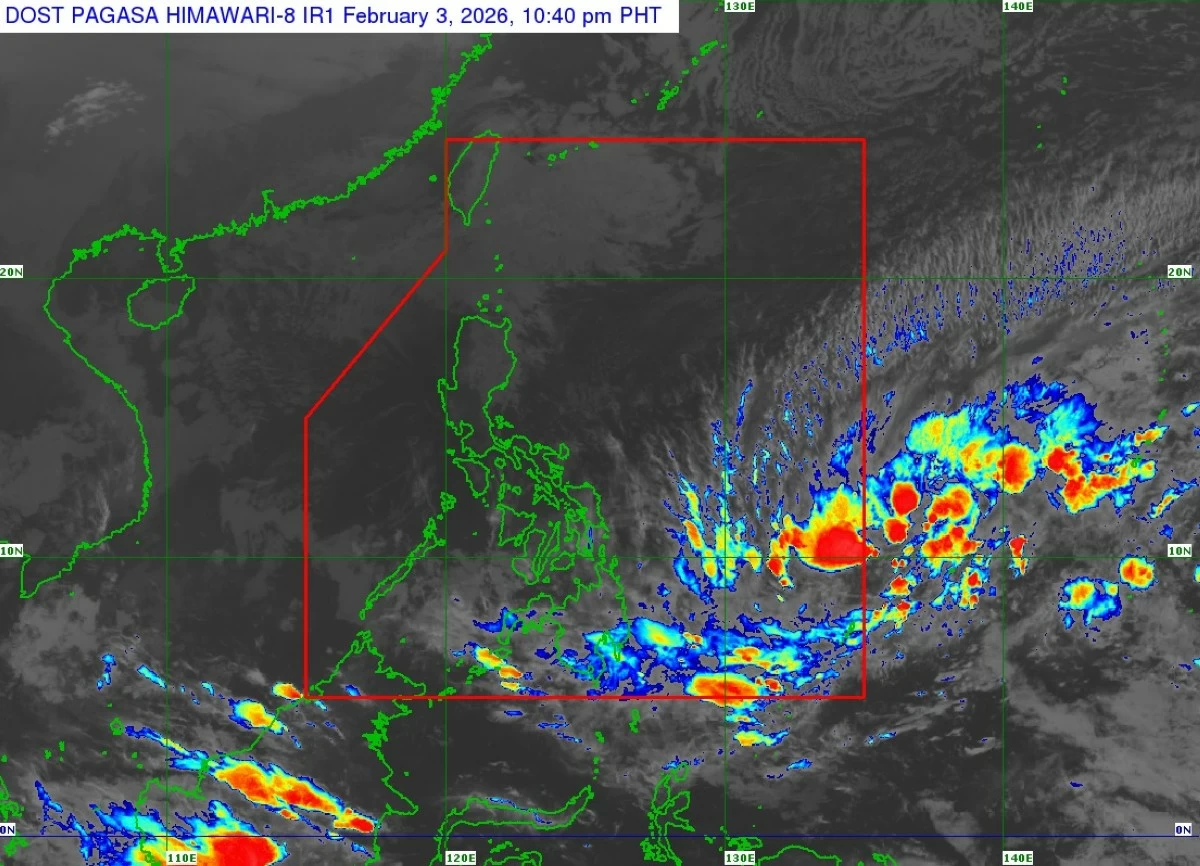
Satellite image of Tropical Depression Basyang (Courtesy of PAGASA)
Tropical Depression Basyang entered the Philippine Area of Responsibility (PAR) on Tuesday evening, Feb. 3, and is expected to make landfall over eastern Mindanao or the southern portion of Eastern Visayas later this week, the Philippine Atmospheric, Geophysical and Astronomical Services Administration (PAGASA) said.
As of 10 p.m., the center of Basyang was located about 965 kilometers east of northeastern Mindanao, with maximum sustained winds of 55 kilometers per hour (kph) near the center and gusts of up to 70 kph.
No tropical cyclone wind signal was in effect, but PAGASA said Signal No. 1 will be hoisted over Caraga as early as Wednesday, Feb. 4.
The highest wind signal that may be raised during the system’s passage is Signal No. 2.
PAGASA said Basyang will generally move west-southwestward until Thursday, Feb. 5, before turning westward to west-northwestward for the rest of the forecast period.
On its current track, the cyclone is expected to make landfall over eastern Mindanao or the southern portion of Eastern Visayas by Thursday evening or Friday morning, Feb. 6.
The weather disturbance is forecast to traverse the Mindanao and Visayas landmass until Saturday, Feb. 7, and may make another landfall or pass close to northern Palawan by Sunday, Feb. 8.
Basyang is also expected to gradually intensify over the Philippine Sea and may reach tropical storm category by Wednesday, but is expected to weaken back into a tropical depression by Friday due to land interaction.
PAGASA warned that Basyang is expected to bring heavy rainfall over several areas in Visayas and Mindanao.
From Wednesday evening to Thursday evening, moderate to heavy rainfall (50 to 100 millimeters) is expected over Eastern Samar, Southern Leyte, Dinagat Islands, Surigao del Norte, Surigao del Sur, Agusan del Norte, Agusan del Sur, Camiguin, Misamis Oriental, Bukidnon, Davao de Oro, Davao del Norte, and Davao Oriental.
From Thursday evening to Friday evening, moderate to heavy precipitation may persist in Eastern Samar, Leyte, Southern Leyte, Cebu, Bohol, Negros Oriental, Negros Occidental, Siquijor, Dinagat Islands, Surigao del Norte, Surigao del Sur, Agusan del Norte, Agusan del Sur, Misamis Oriental, Misamis Occidental, Lanao del Norte, Lanao del Sur, Zamboanga del Norte, Camiguin, Bukidnon, and Davao del Norte.