


LPA outside PAR develops into tropical depression — PAGASA
Published Feb 3, 2026 04:54 pm


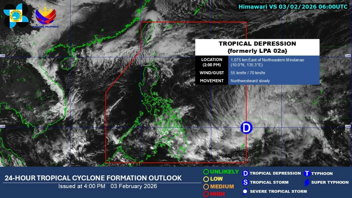
Satellite image of a tropical depression (formerly low-pressure area 02a) near the Philippine Area of Responsibility (Courtesy of PAGASA)
The Philippine Atmospheric, Geophysical and Astronomical Services Administration (PAGASA) on Tuesday, Feb. 3 said the low-pressure area (LPA 02a) being monitored outside the Philippine Area of Responsibility (PAR) has developed into a tropical depression and is expected to enter the PAR within the day.
As of 2 p.m., the tropical depression was located about 1,075 kilometers east of northeastern Mindanao.
It has maximum sustained winds of 55 kilometers per hour (kph) near the center and gustiness of up to 70 kph, and is moving northwestward slowly.
Once the weather disturbance enters the PAR, it will be given the name “Basyang,” which would be the second tropical cyclone of 2026.
Based on the forecast track, the weather disturbance may move west-northwest and pass between the Visayas and Mindanao before heading toward Palawan from Thursday, Feb. 5, until the weekend.
PAGASA weather specialist John Manalo said the tropical depression may intensify into a tropical storm by Thursday, and is expected to remain a storm while traversing land areas.
He added that tropical cyclone wind signals may be raised as early as Wednesday, Feb. 4, with Signal No. 2 being the highest that may be hoisted in the coming days.
From Wednesday afternoon to Thursday afternoon, PAGASA forecast 50 to 100 millimeters of rainfall, or moderate to heavy rains, over Eastern Samar, Southern Leyte, Dinagat Islands, Surigao del Norte, Camiguin, Agusan del Norte, Misamis Oriental, Surigao del Sur, Agusan del Sur, Bukidnon, Davao de Oro, Davao del Norte, and Davao Oriental.
Manalo warned that localized flooding and landslides are possible in hazard-prone areas.
From Thursday afternoon to Friday afternoon, Feb. 6, 50 to 100 millimeters of rainfall may affect Eastern Samar, Leyte, Southern Leyte, Cebu, Negros Occidental, Negros Oriental, Bohol, Siquijor, Camiguin, Dinagat Islands, Surigao del Norte, Agusan del Norte, Misamis Oriental, Surigao del Sur, Agusan del Sur, Misamis Occidental, Lanao del Norte, Lanao del Sur, Bukidnon, Davao del Norte, and Zamboanga del Norte.
By Sunday, Feb. 8, Manalo said that when the system reaches the Sulu Sea, it will be closest to Metro Manila.
Even if it weakens back into a tropical depression, he said the trough or cloud extension associated with the system may reach Metro Manila and bring cloudy skies and a higher chance of rains over Metro Manila, Calabarzon, Mimaropa, Bicol Region, Visayas, Northern Mindanao, and Zamboanga Peninsula.
PAGASA advised residents in the Visayas and Mindanao to stay alert for possible significant rains in the coming days, especially as some areas have already been soaked by rains from the shear line over the past few days.
The shear line is a weather system formed by the collision of cold northeast monsoon (amihan) winds and warm easterly winds from the Pacific Ocean.