


Manila Bulletin
 Philippines
National
LPA east of Mindanao likely to become tropical depression — PAGASA
Philippines
National
LPA east of Mindanao likely to become tropical depression — PAGASA
Philippines
National
LPA east of Mindanao likely to become tropical depression — PAGASA
LPA east of Mindanao likely to become tropical depression — PAGASA
Published Feb 3, 2026 10:12 am
|
Updated Feb 3, 2026 01:38 pm


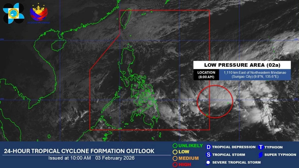
Satellite image of a low-pressure area (LPA) outside the Philippine Area of Responsibility (Courtesy of PAGASA)
The Philippine Atmospheric, Geophysical and Astronomical Services Administration (PAGASA) on Tuesday, Feb. 3, said a low-pressure area (LPA) east of Mindanao has a high chance of developing into a tropical depression and may enter the Philippine Area of Responsibility (PAR) within the day.
The LPA was located about 1,110 kilometers east of northeastern Mindanao as of Tuesday morning.
PAGASA weather specialist Chenel Dominguez said that once the weather disturbance enters the PAR and develops into a tropical storm, it will be given the name “Basyang,” which would be the second tropical cyclone of 2026.
Based on the forecast track, the weather disturbance may move west-northwest and pass between the Visayas and Mindanao before heading toward Palawan from Thursday, Feb. 5 until the weekend, she added.
PAGASA advised residents over parts of the Visayas and Mindanao to stay alert for possible rains in the coming days.
Dominguez said the LPA has no direct effect on the country yet, but the shear line continues to affect the eastern sections of the Visayas and Mindanao.
Over the next 24 hours, the shear line will bring cloudy skies with scattered rains and isolated thunderstorms over the Visayas, Caraga, Davao Region, and Misamis Oriental.
Meanwhile, the northeast monsoon, or “amihan,” continues to affect Luzon.
Batanes and the Babuyan Islands will experience cloudy skies with light rains, while Metro Manila and the rest of Luzon will have partly cloudy to cloudy skies with isolated light rains.
The rest of Mindanao will have partly cloudy to cloudy skies with isolated rain showers or thunderstorms due to localized thunderstorm activity, PAGASA said.