


Manila Bulletin
 Philippines
National
4 to 11 cyclones may develop or enter PAR from February to July — PAGASA
Philippines
National
4 to 11 cyclones may develop or enter PAR from February to July — PAGASA
Philippines
National
4 to 11 cyclones may develop or enter PAR from February to July — PAGASA
4 to 11 cyclones may develop or enter PAR from February to July — PAGASA
Published Jan 31, 2026 09:08 am
|
Updated Jan 31, 2026 01:55 pm


At A Glance
- Weak La Niña conditions are expected to transition to neutral between January and March
- Below-normal rainfall is likely in parts of Luzon, Mimaropa, Bicol, and Western Visayas from February to May
- Most other areas may receive near-normal rainfall, with near-normal conditions expected across the country in June and July
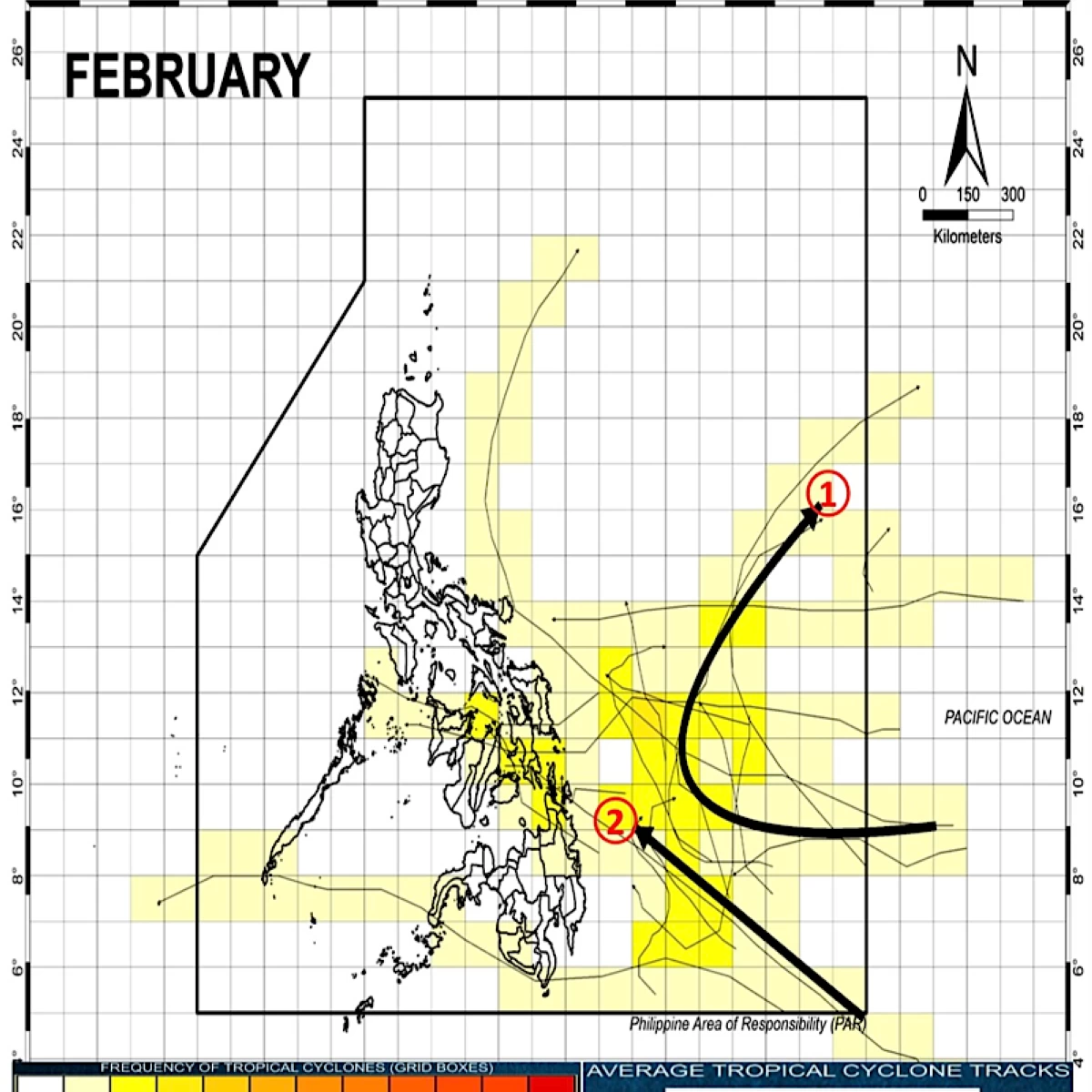
Projected paths of potential tropical cyclones in the Philippine Area of Responsibility for February (Philippine Atmospheric, Geophysical and Astronomical Services Administration)
The Philippine Atmospheric, Geophysical and Astronomical Services Administration (PAGASA) said four to 11 tropical cyclones may develop or enter the Philippine Area of Responsibility (PAR) from February to July, with fewer systems expected in the early months and more toward midyear.
In its latest outlook, PAGASA weather specialist Joey Figuracion said zero or one tropical cyclone is expected in each of February, March, and April.
Cyclone activity is projected to increase to one or two tropical cyclones in each of May and June, before rising further to two to four in July.
PAGASA said most tropical cyclones during February are expected to originate in the western Pacific.
Some may enter the PAR before recurving away from the country, while others could move closer toward the Philippine landmass but are likely to dissipate before making landfall.
La Niña to gradually weaken
Figuracion said the country is still experiencing weak La Niña conditions.
This means temperatures are warmer than usual, particularly over the Philippine Sea, while sea surface temperatures remain cooler over the central and equatorial Pacific, he added.
However, he noted that La Niña is expected to weaken and transition to neutral conditions between January and March 2026, based on forecast models showing about a 75 percent chance.
PAGASA said these changing ocean and atmospheric conditions are also expected to influence rainfall patterns across the country.
From February to May, below-normal to way below-normal rainfall is expected over the western parts of Northern and Central Luzon. Patches of below-normal rainfall may also affect Mimaropa, Bicol, and Western Visayas.
Most areas in the Visayas and Mindanao are likely to experience near-normal rainfall, with some patches of below-normal and above-normal rainfall during the same period.
For June and July, PAGASA said near-normal rainfall conditions are expected across the country, as the southwest monsoon (habagat) becomes more pronounced and tropical cyclone activity increases.