


Manila Bulletin
 Philippines
National
Trough of 'Ada' to bring rains over Camarines Sur, Catanduanes — PAGASA
Philippines
National
Trough of 'Ada' to bring rains over Camarines Sur, Catanduanes — PAGASA
Philippines
National
Trough of 'Ada' to bring rains over Camarines Sur, Catanduanes — PAGASA
Trough of 'Ada' to bring rains over Camarines Sur, Catanduanes — PAGASA
Published Jan 19, 2026 05:16 pm


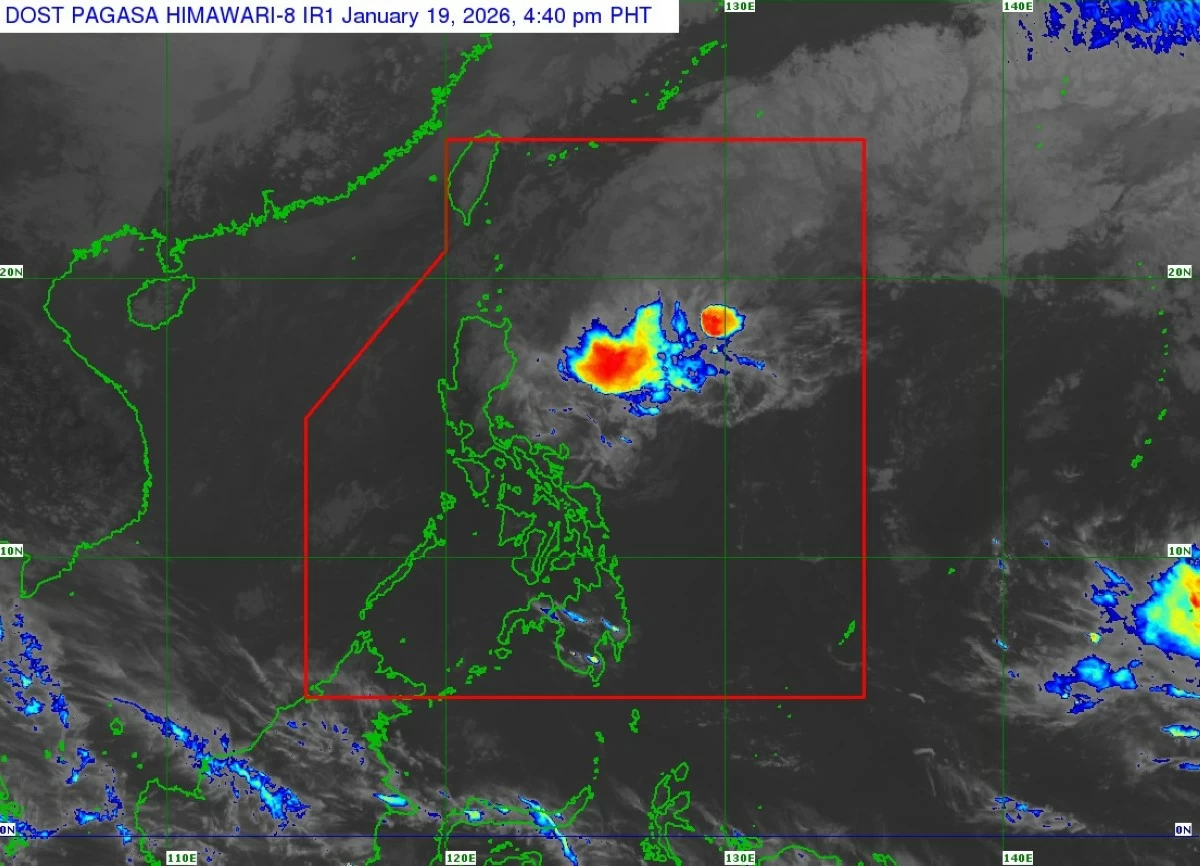
Satellite image of Tropical Depression Ada (Nokaen) (Courtesy of PAGASA)
The trough or extension of Tropical Depression Ada (international name: Nokaen) is expected to continue bringing cloudy skies with scattered rains and thunderstorms over Camarines Sur and Catanduanes in the next 24 hours, the Philippine Atmospheric, Geophysical and Astronomical Services Administration (PAGASA) said on Monday, Jan. 19.
PAGASA warned of possible flash floods or landslides in these areas, particularly during periods of moderate to, at times, heavy rainfall.
As of 4 p.m., the center of Ada was located 465 kilometers east of Casiguran, Aurora, packing maximum sustained winds of 55 kilometers per hour near (kph) the center and gustiness of up to 70 kph.
PAGASA said Ada will likely move east-northeastward over the next 24 hours before turning eastward to east-southeastward from Tuesday evening, Jan. 20, until Wednesday, Jan. 21.
Continuous dry air entrainment from the northeast monsoon is expected to cause the gradual weakening of the tropical depression.
PAGASA said Ada may be downgraded into a low-pressure area by Wednesday, although earlier weakening remains possible.
Meanwhile, the northeast monsoon, or “amihan,” may bring cloudy skies with light rains over the Cordillera Administrative Region and Cagayan Valley.
Ilocos Region, Nueva Ecija, Tarlac, and Zambales may experience partly cloudy to cloudy skies with isolated light amihan rains, while Metro Manila and the rest of the country are expected to have partly cloudy to cloudy skies with isolated rain showers due to localized thunderstorms.