


Manila Bulletin
 Philippines
National
'Ada' maintains strength as it moves away from Catanduanes — PAGASA
Philippines
National
'Ada' maintains strength as it moves away from Catanduanes — PAGASA
Philippines
National
'Ada' maintains strength as it moves away from Catanduanes — PAGASA
'Ada' maintains strength as it moves away from Catanduanes — PAGASA
Gale and rain warnings remain in parts of Luzon, Visayas
Published Jan 18, 2026 03:21 pm


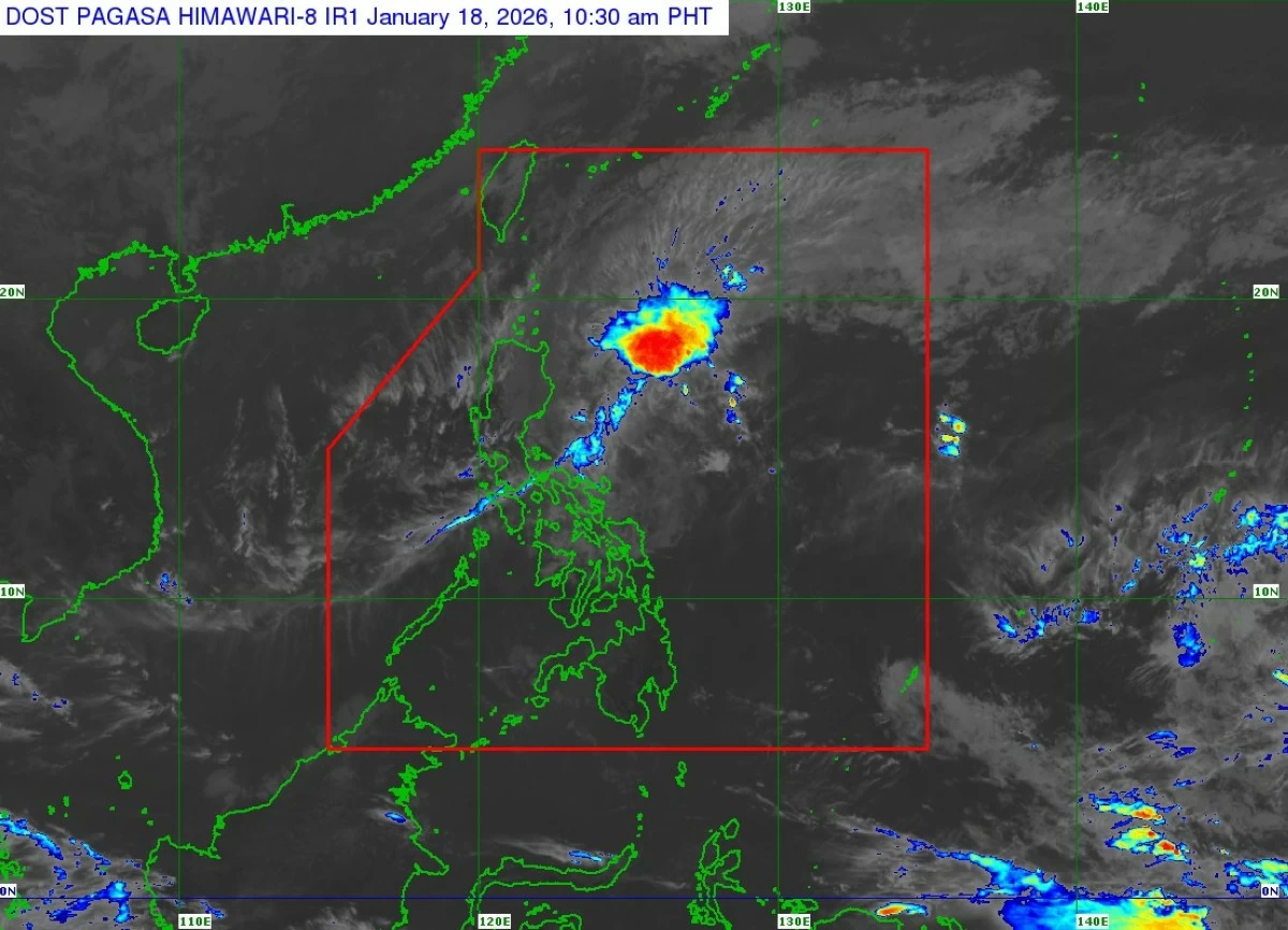
Tropical Storm Ada maintains its strength while moving away from Catanduanes, with gale-force winds and heavy rainfall affecting parts of Luzon and the Visayas. (PAGASA)
Tropical Storm Ada (international name: Nokaen) continues to maintain its strength as it slowly moves away from Catanduanes, the Philippine Atmospheric, Geophysical and Astronomical Services Administration (PAGASA) reported on Sunday, January 18.
As of 10 a.m., PAGASA said the storm’s center was located 140 kilometers northeast of Virac, Catanduanes, packing maximum sustained winds of 75 kilometers per hour (km/h), gusts of up to 90 km/h, and a central pressure of 996 hPa.
"Ada" is currently moving east-northeastward at a slow pace, with gale-force winds extending up to 380 kilometers from its center, PAGASA said.
Tropical Cyclone Wind Signals in effect
PAGASA has raised Tropical Cyclone Wind Signal (TCWS) No. 2 (gale-force winds of 62–88 km/h) over Catanduanes and eastern Camarines Sur, including Caramoan.
TCWS No. 1 (strong winds of 39–61 km/h) remains hoisted over parts of Luzon, including the southern portion of Quezon province (Tagkawayan, Guinayangan, Lopez, Calauag, Buenavista, San Narciso, San Andres, San Francisco, Mulanay, Catanauan, General Luna, Macalelon, Gumaca, Pitogo, Unisan, Atimonan, Plaridel, Agdangan, Padre Burgos, Quezon, Alabat, and Perez), including the Polillo Islands; Camarines Norte; the rest of Camarines Sur; Albay; Sorsogon; Ticao and Burias Islands; and Northern Samar in the Visayas.
PAGASA said these signals indicate minor to moderate threats to life and property in affected areas. Localized winds may be stronger in coastal and upland communities exposed to the storm.
Heavy rainfall and coastal hazards
PAGASA said the northeast monsoon, combined with "Ada’s" periphery, is bringing heavy rainfall and strong winds over Luzon and parts of the Visayas.
Residents in Batanes, Cagayan, Isabela, Aurora, Quezon, the Bicol Region, and Northern Samar are advised to remain vigilant, as gale-force gusts may affect coastal and upland areas today and tomorrow.
PAGASA also warned of a minimal to moderate risk of storm surge of up to 2 meters in low-lying coastal areas of Camarines Sur, Catanduanes, Albay, and Sorsogon.
Coastal and small-boat operators are advised to take precautionary measures or avoid venturing out to sea, as waves in some areas may reach up to 4 meters, PAGASA said.
Forecast and safety reminders
"Ada" is forecast to continue moving generally northeastward before looping over the sea east of Luzon. The storm is expected to weaken into a tropical depression by January 20 and further into a low-pressure area by January 22 due to the surge of the northeast monsoon.
PAGASA urged residents in highly susceptible areas to follow evacuation orders and disaster preparedness measures issued by local government units.