


'Ada' decelerates over Catanduanes waters — PAGASA
Published Jan 17, 2026 08:42 pm


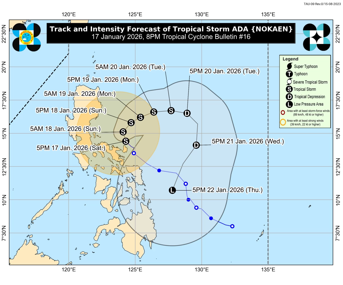
Forecast track and intensity for Tropical Storm Ada (Nokaen) (Courtesy of PAGASA)
Tropical Storm Ada (international name: Nokaen) slowed down as it moved over the coastal waters of Pandan, Catanduanes on Saturday evening, Jan. 17, the Philippine Atmospheric, Geophysical and Astronomical Services Administration said.
As of 8 p.m., the center of Ada was estimated based on all available data over the coastal waters of Pandan, Catanduanes.
The storm was moving north-northwestward at 15 kilometers per hour (kph), packing maximum sustained winds of 85 kph near the center and gustiness of up to 105 kph.
PAGASA said Ada is expected to move generally northwestward on Saturday before slowly turning northward to northeastward on Sunday, Jan. 18.
From Sunday onward, the tropical cyclone is forecast to follow a looping track over the sea east of Luzon, although changes in the forecast track remain possible in the succeeding bulletins.
Ada is forecast to remain a tropical storm while traversing the sea east of Luzon, but further intensification into a severe tropical storm is not ruled out.
PAGASA said the possibility of further strengthening could prompt the raising of Tropical Cyclone Wind Signal No. 3.
As of Saturday evening, Signal No. 2 remained hoisted over the eastern portion of Camarines Norte (Vinzons, San Lorenzo Ruiz, San Vicente, Talisay, Basud, Mercedes, Daet, and Paracale); eastern and central portions of Camarines Sur (Siruma, Tinambac, Ocampo, Goa, Lagonoy, Milaor, Nabua, Buhi, Caramoan, Baao, Cabusao, Bato, Camaligan, Pili, Sipocot, Tigaon, Pamplona, Garchitorena, Iriga City, San Fernando, Magarao, Minalabac, Balatan, Libmanan, Naga City, Calabanga, Bombon, Bula, Canaman, Pasacao, Sagñay, San Jose, Presentacion, Gainza, and Lupi); Albay; and Catanduanes.
Meanwhile, Signal No. 1 was still in effect over the southeastern portion of Isabela (Dinapigue and Palanan); Aurora; eastern portion of Quezon (Tagkawayan, Guinayangan, Lopez, Calauag, Buenavista, San Narciso, San Andres, San Francisco, Mulanay, Catanauan, General Luna, Macalelon, Gumaca, Pitogo, Unisan, Atimonan, Plaridel, Agdangan, Padre Burgos, Quezon, Alabat, Perez, General Nakar, Infanta, Real, and Mauban, including the Polillo Islands); Marinduque; eastern portion of Romblon (Cajidiocan, Magdiwang, and San Fernando); the rest of Camarines Norte; the rest of Camarines Sur; Sorsogon; Masbate; Northern Samar; northern and central portions of Eastern Samar (Can-Avid, Maslog, San Policarpo, Dolores, Jipapad, Oras, and Arteche); and northern and central portions of Samar (San Jorge, Matuguinao, Almagro, Calbayog City, Jiabong, Pagsanghan, the City of Catbalogan, Gandara, Motiong, Santo Niño, Tagapul-An, San Jose de Buan, Santa Margarita, Tarangnan, and Paranas).
PAGASA said Ada is expected to weaken into a tropical depression by Tuesday afternoon or evening, Jan. 20, due to the effects of the surge of the northeast monsoon, locally known as “amihan.”