


Manila Bulletin
 Philippines
National
'Ada' may strengthen into tropical storm within 24 hours; 6 areas under Signal No. 1
Philippines
National
'Ada' may strengthen into tropical storm within 24 hours; 6 areas under Signal No. 1
Philippines
National
'Ada' may strengthen into tropical storm within 24 hours; 6 areas under Signal No. 1
'Ada' may strengthen into tropical storm within 24 hours; 6 areas under Signal No. 1
Published Jan 14, 2026 05:57 pm


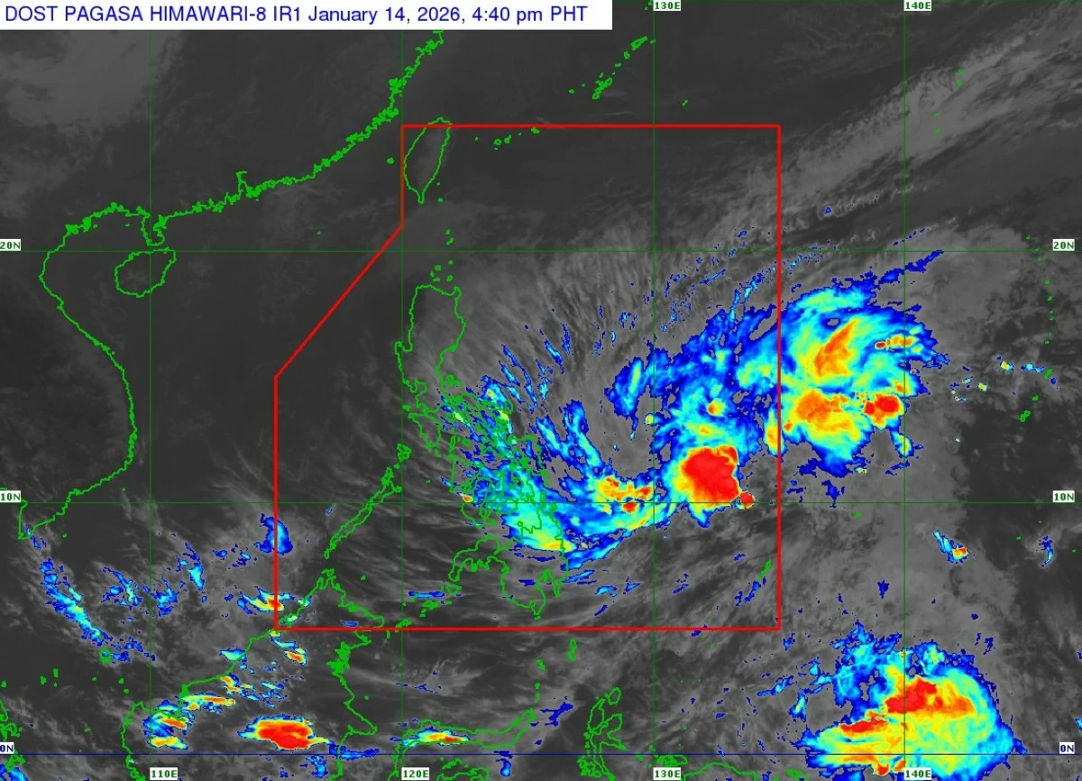
Satellite image of Tropical Depression Ada (Courtesy of PAGASA)
Tropical Depression Ada is expected to intensify into a tropical storm within the next 24 hours as it continues to move over the Philippine Sea east of Mindanao, the Philippine Atmospheric, Geophysical and Astronomical Services Administration (PAGASA) said on Wednesday afternoon, Jan. 14.
As of PAGASA’s 5 p.m. advisory, the center of Ada was estimated at 545 kilometers east of Hinatuan, Surigao del Sur, moving west-northwestward at 10 kilometers per hour (kph).
It has maximum sustained winds of 45 kph near the center with gusts of up to 55 kph.
Tropical Cyclone Wind Signal No. 1 is currently in effect over six areas, which include Northern Samar, Samar, Eastern Samar, Dinagat Islands, Surigao del Norte, and Surigao del Sur.
Minimal to minor impacts from strong winds are possible in these areas, PAGASA said.
The highest tropical cyclone wind signal that may be raised during Ada’s passage is Signal No. 2.
PAGASA said the tropical depression is projected to move generally northwestward over the next three days.
On the forecast track, it may pass close to or make landfall over Eastern Visayas on Friday, Jan. 16, or early Saturday, Jan. 17, then pass close to or make landfall over Catanduanes on Saturday or Sunday, Jan. 18.
Afterwards, it is expected to turn generally northeastward over the sea east of Luzon.
Ada is the first tropical cyclone to form inside the Philippine area of responsibility this year.